
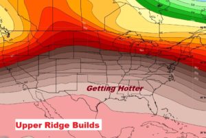
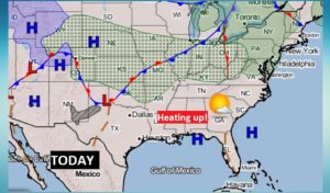
Good Morning! The news is good. The first weekend in May will feel more like the first weekend in June. A ridge of high pressure is building in the upper atmosphere across the Gulf South. We’ll be heating up today and Sunday. Many towns could see the first 90 degree days either Sunday, Monday or Tuesday.
The dry, warm, storm-free pattern will pattern will stick around through Tuesday. An approaching cool front could bring some showers and thunderstorms by mid-week, followed by some cooler air.
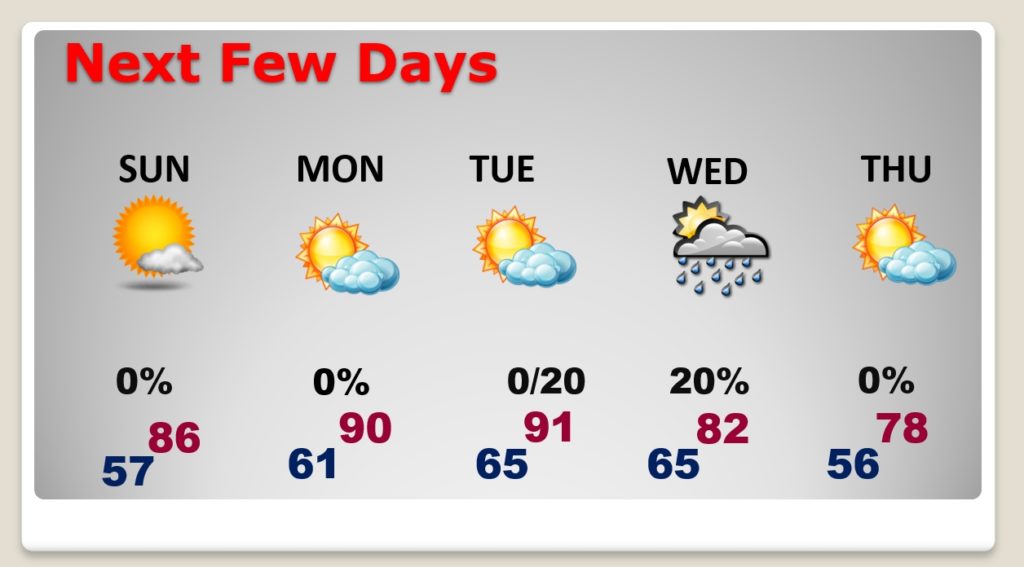
TODAY: Sunshine will dominate. Warmer. High 85-87. SW wind at 5 to 10. Milder tonight. Mostly clear. Low in the upper 50’s.
NEXT FEW DAYS: Sunday through Tuesday will feel like early June with highs near or above 90. Chance of showers or thundershowers Tuesday night into Wednesday, as a cool front heads south. Cooler Thursday. Rainfall should be spotty and mostly light.
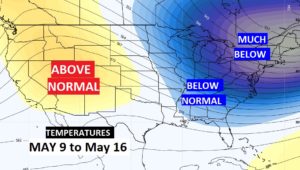
LONGER RANGE: The longer range model continues to hint at a cooling trend later in the month for much of the eastern half of the Nation .
– -.
I will have another Blog update tomorrow morning. Follow me on Twitter: @RichThomasWX. Enjoy this nice weather! Stay safe and well.
-Rich