
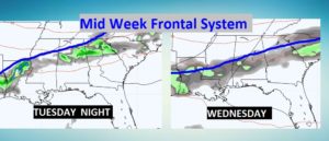
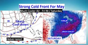
Our string of nice, storm-free warm days continues. Yesterday’s high was 86. Today we’ll in the upper 80’s, and near 90 Monday & Tuesday. A mid-week frontal system will bring some spotty showers or thundershowers late Tuesday night into Wednesday. A More important cold front arrives Friday. That front will deliver a shot of much cooler air by Friday night.
TODAY: Another great day. Abundant sunshine. Very warm for May. High in the upper 80’s. Mostly clear and mild tonight. Low 62.
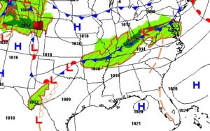
NEXT FEW DAYS: The nice days continue through Tuesday. It will feel more like early June. Widely scattered storms Wednesday with frontal system number one. A little cooler Thursday.
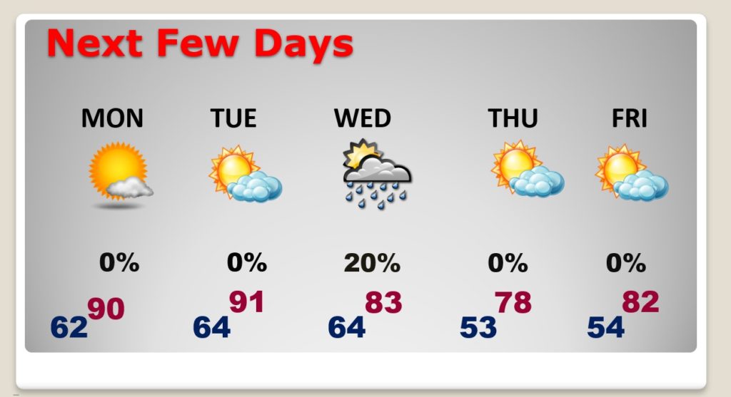
WEDNESDAY FRONTAL SYSTEM: A cool front will bring in some widely scattered thunderstorms into the state Tuesday night into Wednesday. Thursday will be a little cooler.
SHARPLY COOLER AIR AHEAD: A more important cold front arrives Friday. Showers and thunderstorms will proceed the front. MUCH cooler air arrives by Friday night into Saturday. Highs will be in the upper 60’s or lower 70’s. We could be in the middle 40’s by Sunday morning.
—
I’ll have a complete video update for you Monday morning, posted by 4:45AM
Stay safe and well. Enjoy this beautiful string of days…
–Rich