Good Morning! The atmosphere is primed for action today and over the week ahead. Look for a better than normal chance of those daily showers and storms. Some days will have better chances than others. I have updated the rain chance through the weekend. Plus, another period of hotter temperatures may be just a few days away. And, The National Hurricane Center is monitoring a new Area to Watch off the Southeast US coast.
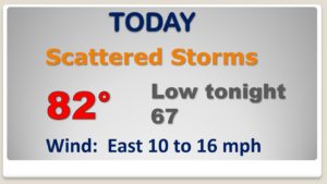
Scattered to numerous showers and storms today. Diminishing tonight. Not as hot.
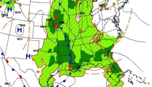
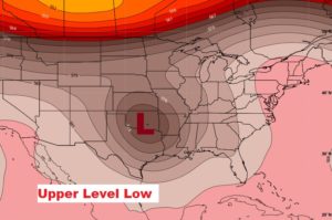
We’ll be on the WET side of an upper level low over the southern plains this week.
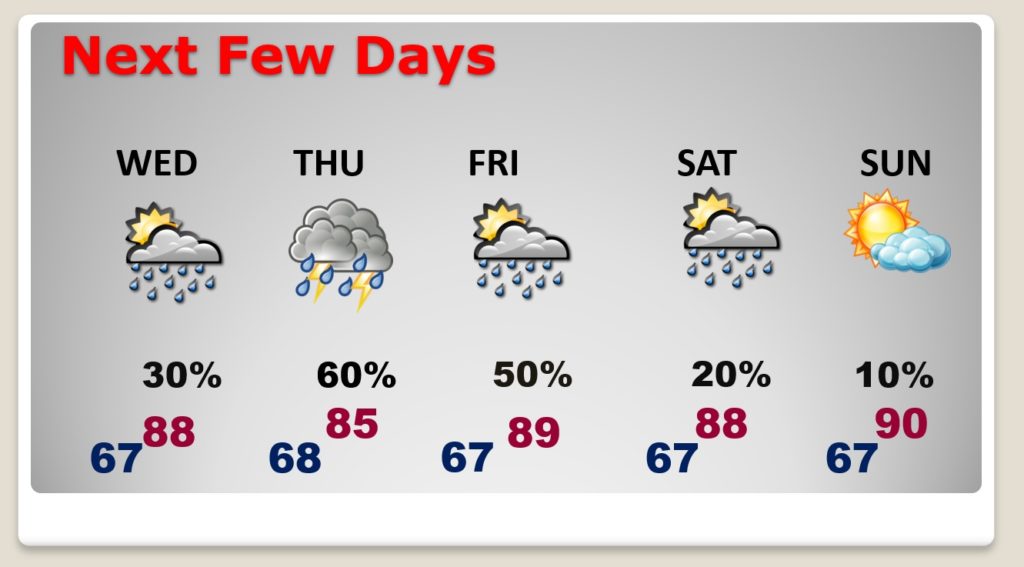
Better than normal rain chances will continue through the end of the week. The showers will thin out over the weekend has temperatures get hotter.
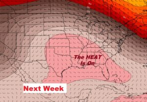
The Upper Ridge will expand and get stronger. The Heat will build & expand again next week.
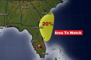
NHC is monitoring an Area to Watch off the southeast us coastline:
Widespread showers and thunderstorms extending across Florida, the
Bahamas, and the adjacent Atlantic and Gulf of Mexico waters are
associated with an elongated surface trough interacting with an
upper-level disturbance.  Although a weak surface low could form
along the surface trough just off the east coast of Florida and
move northward toward Georgia and South Carolina on Tuesday and
Wednesday, the low is not expected to become a tropical cyclone due
to strong upper-level winds.