
Good Morning! This can be a rather short update, and that means, the news is good for the next few days, as May ends and June begins.
The upper Low that has plagued our forecast for many days is lifting out. A surface cool front is pushing through the area. Although today will still feel rather humid, tonight will be less humid and pleasantly cooler.
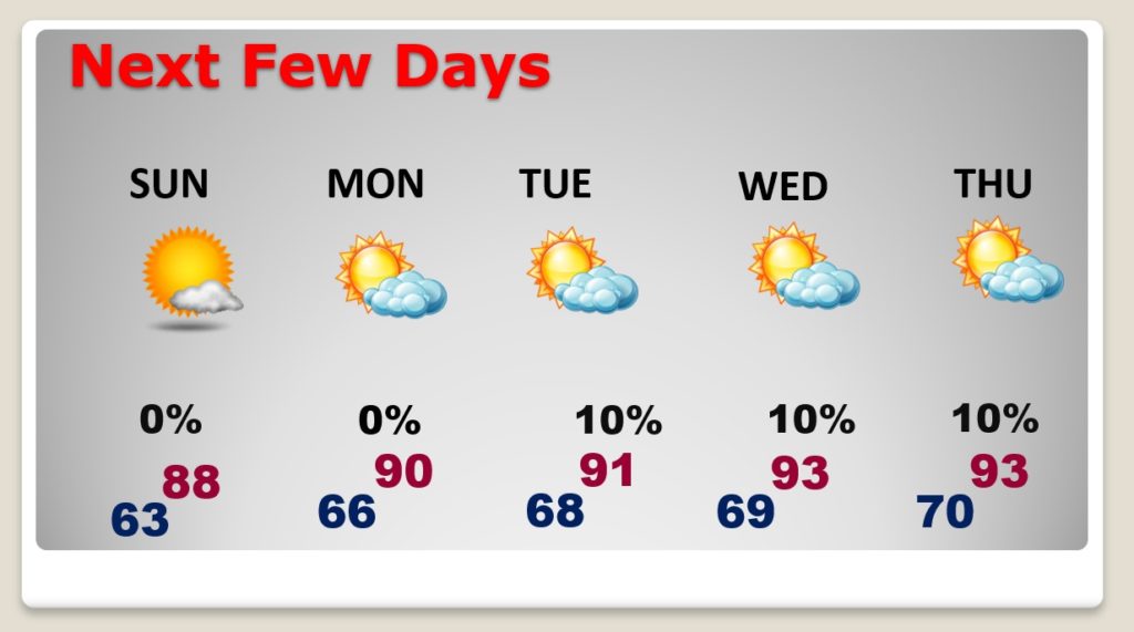
The rain chance will be tiny today, and then, we should be dry for a series of several days Sunday through Thursday. June starts on a nice note..
TODAY: A good bit of sunshine today. Could there be a stray shower somewhere this afternoon. It’s not out of the question. I have a 20% chance in… With dewpoints in the upper 60’s, it will still feel humid. Today’s high near 90°. Tonight will be less humid and kind of nice. Low 63.
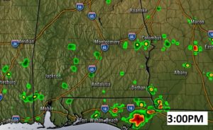
Here’s a Future Radar snapshot at 3PM. Couple of blips on the radar, perhaps….
NEXT FEW DAYS: Less humid tonight and Sunday. Expect a period of dry and mostly sunny days, as May ends and June begins. HOT, but not humid.
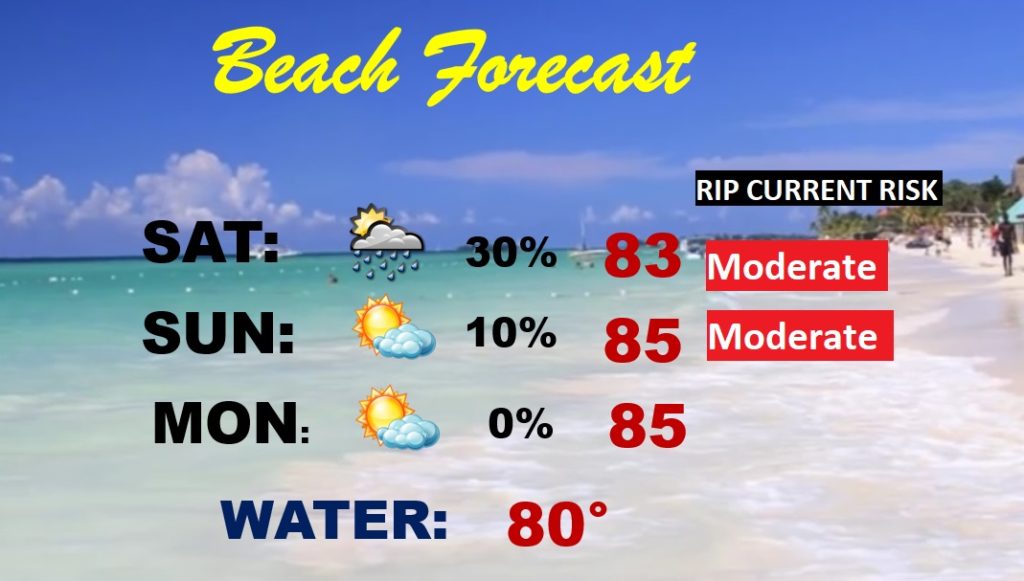
BEACH FORECAST: Moderate rip current risk today and tomorrow. Rain chance: small today. Scattered thunderstorms. A period of dry weather Sunday through Wednesday. A good week at the beach. Water temperature now at a season high 80°.
THE TROPICS: In the central Atlantic, there is yet another pre-season tropical system being monitored by the National Hurricane Center. Invest 92-L has a 60% chance of developing into a depression or tropical storm. Do we care, on any level? NO. Next name on the list…a boy name….Cristobal. The hurricane season officially starts Monday.

I will have another Blog update tomorrow morning. Follow me on Twitter: @RichThomasWX. Have a great weekend. Stay safe and well.
-Rich