
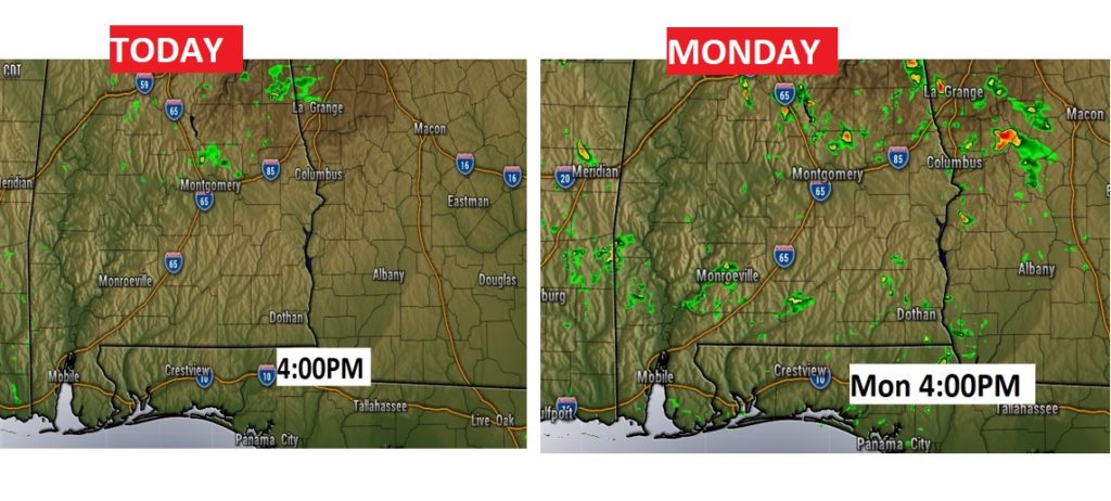
Good morning! There’s a few subtle changes to the forecast for the next few days, but nothing major. Rain chances, while small, are not zero. There will be a few “blips” on the radar at times over the next three afternoons. Coverage will be tiny, and mostly in the eastern counties.
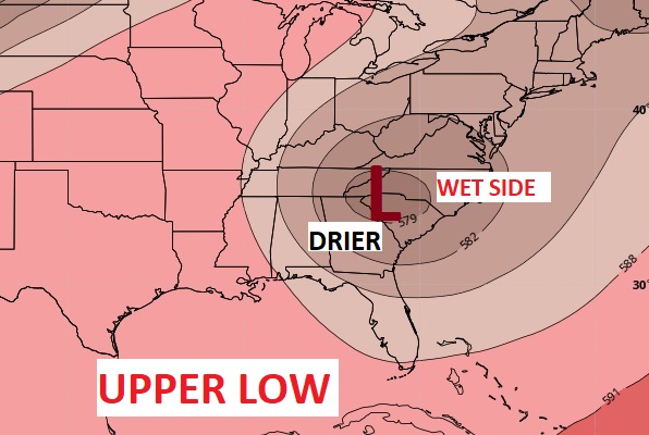
Today, like yesterday will be hot, but not crazy humid. But, look for some more reasonable temperatures Monday through Wednesday. That’s because of an Upper Low which will be parked over the southeast U.S. That will allow somewhat cooler air aloft to mix down to the surface.
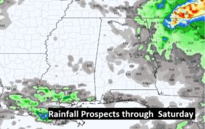
In general however, the rain chances will remain relative small for the rest of this week.
Here’s the Upper Low. The WET side is east of the center. We will stay on the somewhat drier west side of the low.
TODAY: Abundant sunshine mixed with a few clouds. Rain chance not zero. But small. 10-15% here in central Alabama. A little better over the Georgia border. Hot again. We had 91 yesterday and we’ll be close to that again today. Mostly clear, comfortable tonight. Low 65.
Future radar snapshots for the next two afternoon’s showing a few isolated showers with tiny coverage.
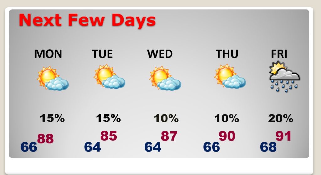
NEXT FEW DAYS: Highs in the 80’s Monday through Wednesday. Rain chance about 15 to 20% for most of us, Monday & Tuesday. Hotter Thursday & Friday. Widely scattered storms return on Friday. That’s the last full day of Spring. Summer begins Saturday at 4:53 PM. The summer solstice.
Rainfall amounts will be spotty and light through Saturday.
THE TROPICS: …are very quiet.
—
I’ll have a complete video update for you tomorrow morning.
Stay safe and well. Enjoy your Sunday …
–Rich