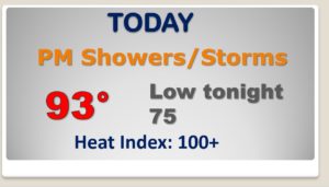
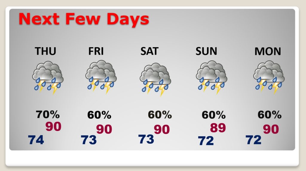
Good Morning! Welcome to July. Heat and humidity will set the stage for thunderstorms. There will be a generous supply of storms each day from today, through the 4th of July Holiday weekend and beyond, for here, the Lakes and the Gulf Coast Beaches. Clusters of storms will be rather strong at times, with gusty winds, lots of lightning and tropical downpours. There will be a few warnings at times. On this video, I have adjusted the daily rain chance through Tuesday. I have an update on the tropics, too.
Heat and humidity will lead to widespread showers and storms.
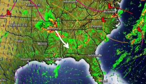
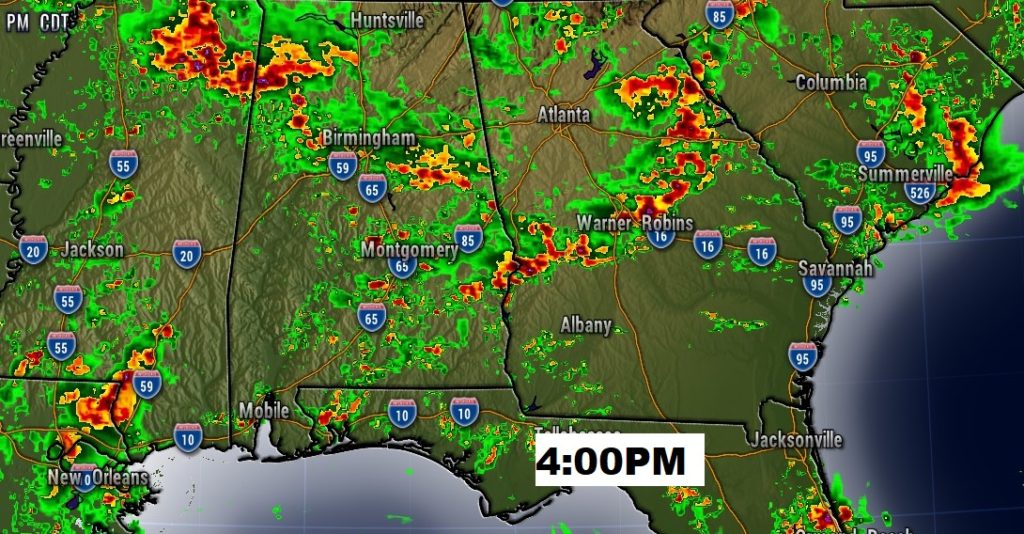
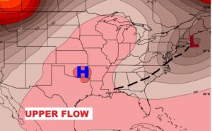
Clusters of storms will move from the northwest to the southeast today.
An upper level trough of low pressure, combined with deep tropical moisture will lead to numerous storms, day after day, for several days.
Thunderstorms will be rather numerous each day through the weekend into early next week.
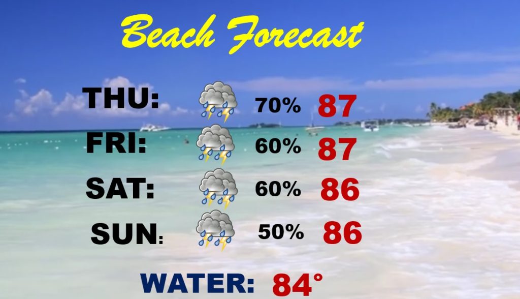
Be flexible. It will be stormy at times at the beach through the holiday weekend. Have a plan B. Watch out for lightning.
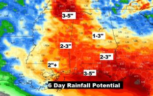
This is only AVERAGE rainfall for the next 6 days. Actual rainfall totals will vary widely. It looks very wet at times for several days.
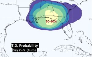
The EURO model suggests a tropical depression could form near the coast and head northeast. The GFS model also suggests tropical development.