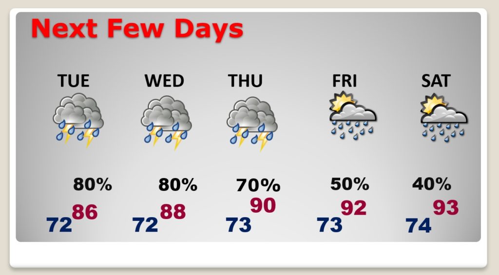
Good Morning! Some lucky towns had a nice downpour yesterday. Today those random storms will be much more numerous. In fact, the next 3 or 4 days will feature a generous supply of storms. I have adjusted the daily rain chances. Storms will thin out closer to the weekend. Will we be headed back to dangerous heat indices? The tropics are getting more active. In fact, we’re monitoring Invest 98-L in our “backyard”.
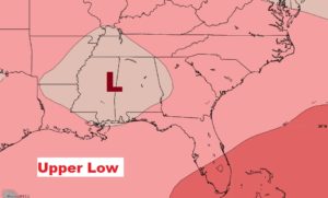
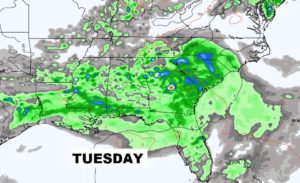
We’re on the wet/active side of that upper low in eastern Mississippi. Showers and storms will be widespread today.
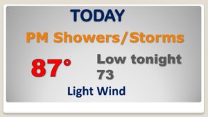
Storms will be in generous supply today. Tropical downpours in spots.
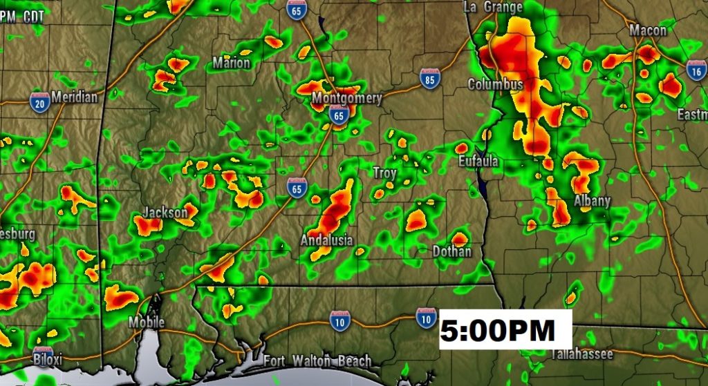
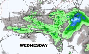
Showers and storms will be quite numerous again Tuesday & Wednesday. Tropical downpours.
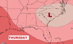
As the upper low migrates to the Carolinas, storms will thin out in number late week.
Very high rain chances through Wednesday & Thursday. Storms thin our by Friday through Sunday. Heat index could be close to the 105 danger range by Saturday & Sunday.
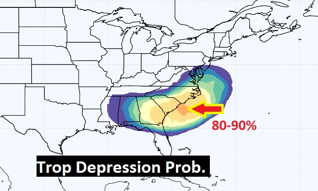
INVEST 98-L is in our backyard. It has a “medium” chance of becoming a Depression or Tropical Storm in the next few days.
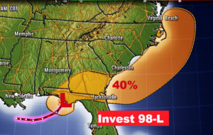
The EURO model suggests it has a strong chance of becoming a Depression or storm. Next name on the list is Fay.