
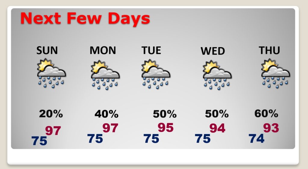
Good morning! It looks like we are in for one of the hottest weekends of the summer so far. Highs will soar to the upper 90’s and the Heat Index will be well into triple digits.
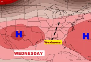
Although those random afternoon storms will be very isolated in coverage this weekend, hang on… The rain chances will get a lot better in the week ahead. The Heat Dome over the state now will start to break down. A “weakness” in the atmosphere will promote much better coverage on those afternoon storms, particularly Tuesday through Friday.
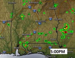
TODAY: Very hot day. More sun than clouds. High in the upper 90’s. Heat Index 101-105. Widely scattered storms. Roughly 20% coverage at best today and Sunday. Low tonight 75. This Future Radar snapshot at 5PM does not look too encouraging.
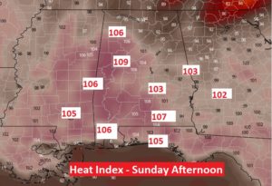
SUNDAY: Very similar to today’s forecast, except the models are printing some very excessive Heat Indices on Sunday afternoon.
NEXT FEW DAYS: Lots of folks are looking for some rain, as are lawns are burning up after a week with few showers. The rain chances start to pick up Monday. By mid to late week the chances increase to 50-60% each day. The storms will still be random of course, there will just be more to go around.
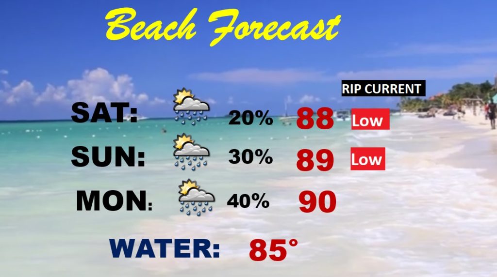
BEACH FORECAST: If this is your weekend for the Beach..the news is good. Showers will be few and far between. Low rip current risk. More sun than clouds. Gulf water temperature is now 85.
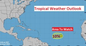
THE TROPICS: For the moment, things are relatively quiet. There is one Area to Watch with a small chance of development.
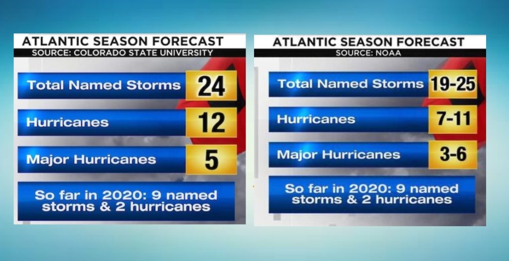
But, in case you missed it, two disturbing forecasts came out this week. One from the tropical experts at Colorado State. The other from NOAA. Both of them forecast an “extremely active” rest of the season. The NOAA forecast is the most aggressive in numbers since they started issuing these outlooks 22 years ago.
—
I will have another Blog update tomorrow morning. Follow me on Twitter: @RichThomasWX. Stay safe and well.
-Rich