
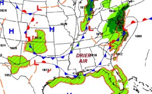
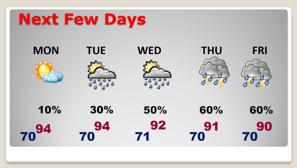
Good morning! There has been a change. The frontal system that brought showers yesterday has ushered in somewhat drier air. Our forecast is storm-free today and tomorrow. That is a quite a rarity this summer, indeed.
The humidity will be a little lower than it has been, and the heat index may actually stay below triple digits for a couple of days. But, we’ll be getting back to business as usual in the week ahead. Those random pop-up storms will make a comeback by Tuesday and Wednesday, and they will be quite numerous again by late week.
A northwesterly flow in the atmosphere has allowed a couple of fronts to make it into the state delivering drier air.
TODAY: Some foggy areas early in the morning. Then, abundant sunshine. It’s a dry forecast. High 94. Mostly clear tonight. A little more tolerable. Low near 70.
NEXT FEW DAYS: The break from storms won’t last long. Showers and thunderstorms make a comeback Tuesday and Wednesday and they will be quite numerous by late week, again.
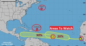
THE TROPICS: Josephine is still just a minimal tropical storm with 40 mph winds in the Atlantic. It is expected to weaken and become a Depression. Kyle has become “post tropical” in the North Atlantic.
Now, all of a sudden we have two new “x”s on the map. Two new “areas to watch” in the Tropical Atlantic heading toward the Caribbean. The next name on the list is Laura.

–
I’ll have a complete video update for you tomorrow morning.
Stay safe and well. Enjoy your Sunday!
–Rich