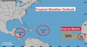
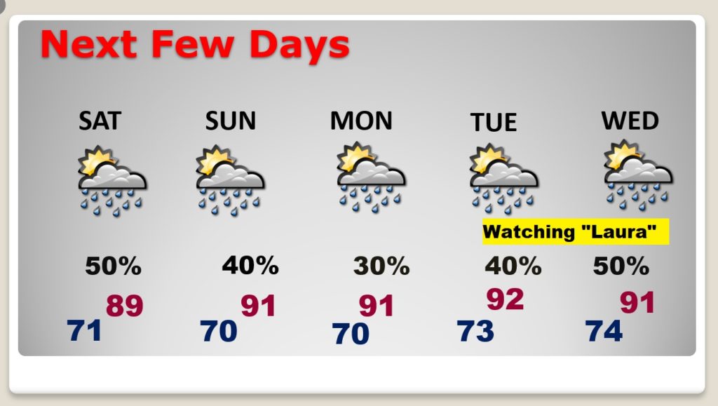
Extraordinary Tropical threat for the Gulf Coast continues to increase, as we track two systems at one time. Could we see two landfalling Hurricanes? Where and When? I the updated track/cones from Hurricane Center. We’ll be OK through the weekend. Rain probabilities are very high again today. The number of storms will start to slack off a bit over the weekend, except on the coast. I have updated the rain chances. But, after the weekend, all bets are off. There are many question marks, and the forecast hinges, of course on the tropical tracks. We’ll be hearing the names Laura and Marco a lot. Stay informed.
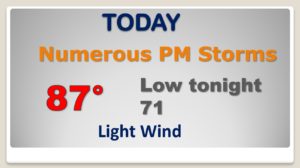
Another very active day. Numerous showers and storms especially this afternoon.
Not quite as many storms around this weekend. Probabilities a little lower. Scattered storms. Tuesday and Wednesday…the forecast all depends on the tropics. Will we have a Hurricane affecting our coast? Stay tuned.
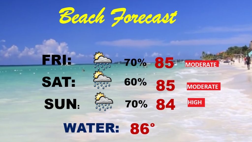
NOT a good beach forecast. Lots of showers and storms around. Yellow flags through Saturday and RED flags likely by Sunday.
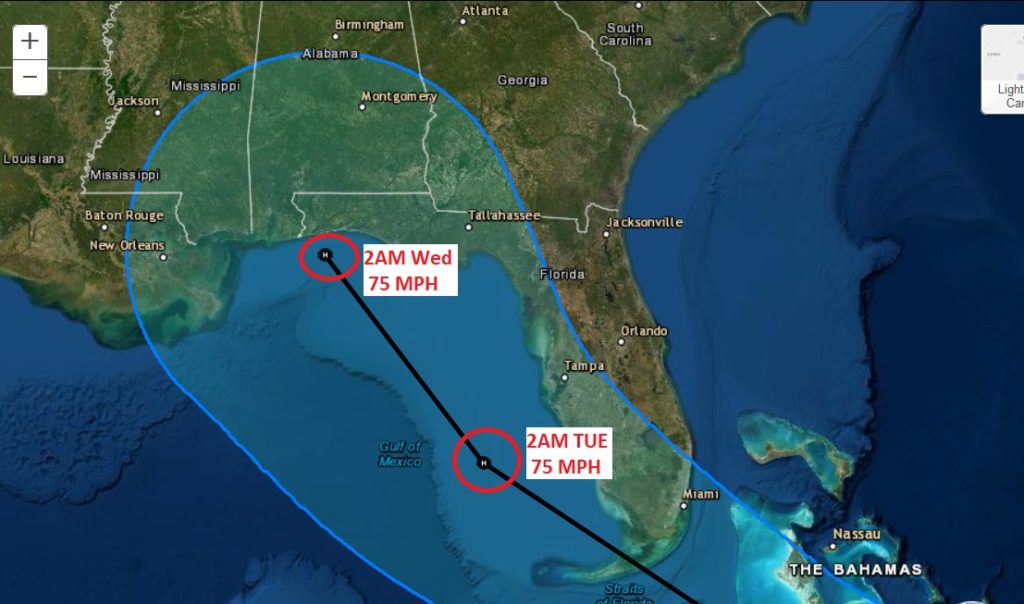
EXTREMELY RARE and DANGEROUS. We could see two hurricanes almost concurrently making landfall on the US Gulf coast early next week.
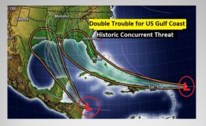
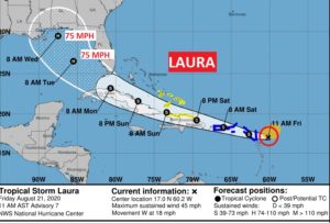
We may indeed have a landfalling Cat 1 hurricane on the Alabama or Florida Gulf coast by late Tuesday night. Laura or Marco depending on what system gets a name first.
 4
4
The Texas/LA Gulf coast will likely have a landfalling hurricane late Tuesday or Tuesday night.
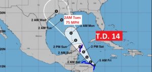
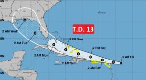
Besides the lead two systems, don’t forget, NHC is tracking another strong tropical wave coming off Africa. The next name after Laura and Marco is Nana.