
SPECIAL 4:00PM UPDATE:
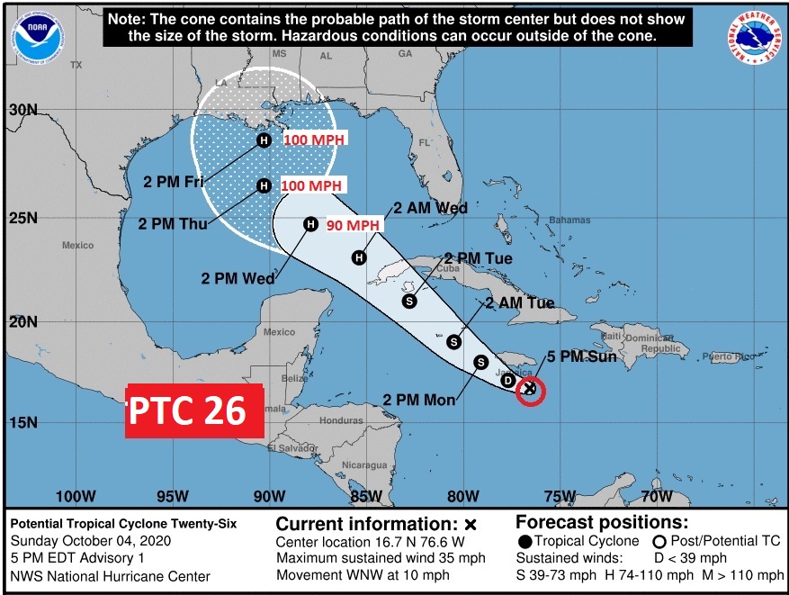
The stakes just got much higher. Potential Tropical Depression 26 has formed in the Caribbean, 90 miles south of Kingston, Jamaica, moving WNW at 10. Expected to become Tropical Storm Delta before reaching the Cayman Islands Monday .Expected to become Hurricane Delta before reaching western Cuba Tuesday. Then, it will intensify in the Gulf as the week unfolds. Possible landfall as a Cat 2 Hurricane along the northern Gulf coast Friday. Strangely feeling like a Sally scenario. Obviously, this is now very serious business. Stay tuned. ANOTHER potential hurricane landfall.. I’ll have a complete video in the morning. Stay weather aware on the Future of DELTA.
EARLY MORNING UPDATE:
Good morning! Our news continues to be very good for the next few days. We have a perfect Sunday to look forward to, and a great start to the first full week of October tomorrow.
A warming trend is on the way. Upper 80’s look like a good bet by Wednesday.
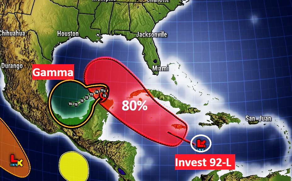
But, now, lets talk about the elephant in the room. More potential tropical trouble in the Gulf of Mexico by late week, and I am not talking about Tropical Storm Gamma. Nope. I’m talking about Invest 92-L, not too far from Jamaica this morning, bound for the Gulf of Mexico. It’s likely to become DELTA this week. And, it is something we need to watch very carefully. I’ll be honest, I’m not a happy guy this morning. More about this developing potential threat below.
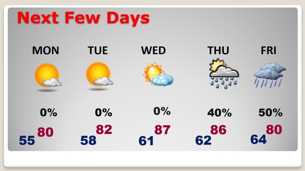
TODAY: Just about text-book perfect. You may see a few of those high cirrus clouds mixed in with the abundant sunshine today. Otherwise, it will be yet another comfortable day with low humidity. High 78. Pleasantly cool tonight. Jacket weather. Low 56. (By the way, the normal high is 82, low 59)
NEXT FEW DAYS: Looks like a warming trend is on the way. Near 80 Monday. Low 80’s Tuesday. Upper 80’s Wednesday. Dry through Wednesday. By Thursday or Friday, what kind of effect will the tropics have on us. Will we be dealing with Tropical Storm or Hurricane Delta? I don’t know.
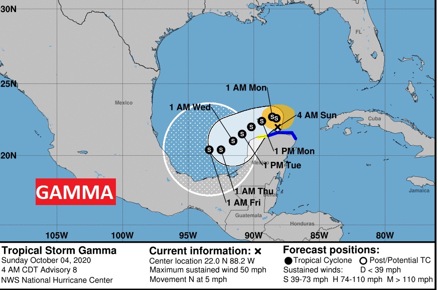
NEW WORRIES ABOUT THE TROPICS: First there is Tropical Storm Gamma, which is a 50 mph Tropical Storm located in the extreme southern Gulf of Mexico just north of the Yucatan. It’s moving north at 5. As you can see from the cone, it is a Bay of Campeche problem.
Let’s move on and talk about very interesting Invest 92-L. It’s located just SE of Jamaica. It’s moving WNW at 15 toward the Gulf. It has an 80% chance of becoming a tropical cyclone in the next couple of days. Next name on the list is Delta.
Then what? Well, unfortunately the models like the idea of bringing it to the northern Gulf Coast by late week. Here’s a sample of some of the spaghetti models.
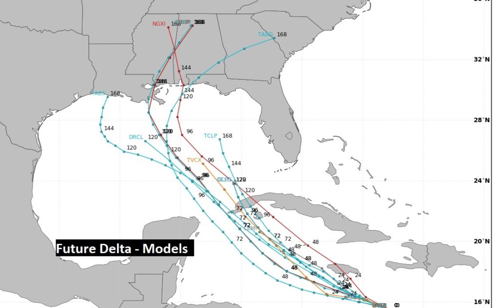
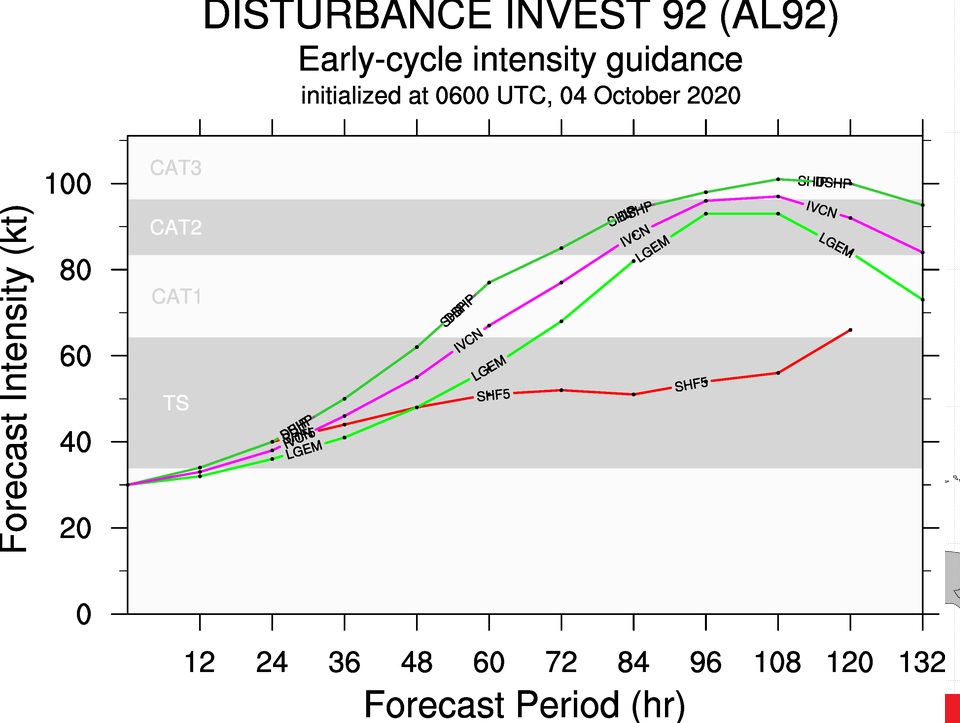
How strong, potentially could Delta get in the warm Gulf waters. Some models take Delta to hurricane strength by late week. Not good. Stay tuned. It’s early. I hate looking at this graphic.
HURRICANE OPAL ANNIVERSARY: This is the day Hurricane Opal slammed into the Gulf coast 25 years ago today. After undergoing a night of rapid intensification, we woke up, on this morning, 25 years ago today, to a frightening 150 mph, nearly category 5 hurricane in the Central Gulf, headed for our coast.
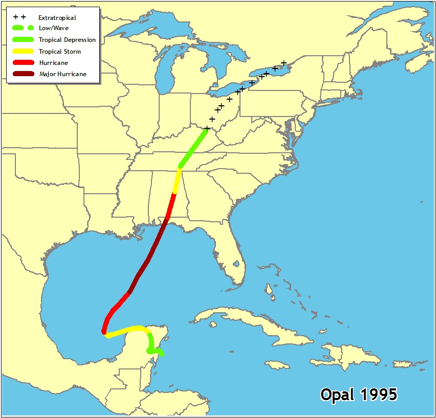
Fortunately, Opal weakened some before Landfall near Navarre Beach, as a Category 3..with 115 mph winds., on that Wednesday afternoon. And, it headed northward into Alabama, maintaining much of it’s intensity. In fact, winds gusted to 90 mph in Montgomery at Dannelly Field and Maxwell. Damage was extensive. Power failures we’re widespread. Many were without power for a week or more. Even in Atlanta, thousands of trees fell killing 5. Total damage from the storm, adjusted for inflation. $7.8 Billion. At the time, it was the costliest hurricane of all time. A total of 63 people died in Opal. This is exactly why we watch potential tropical systems in the Gulf especially in October. Historic Category 5 Michael is another great example in 2018.


—
I’ll have a complete video Monday morning. There may be additional updates today as needed. Stay safe and well. Enjoy your Sunday.
–Rich