4:00PM UPDATE:
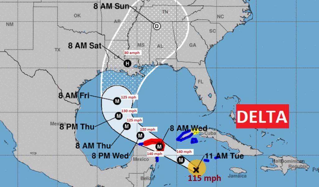
Historic Cat 4 Hurricane Delta could be nearly Cat 5 near landfall on the Yucatan Penn. Wednesday. In fact, Hurricane Delta could be a Cat 3 Hurricane at landfall on the north central United States coast Friday. Winds already 140 mph. Extremely dangerous hurricane. #delta
11:00AM UPDATE:
**DELTA becomes a Cat 4 hurricane with 130 mph winds. Could we be looking at a new record as far as Hurricane Rapid Intensification in the Atlantic Basin? Delta was a 40 mph Tropical storm at 7AM Monday. 27 hours later we have a 130mph Cat 4. With nearly 90 degree water temps., Delta will become Cat 4 before it nears the Yucatan coast Wednesday. Historic. Frightening. #Delta
**10:00AM UPDATE:
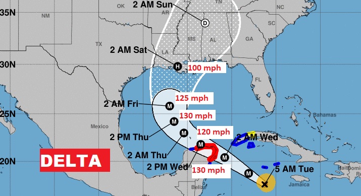
Delta is now a Major Cat 3 hurricane with 115 mph winds, expected to become a Cat 4, 130 mph Hurricane before it reaches the Yucatan coast Wednesday, then turn northward into the Gulf. Could be a Cat 3 hurricane along the north central Gulf coast by Friday night. Currently located 120 SW of Grand Cayman IS., moving WNW at 16. Pressure 955 mbs.
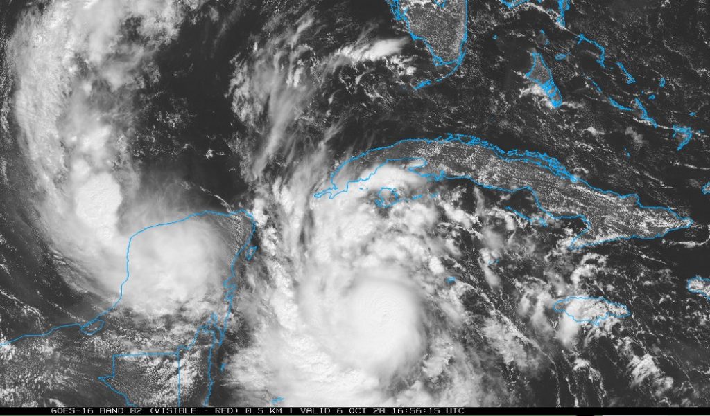
TWEET: Major Hurricane Delta looking pretty mean on the visible satellite imagery. Winds now 115 mph, but still in a rapid intensification cycle. Could reach 140 mph before interrelating with the Yucatan coast Wednesday. Looks like serious business for Cancun and Cozumel. #Delta
EARLY MORNING UPDATE:
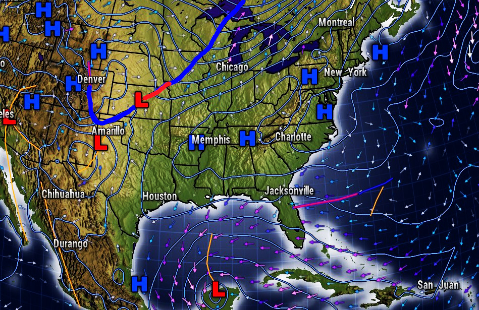
Good Morning! Obviously, Hurricane Delta approaching the Gulf will be the major story for the next several days. How much of a direct influence on us depends very much of the track. When does the approaching trough pick up Delta and where & when does Delta make landfall? Delta is still expected to become a major Hurricane well before reaching the Gulf. We’ll look at the most likely scenario for Alabama, as far as timing and rainfall and expected winds.
Delta is still rapidly intensifying. Now Cat 2 with 100 mph winds, expected to become a Cat 4 hurricane before reaching the Yucatan.
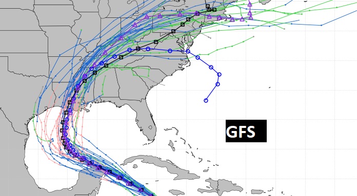
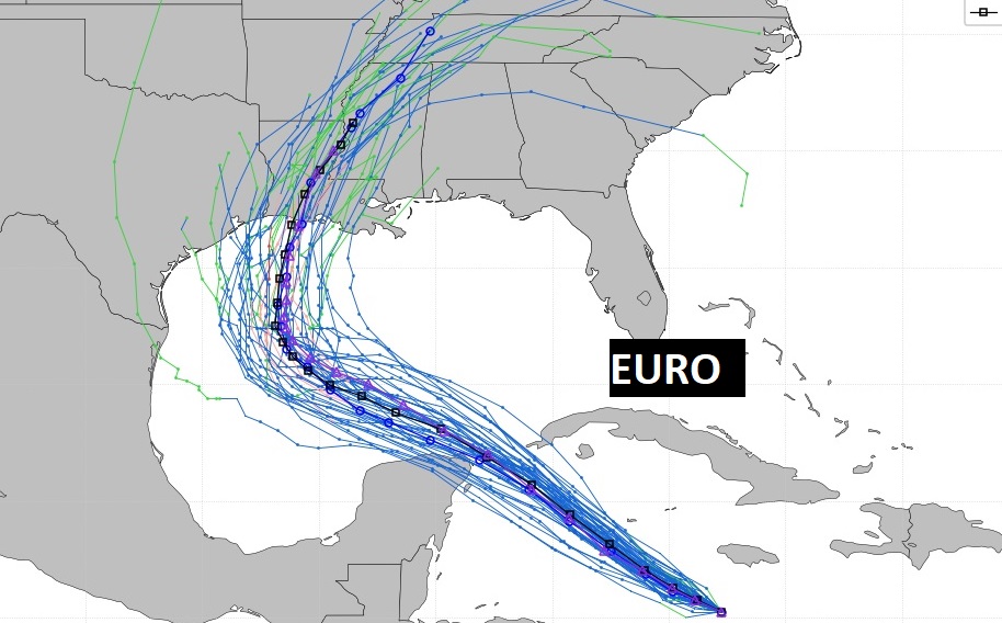
Both the GFS Abd the EURO Ensemble members are bunched together, which adds confidence to the forecast, and both models have edged a little farther left on the track.
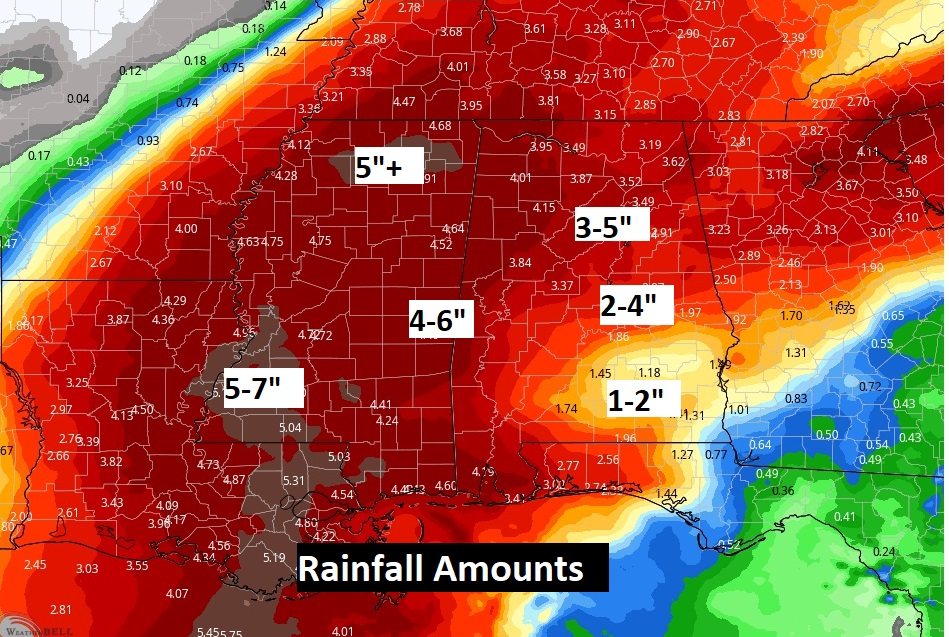
Rainfall amounts have been drastically updated based on the latest expected track of Delta.
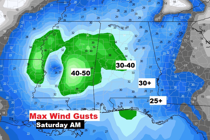
For us, maximum wind gusts are most likely on Saturday and paricykarly Saturday morning and mid-day. 30 mph wind gusts or higher not out of the question.
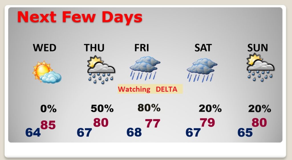
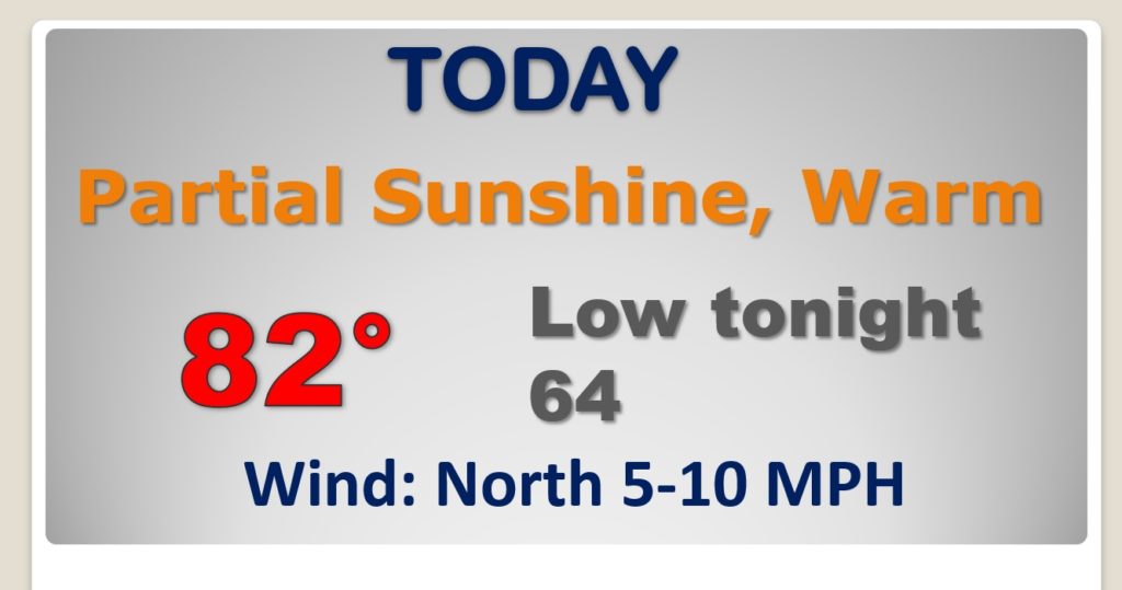
Wednesday will be warm but dry. Risk of showers begins Thursday afternoon and Thursday night. Periods of rain and squalls from Delta especially late Friday, Friday night into Saturday. Decreasing rain chance Sunday as Delta moves into Tenn and toward the Carolinas.