
Good morning! It’s not only chilly, early this morning, it’s the coolest morning of the Fall season so far. Parts of north Alabama could see patchy frost. We’re in the lower 40’s in central Alabama as I type this at 4:45 AM.
Unlike last weekend, the weather for the next few days will be uneventful. We’ll be dry for several days. By Thursday afternoon, there may be enough moisture for an afternoon thundershower somewhere in the area.
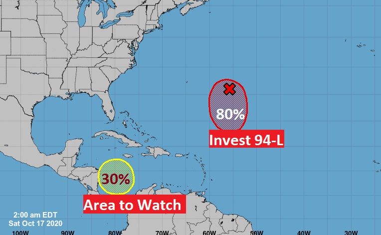
In the tropics, believe it or not, we may need to use TWO more Greek names in the week ahead. I kid you not. Details below.
GREAT day for Football across the Southeast US.
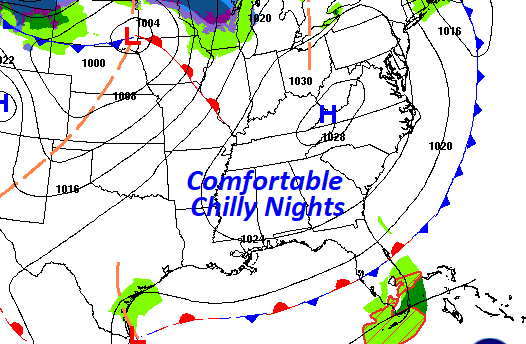
TODAY: Perfection. Cool start. Sunshine. Comfortable. High I the lower 70’s Clear, jacket-weather night. Low 49. North wind at 6 to 12 MPH.
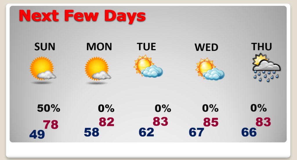
NEXT FEW DAYS: Gosh. Nice. Upper 70’s Sunday after a chilly start. Lower 80’s Monday and Tuesday. Dry through Wednesday. NICE Weather at the BEACH, too this weekend!
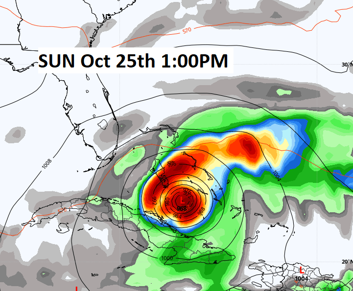
TROPICS: I kid you not. It’s NOT out of the question that we could use TWO more Greek names this week. (sigh) There is Invest 94-L in the Atlantic. It is very likely to become a depression and/or a Tropical storm or sub-tropical storm this weekend. It will not be a problem for the United States. But, hold the phone. Their may be a BIGGER concern. That system in the western Caribbean needs to be watched carefully. The GFS model has consistently suggested it will become a hurricane. Will it have future implications for the Unite States, perhaps by next weekend? Maybe…. It has my attention, for sure.
.
—
That’s one of the shortest weather Blogs I have ever written. Not because I’m lazy….there’s just nothing going on. ????
I hope you have a great Football weekend! Great weather weekend for the Fair, too! Stay safe and well. I’ll have another Blog update early tomorrow morning.
–Rich