
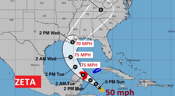
*4:00PM NHC Update:
Zeta is a little stronger, with 50mph wind, stationary over the NW Caribbean. Expected to become a Hurricane before it reaches the Yucatan Monday. Zeta is expected to be just below hurricane intensity at landfall Wednesday along the northern Gulf Coast. #alwx
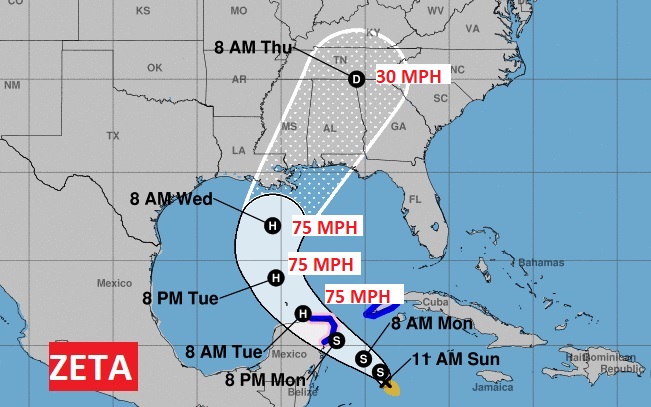
**Changes in the 10:00AM UPDATE:
The track/cone has shifted a little to the east. The cone now covers all of Alabama. Landfall Wednesday, perhaps MS/LA coast. Could be close to hurricane intensity at landfall.
EARLY MORNING UPDATE:
Good morning! We have some very unpleasant things to talk about on this blog update, this morning. The reason for my massive headache, involves Tropical Storm Zeta. Believe it or not, this system is likely to become a hurricane in the Gulf, and the track is aiming toward the north central Gulf Coast again.
In the short term, things are quiet. The front that brought all the rain has made it to the coast. Lots of cloudiness is on the menu today, tonight and part of Friday, but at least it will be comfortable.
Our big tropical problems start Wednesday, through Wednesday night and into Thursday, with multiple weather hazards to worry about. More details.
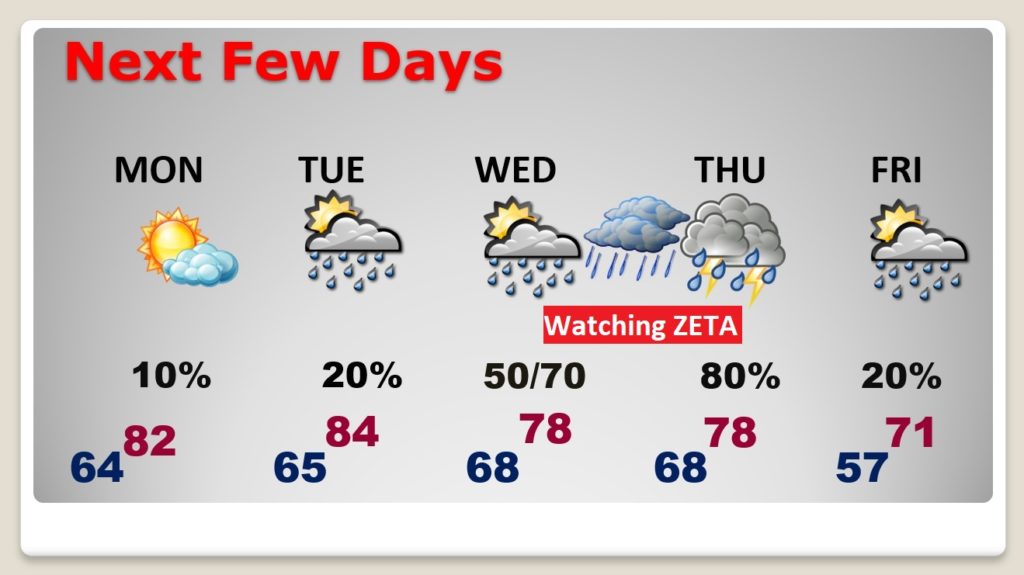
TODAY: Cloudy most of today and tonight. Patchy AM drizzle is possible. Comfortable. High 75. Low tonight 64.
NEXT FEW DAYS: Clouds will hang tough much of the day Monday, but I think the sun will break through in the afternoon. Widely scattered showers Tuesday. But, it looks like the main action with Zeta will begin Wednesday, through Wednesday night into Thursday.
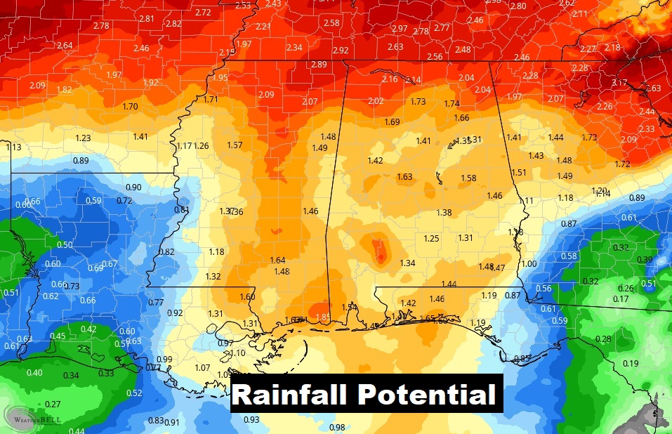
TROPICAL STORM ZETA: It’s hard to believe that we are dealing with another Tropical Threat this week. ZETA is as far as we have ever gone into the Greek Alphabet. (2005) It is the 28th named storm. This system is expected to become a hurricane in the warm Gulf waters, and then aim for the northern Gulf Coast. Complicating the situation, a strong Cold frontal system, sweeping east along the Gulf states will interact with Zeta. Expect locally heavy rainfall, gusty winds, and perhaps the threat of Tropical Tornadoes. The only good news is…these October systems move rather quickly. That may limit the amount of excessive rainfall totals.
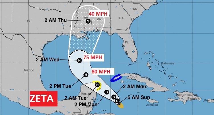
Here’s the latest on ZETA early this morning. Zeta is a 40 mph tropical storm, nearly stationary in the NW Caribbean. Expected to reach the Yucatan channel late Monday as it enters the Gulf. Zeta is expected to become a hurricane in the Gulf by early Tuesday. However, just before Zeta reaches landfall along the north central Gulf coast Wednesday night, the system will likely lose a little of it’s intensity as it begins to deal with increasing wind shear as it begins to merge with the approaching cold front. So, Zeta may come ashore as a Tropical Storm.
Here’s the map set-up late Wednesday on the EURO model. It shows Beta on the LA coast, as a strong Cold Front moves eastward out of Texas. It looks like a very unpleasant set-up, Wednesday, Wednesday night and Thursday.
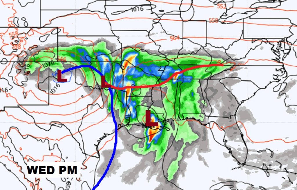
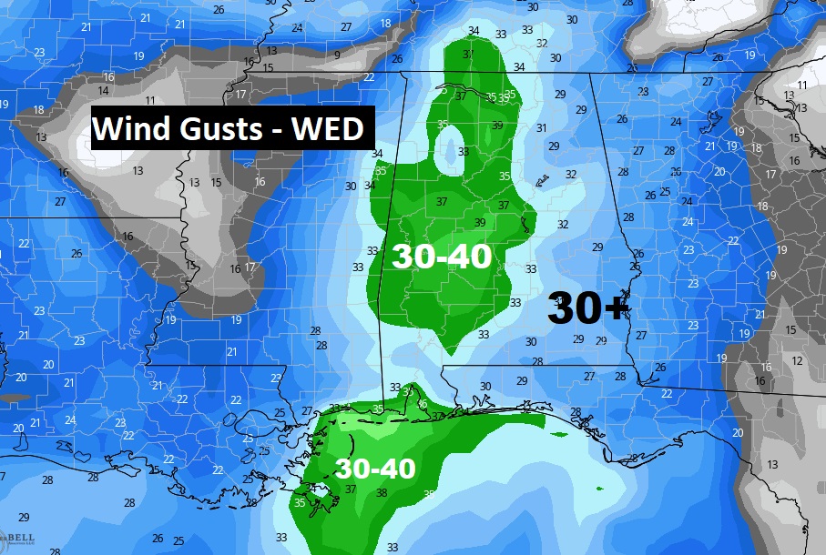
ZETA EFFECTS: We’ll be on the active east side of the track. Here in Alabama, Zeta will bring locally heavy rainfall, gusty winds and probably a tornado threat, too, especially late Wednesday and Wednesday night.
TROPICAL HISTORY: What a year! Historic. Zeta will likely become the 11th landfalling storm in the United States this year. It could become the 11th hurricane. If we go down one more name on the list to ETA, that will be the all-time record.
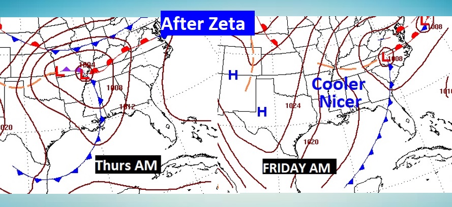
AFTER ZETA: Hang on. Things get much nicer after Zeta. A cold front delivers cooler, less humid air, which should set the stage for a nice Halloween weekend.
—
I’ll have another Blog update in the morning, or sooner if needed. Stay safe and well. Enjoy your Sunday.
–Rich