
Good morning! It’s a Frosty Election Day morning. This morning, by far, is the COLDEST morning of the season so far. Frost will be widespread. Dress appropriately.
The weather on this Election Day should be spectacular. And, after today, this unusually cool November pattern will start to fade away. We have a nice warming trend on the way for late week and into the weekend.
TODAY: Simply beautiful Election Day. Sunshine. Pleasantly cool. High 67. (Yesterday’s high was 64, normal 74) North wind at 4 to 8 mph. Clear and cold tonight. Low 42.
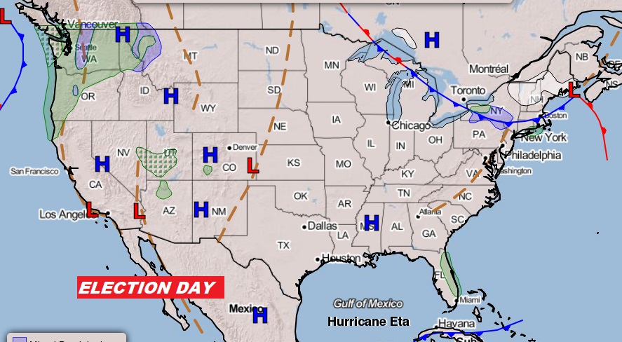
Election Weather Coast to Coast today.
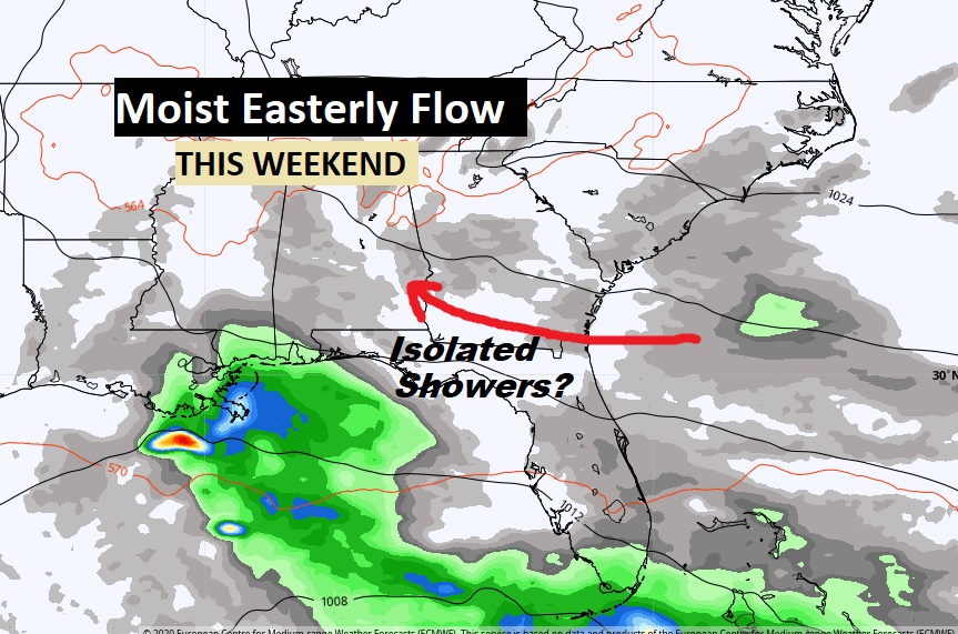
WEEKEND MOISTURE RETURNING? This weekend, a most easterly flow off the Atlantic will bring in a sun/cloud mix and perhaps some isolated showers. The Good news is, we will have a very ice warming trend underway. We’ll put in a small chance of isolated showers over the weekend.
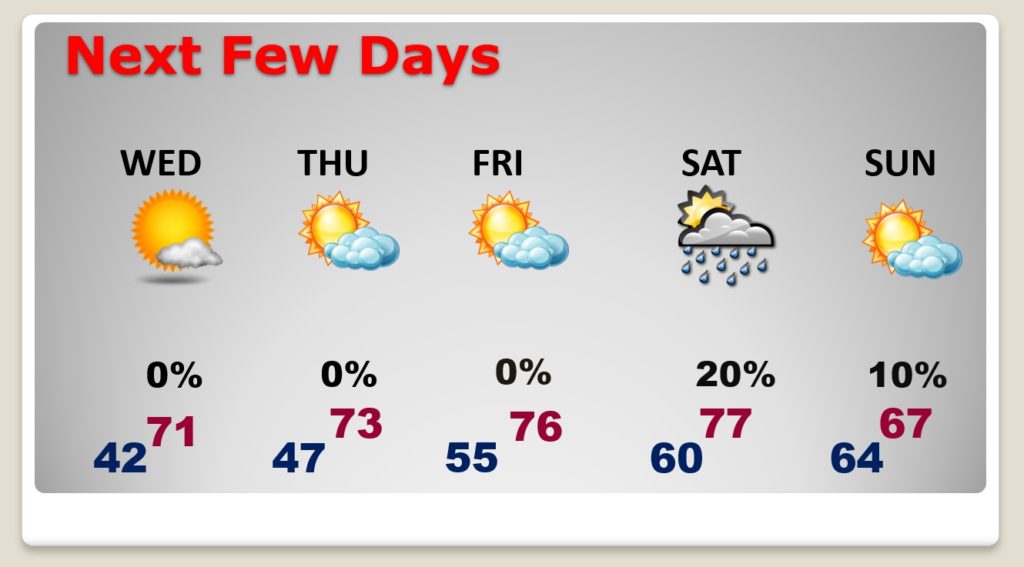
NEXT FEW DAYS: The days and nights will be getting warmer. We’ll be in the lower 70’s Wednesday & Thursday, mid 70’s Friday and upper 70’s this weekend. I’ll traduce a small chance of widely scattered showers this weekend.
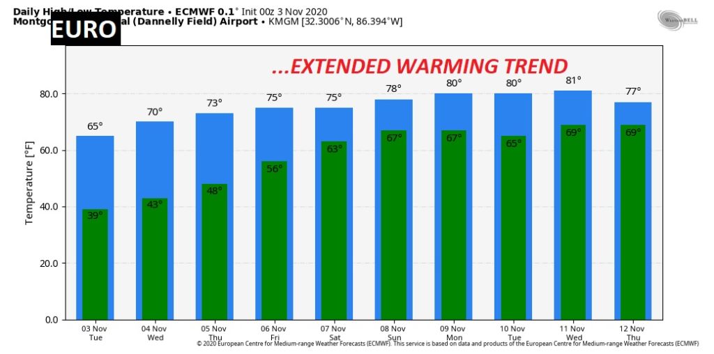
Good news. The late week warming trend will continue well into next week.
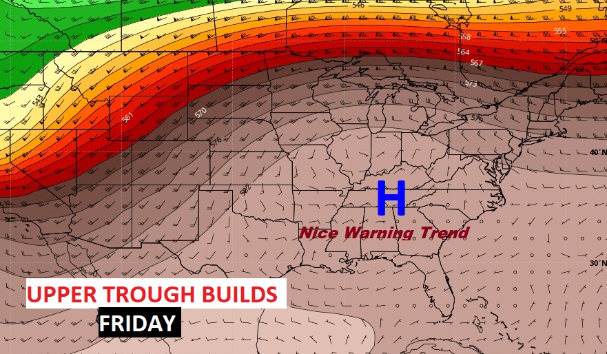
The Upper High, building late in the week will promote a nice warming trend. Beautiful. The warming trend will last through the upcoming weekend. Looks great.
HURRICANE ETA IN THE CARIBBEAN: Eta went through a scary rapid intensification in the warm Caribbean on Monday, becoming a dangerous Category 4 Hurricane. This morning, it is not too far under Category 5 intensity.
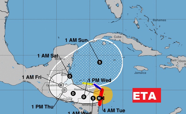
ETA is an extremely dangerous SEVERE Hurricane, with 150 mph winds, now located 25 miles from the coast of Nicaragua, hours from landfall, moving WSW at 5.
NHC says, about ETA: ...LIFE-THREATENING STORM SURGE, CATASTROPHIC WINDS, FLASH FLOODING,
AND LANDSLIDES EXPECTED ACROSS PORTIONS OF CENTRAL AMERICA…
On the NHC Cone, I want you to notice the disturbing turn Eta makes back into the open Caribbean over the weekend. Eta’s future must be monitored very carefully.
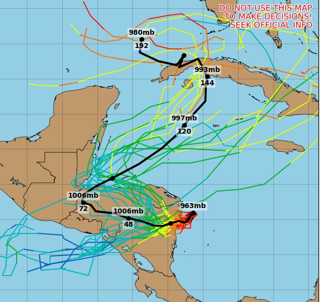
Some of the future model tracks on ETA’s distant future is very disturbing. The models are all over the place, but they suggest Eta could have an interesting Future after it’s encounter with Central America. We will be closely monitoring Eta’s future. It could become a Gulf of Mexico problem, maybe.
A VIDEO GREETING!:
- –
I will have another Blog Update for you tomorrow morning. Everything should be back to normal. Have a great Election Day! Please vote!
–Rich