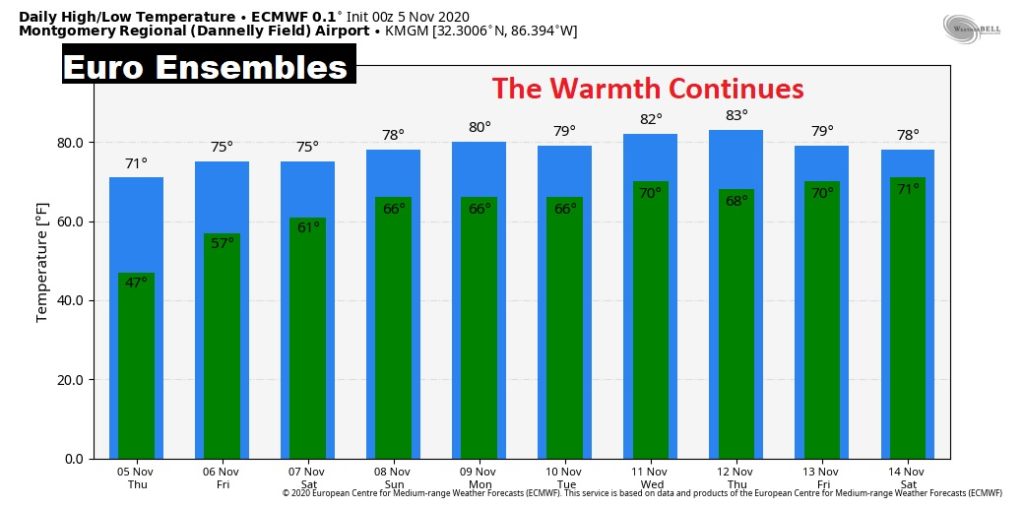
Good Morning! Our temperatures are moderating. The nice trend will continue. The weekend forecast is mainly warm and dry and that trend continues into the next week. But we continue to monitor the future progress on ETA in the Caribbean. It is now becoming more and more likely that Eta will be in the Gulf next week, and eventually could threaten the northern Gulf coast. I’ll show you future model trends on this video.
Nice comfortable day today. Warm & Dry today. Highs aiming for the mid 70’s. Tonight….not nearly as cool.
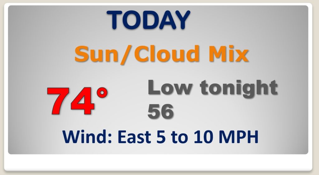
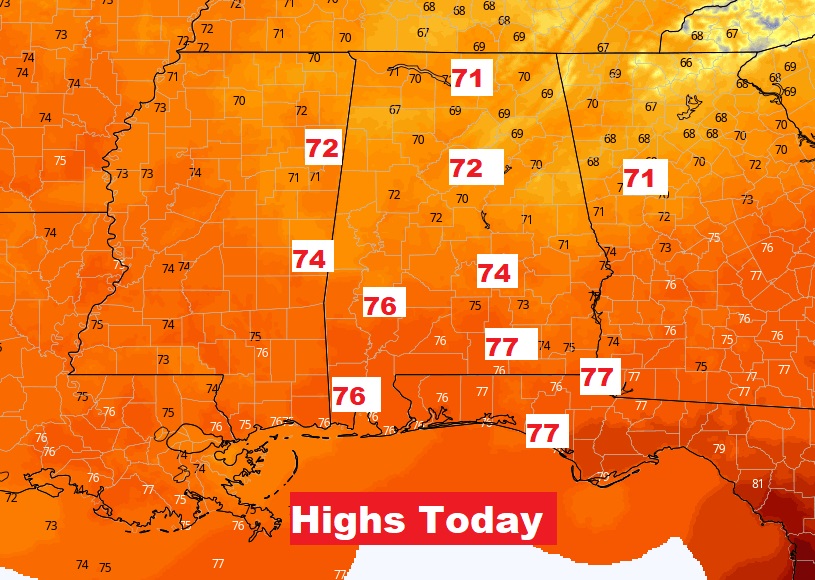
NICE Warming continues today. We will be well into the 70’s.
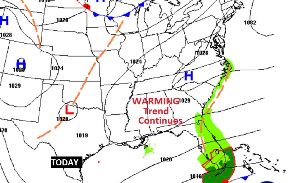
There will be cloudiness at times, but the weekend should be warm & mainly dry. Showers will tease the cost, but I have the rain chance under 20% locally through Monday. The Warming Trend continues. Fortunately the nights will be much warmer.
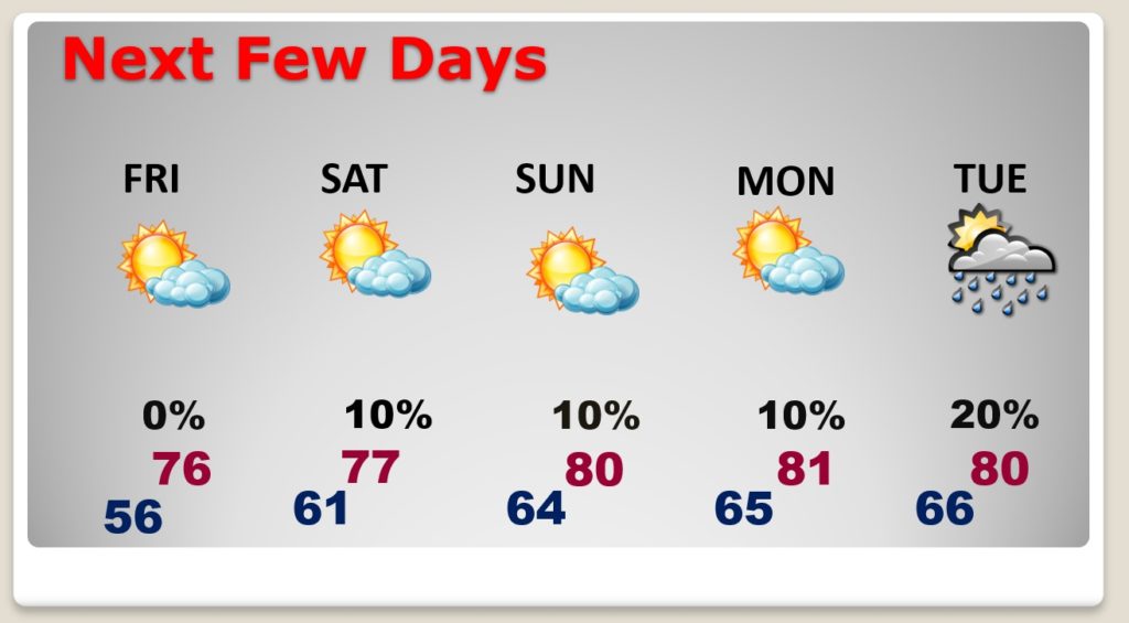
Good news. No signs of any Chilly Air arriving over the next several days. the warming trend continues.
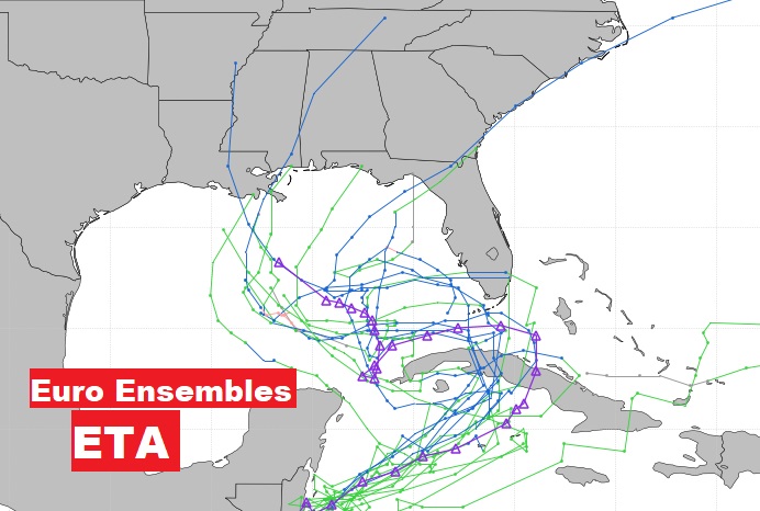
Here’s the latest ETA cone from NHC this morning.
It now appears LIKELY that we will be dealing with ETA in the Gulf of Mexico next week. It could target the northern Gulf Coast by late next week.
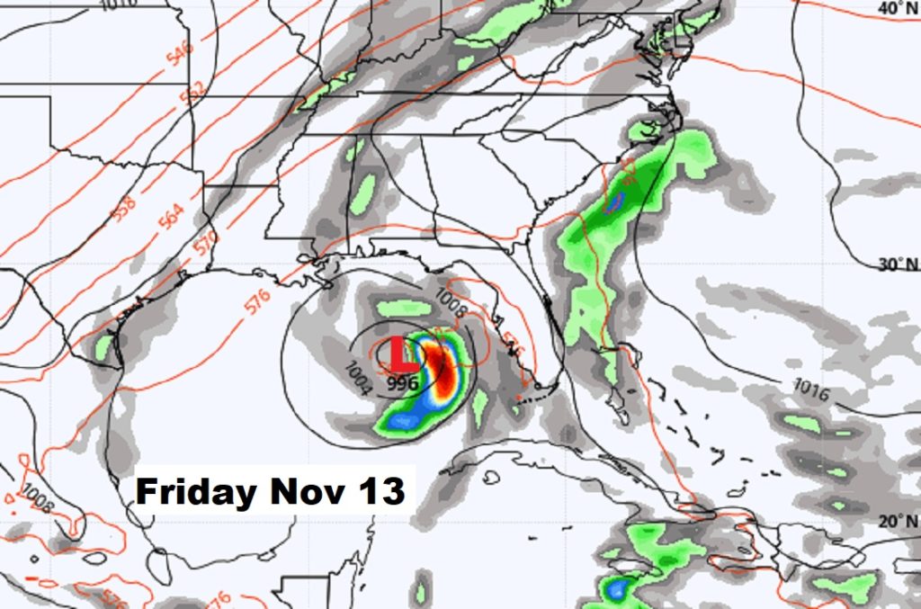
This is just one Model. But, here’s a snapshot of the GFS about a week from now on Friday November 13th. Something NONE of us want to see. Stay tuned.