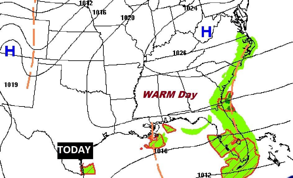
Good Morning! Our weather in the short-term is routine. Our nice warming trend continues, and we’ll be rather warm for November this weekend. The rain chance over the weekend is not zero, but very low. Looking ahead to next week, all eyes are on the Gulf of Mexico. The tropical system named ETA will assault south Florida this weekend, and then make a left turn into the Gulf next week. What then? Will it be a tropical storm? Could it be hurricane? Where will it make landfall? It’s complicated, but I’ll update you on the latest on today’s video.
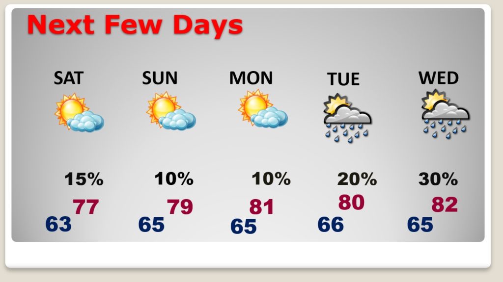
It will be cloudy and times, but today will be warm for November, and dry. Comfortable.

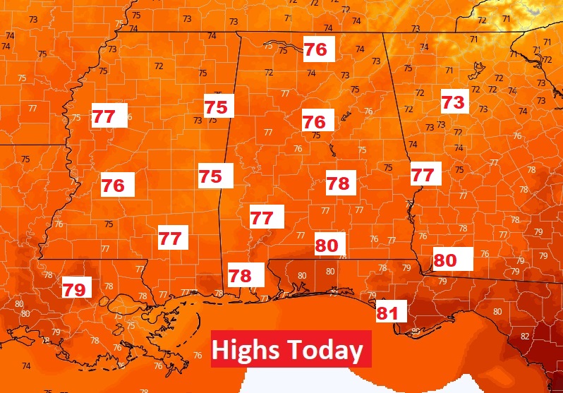
Our nice warming trend continues today. Yesterday’s high was 76. Even the nights are becoming warmer.
Over the weekend it will be cloudy at times. Rain chances are not zero, but very low. Gulf moisture increases Tuesday and Wednesday, so showers are back in the forecast. After Wednesday, there is much uncertainty as we watch the Tropical System in the Gulf.
The latest CONE on ETA from the Hurricane Center shows that big balloon dominating most of the eastern Gulf, highlighting the unusual degree on uncertainty on this system’s future. Eta is a Tropical Depression this morning, expected to regain Tropical Storm Strength again today over the warm Caribbean. Air Force RECON will investigate ETA today. It’s expected to have a rather nasty interaction with Cuba, south Florida and the Florida Keys over the weekend, before entering the Gulf early next week. Current NHC intensity forecast has this system as a strong Tropical Storm over the Gulf.
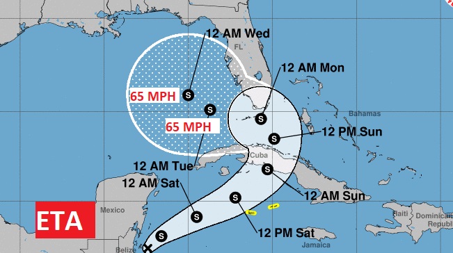
As you can see on the GFS and EURO Ensemble model trends, once the Tropical System enters the Gulf, most tracks point to the northern Gulf coast late next week.
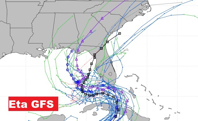
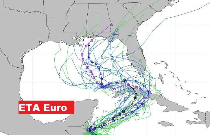
Most models keep the Tropical System under hurricane intensity. At least one model brings it close to hurricane intensity. Stay tuned. This could change over the next few days.