
Good morning! The news for now is routine and comfortable . Our warmer than normal November temperatures are still in place and we’re dry.
Gulf moisture will bring showers back into the forecast by mid week.
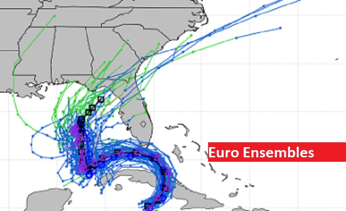
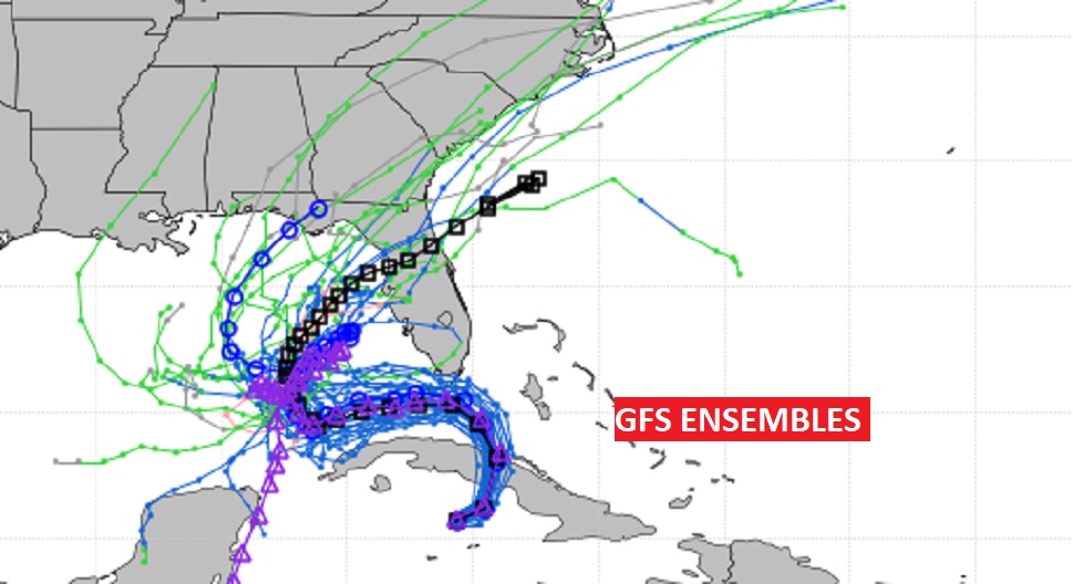
Then, we are still monitoring the future Track of Eta which will enter the Gulf Monday night. The future destination of Eta’s landfall is still unknown.
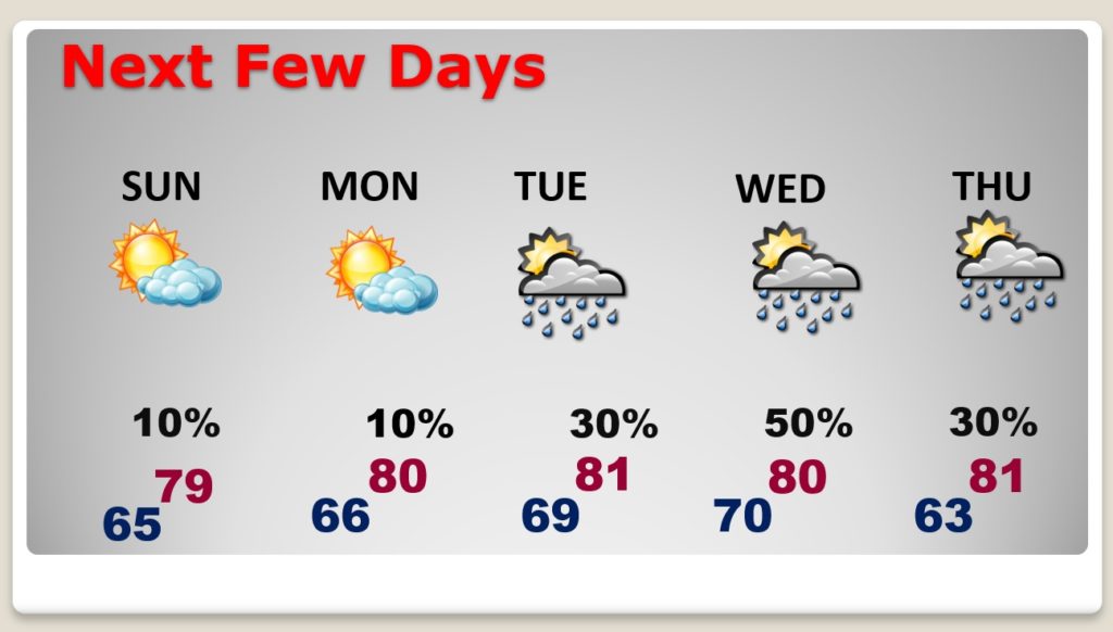
TODAY: Partial sunshine. We should be dry and warm. High upper 70’s to near 80. Low tonight 66.
‘
NEXT FEW DAYS: Monday is dry and warm. Scattered showers return to the forecast Tuesday and Wednesday. Late week depends on ETA.
TROPICAL STORM ETA: Eta is a strong tropical storm with 65 mph winds headed towards south Florida today. Tropical storm warnings. But, later in the week, the models are still having a lot of trouble with Eta’s future destination. NHC still has a rather large cone covering the eastern and northern Gulf.
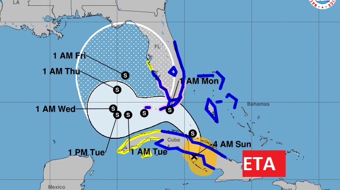
Many model trends take Eta to a landfall on the northeast Gulf coast late week, but as you can see not all models agree.
—
I’ll have a complete video update in the morning. Enjoy your Sunday.
–Rich