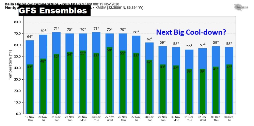
Good Morning! It’s another very chilly morning. But, our week-long chill is about to fade. The days will be warmer, and the nights will not be nearly as cold. The big warming trend really gets rolling Friday and into the weekend as we soar well into the 70’s. Nights will be back to the 50’s by Saturday night. And, we still have a storm-free pattern, probably through Tuesday. However, a Thanksgiving Week storm system is starting to look more impressive. I have the latest on timing. Plus, the Thanksgiving Day forecast.
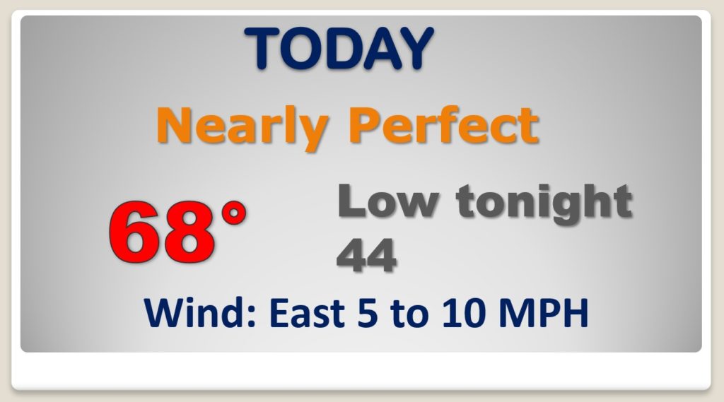
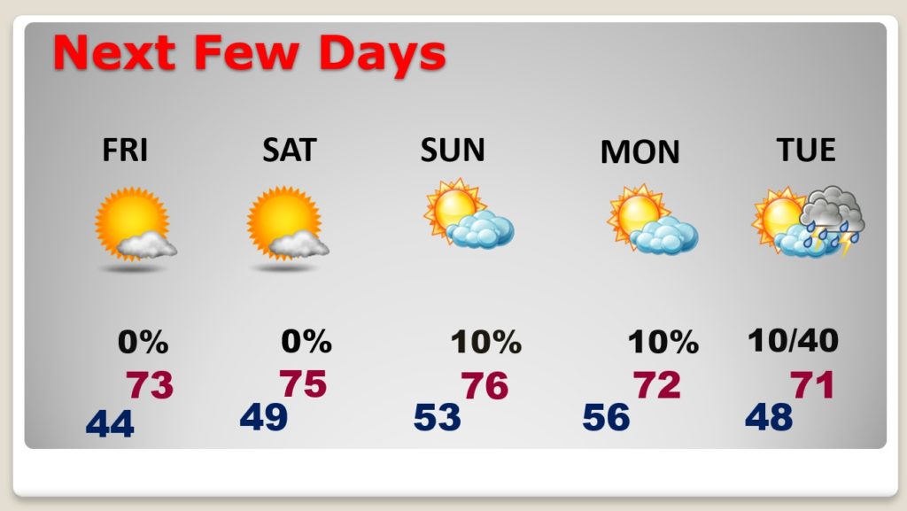
GREAT day today. the early morning chill will fade quickly as we head for the upper 60’s. Not as cold tonight.
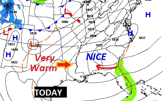
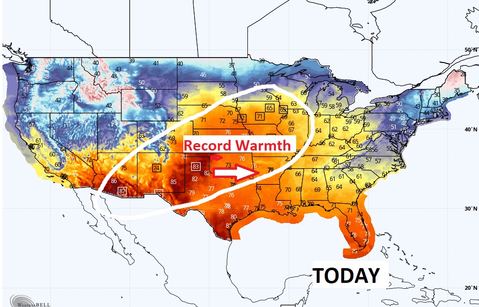
It’s very warm in the the middle of the country. Record Highs continue. That warmer air is spreading eastward, just in time for our weekend.
Nice Warming trend starts Friday. Still dry and storm-free will maybe Tuesday night.
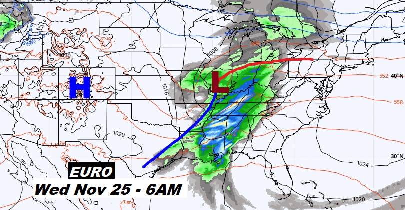
That mid week storm system on Wednesday (Thanksgiving Eve) is starting to look more impressive. Showers and thunderstorms. Here’s the EURO at 6AM next Wednesday.
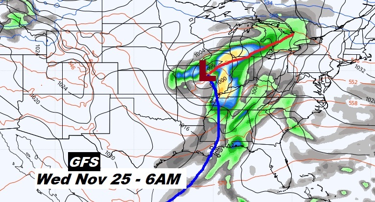
The set-up on the GFS model is a little more ominous, as the possibility of stronger storms. Will they be severe? It’s too early to say.
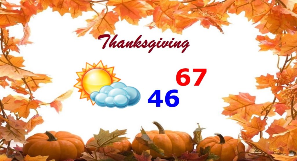
So far, Thanksgiving looks like a very nice day.
The next big cool down could begin during that last week of November into the early part of December.