Good Morning! We’re in a transition from a tranquil weather pattern to a very active pattern over the next 5 days. Storm system #1 will effect the state today and tonight. A late weekend storm system looks little concerning. And, in between, a series of disturbances will keep us wet at times. There will be a low-end severe threat tonight, and perhaps a stronger threat Sunday. MUCH Colder air funnels into the state Monday. Get ready for cold week next week.
Formidable storm system from the Great Lakes to the Gulf coast will affect Alabama today and tonight with showers and storms.
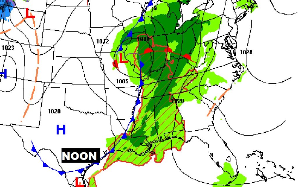
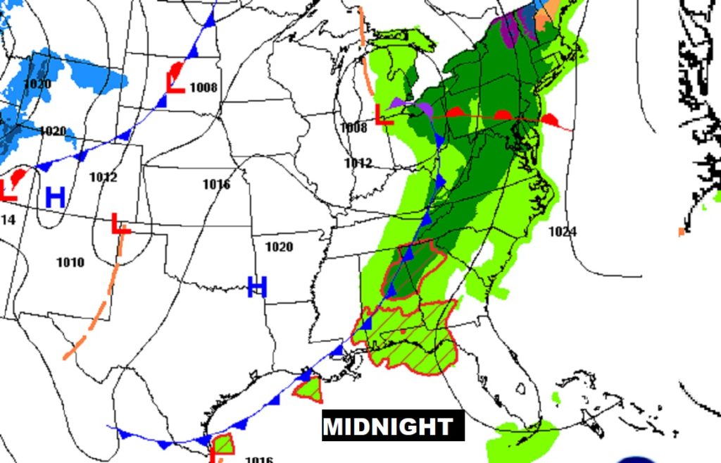
Some of the stronger storms could affect central and south Alabama after Midnight and into the wee hours.
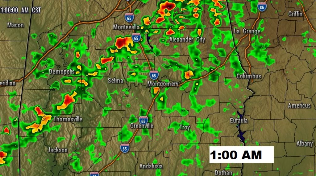
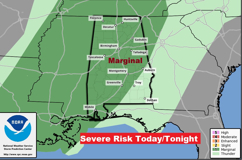
Low end severe weather threat especially this evening and tonight, and particularly in the western and northwest counties. Can’t rule out a few severe storms. Marginal Risk.
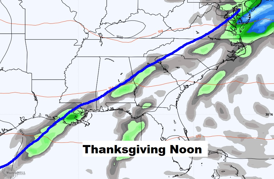
The front slows up on Thanksgiving. I’m going to have to keep in at least a 30% chance of scattered showers in the forecast, especially through mid day. Comfortable. Highs in the 70’s
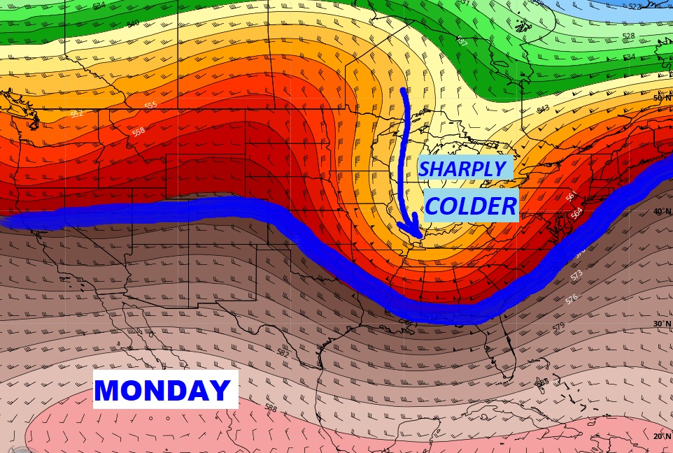
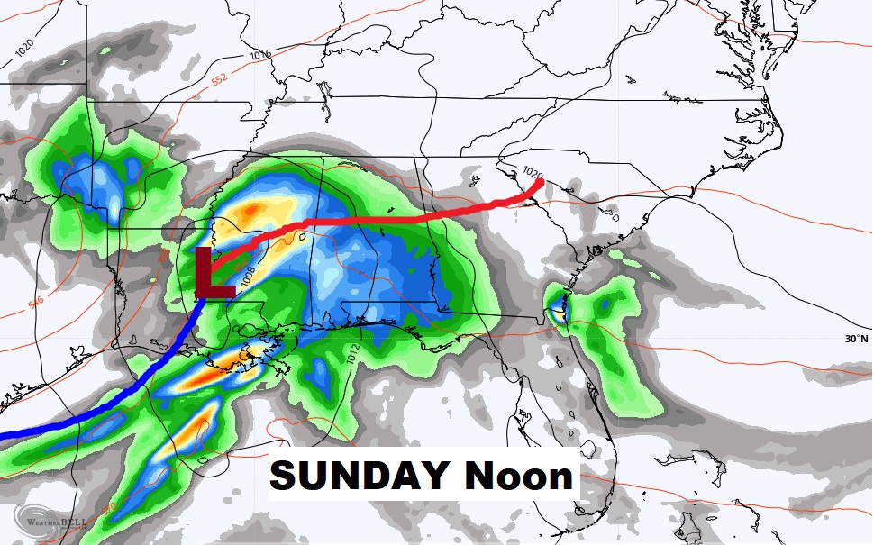
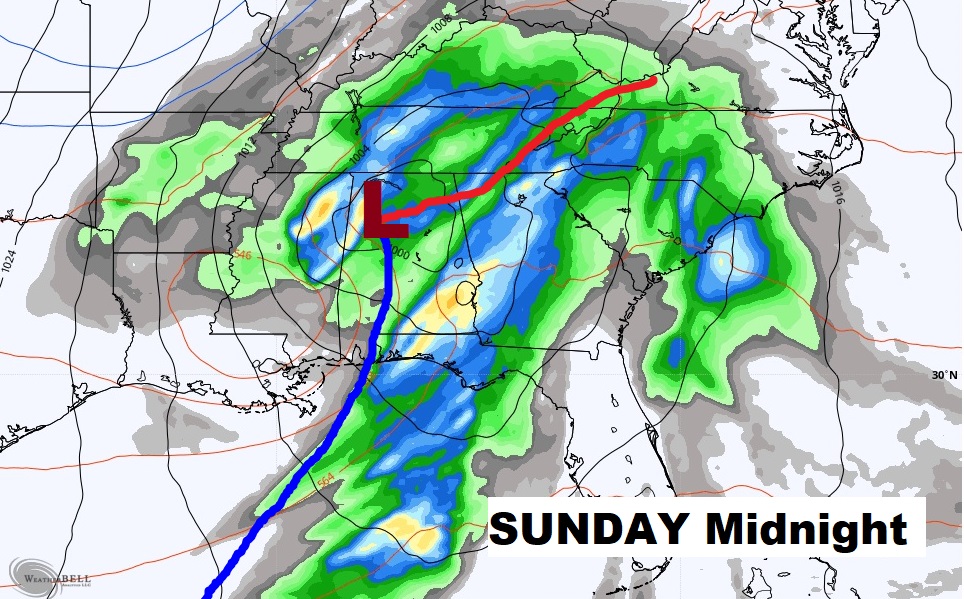
Wet at times through Sunday and perhaps early Monday, before it turns sharply colder.
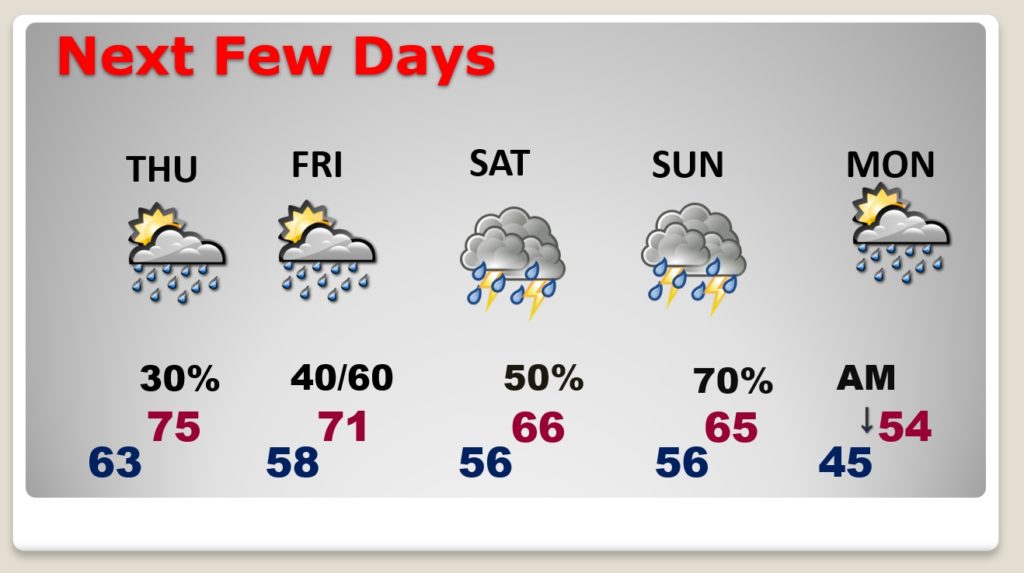
That Sunday storm system looks concerning to me. I’m worried about severe weather. MUCH colder air follows the storm.
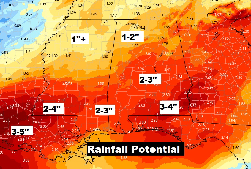
After weeks of dry weather, we could see a significant amount next 5 days.
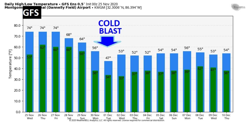
Are you ready for a COLD BLAST next week? Sharply colder, starting Monday.