
Good Morning! Today will be relatively quiet and dry. But, get ready for big changes ahead.
Tomorrow will be the main event, as a robust storm system affects to the state. The final and strongest disturbance in this series. That system is associated with a strong cold front.
Expect a shocking temperature drop Monday. Get ready for temperatures in the 20’s by Monday night. The first widespread freeze. The coldest morning will be Wednesday morning.
.
TODAY: Patchy fog early in the morning. Mostly cloudy, dry and quiet today. High 69. Cloudy tonight. Dry. Low 56.
STORM SYSTEM TOMORROW: The final disturbance begins to effect the state in the wee hours of Sunday. This will be a rather robust storm system, associated with a strong cold front. Showers and storms will become likely. Rainfall could be rather heavy.
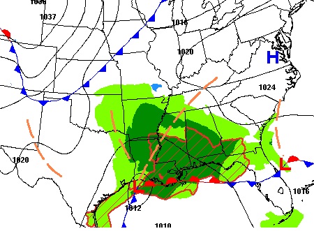
Here’s the map tomorrow morning, with the main low on the Texas coast.
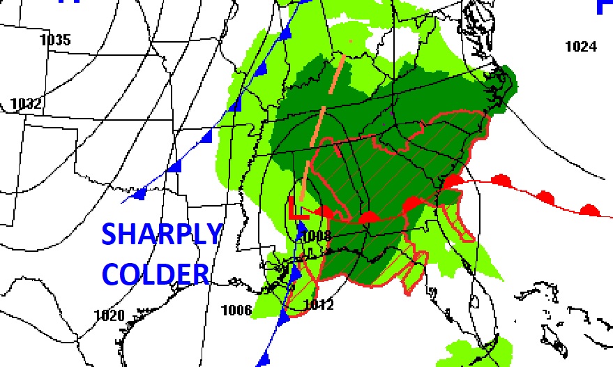
By 6 PM, the low has made it to the Alabama border.
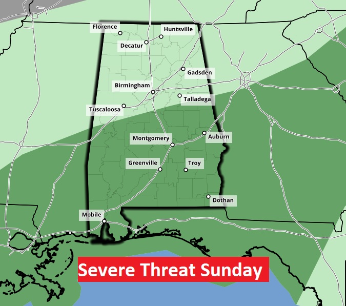
The Storm Prediction Center says there could some severe storms. Right now, a Marginal Risk covers the southern half of Alabama.
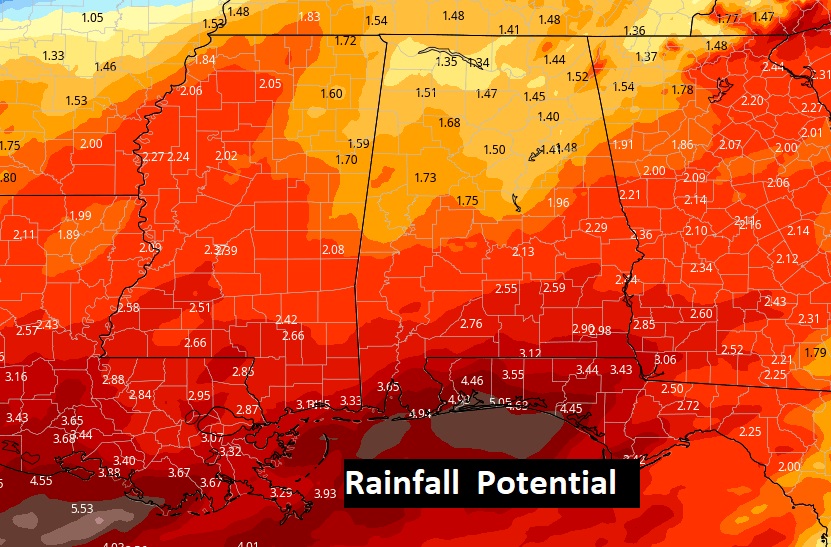
Additional rainfall potential could total 2”+ in spots before the rain ends by Monday morning.
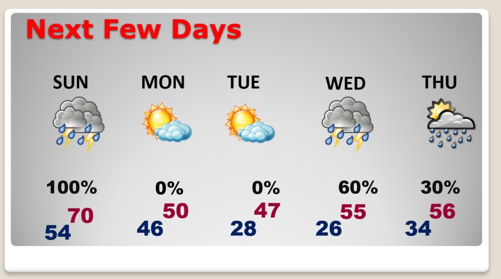
NEXT FEW DAYS: By far the coldest air of the season will follow the storm. Monday’s high will barely reach 50. Winds will make it seem colder. We’ll be in the 20’s Monday night and perhaps the mid 20’s by Wednesday Dawn. Tuesday’s high will only be in the 40’s. Winter is coming. Get ready.
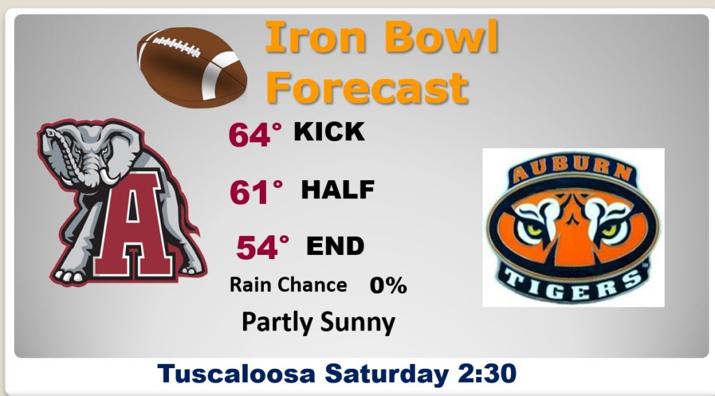
IRON BOWL FOREAST: Looks like a great day for football in Tuscaloosa today. Partly sunny. High in the mid 60’s. North wind at 5 to 10 mph. Dry.
- –
I will have another Blog Update for you tomorrow, Sunday morning. I Hope you and your family have a wonderful Iron Bowl Saturday!