
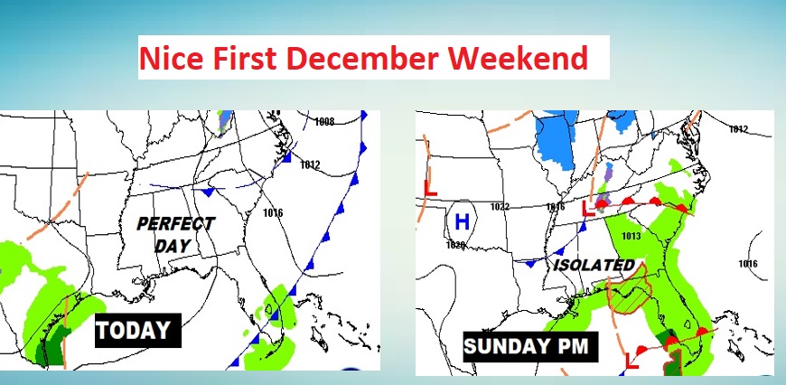
Good Morning! The News is good on this first weekend of December. In fact, we are headed into an extended period of tranquil storm-free weather.
You won’t find much to complain about this weekend. Today will be just about perfect, with lots of sunshine, and comfortable for December. While Sunday will be mostly cloudy, the rain chance will be very small. Perhaps a stray shower somewhere.
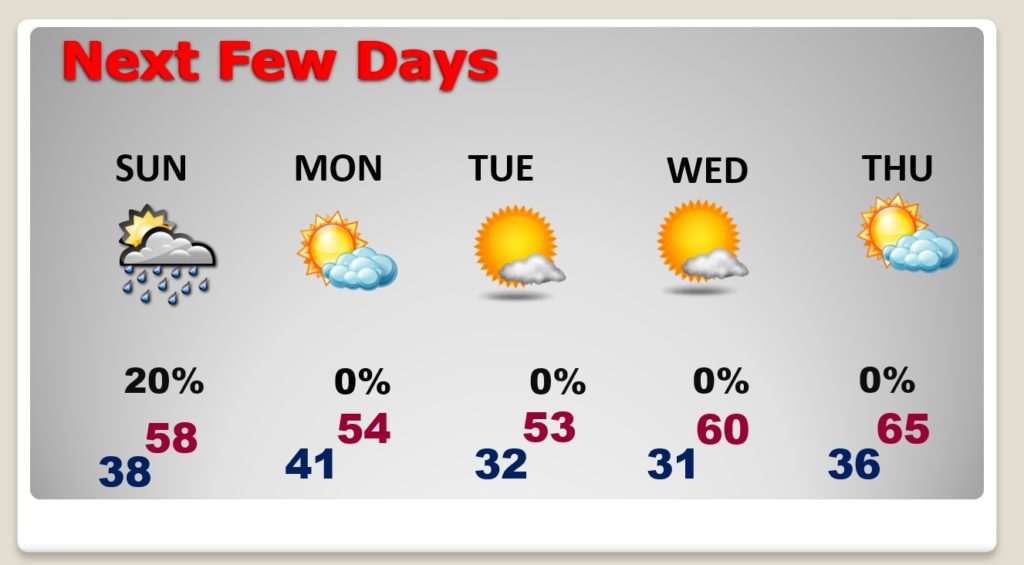
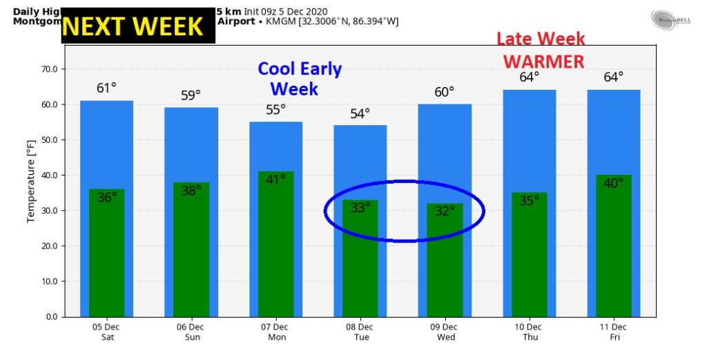
Next week will be storm-free. Chilly Monday and Tuesday. A lot warmer Thursday, Friday and maybe beyond.
TODAY: Plenty of sunshine. The morning chill will fade quickly. High 61. (Normal High 63) Partly cloudy and chilly tonight. Low 38. (Normal Low 39)
NEXT FEW DAYS: Sunday a minor disturbance will brush by the state, followed by a cool front late Sunday night into Monday morning. I have a tiny rain chance in the forecast (20%) especially late Sunday afternoon into Sunday evening. Rather Chilly Monday and Tuesday. Breezy and cool. We’ll be near the freeze mark on Tuesday and Wednesday morning. Nice late week warming trend.
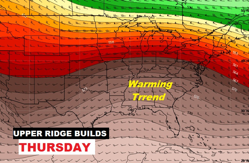
By Late week, a Upper Ridge builds, which will for some warmer days. Look for warmer days Wednesday through Friday and perhaps into the following weekend.
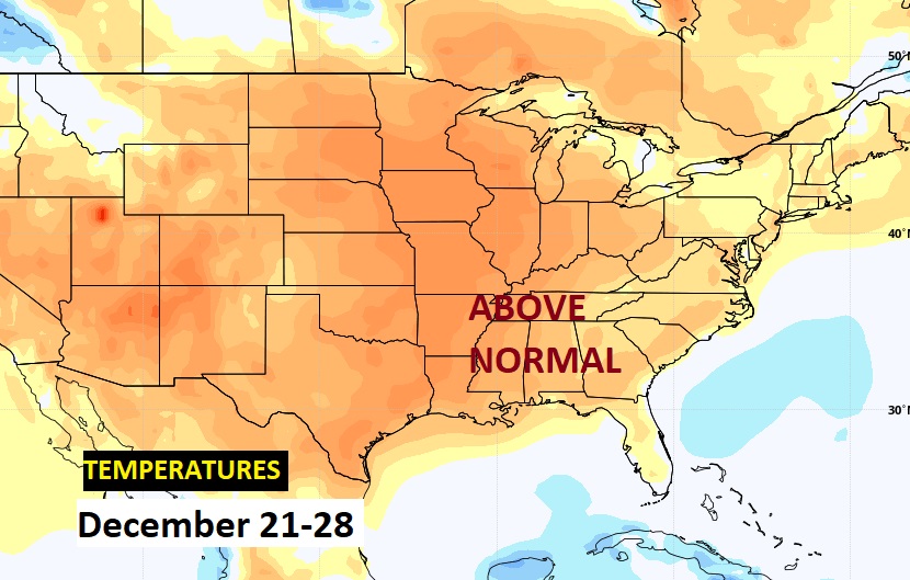
LONG RANGE: Depending on which model you look at, we could get into a more active storm pattern between about December 12-18. Perhaps two potentially “interesting” storm systems. (Severe Weather potential? Maybe one of them. Stay tuned. ?) ) MOST models continue to indicate much above normal temperatures for late December
GOOD MORNING!
—
I hope you enjoy this nice, storm-free early December weekend. I’ll have another Blog update early tomorrow morning. Stay safe and warm.
–Rich