
Good morning! Much of today will be dry and very mild again. Hang on, though. We have another storm system on the way which will spread rain and a few thunderstorms across the area tonight.
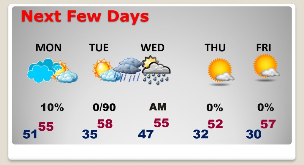
Get ready. Monday will windy and sharply colder, much like last Monday. We are in an active weather pattern. There’s more rain in the forecast by Tuesday night. Late week will be chilly with a couple of freezes. Another storm system will move in next weekend.
Here’s the set-up at 6:00PM tonight. Low pressure near Jackson, MS. Will track northeastward, dragging a cold front across the state overnight.
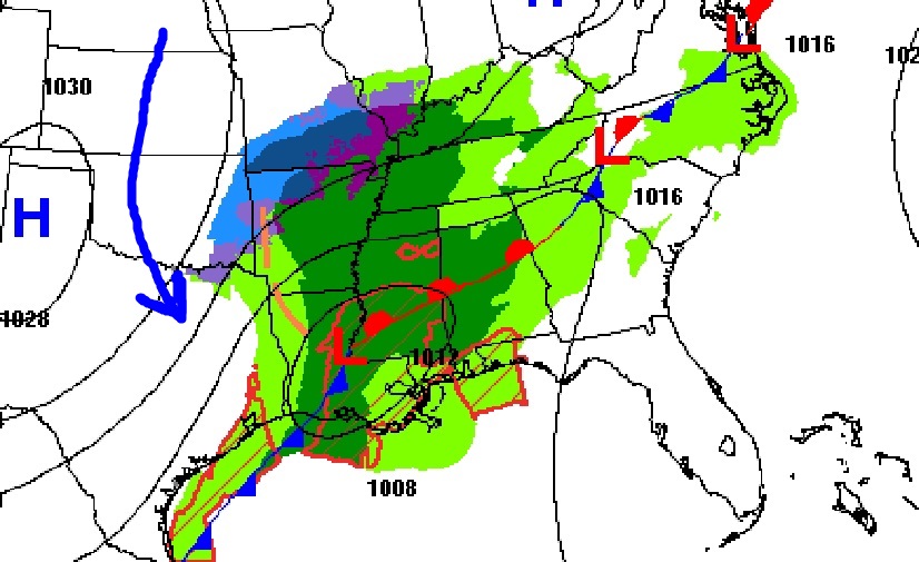
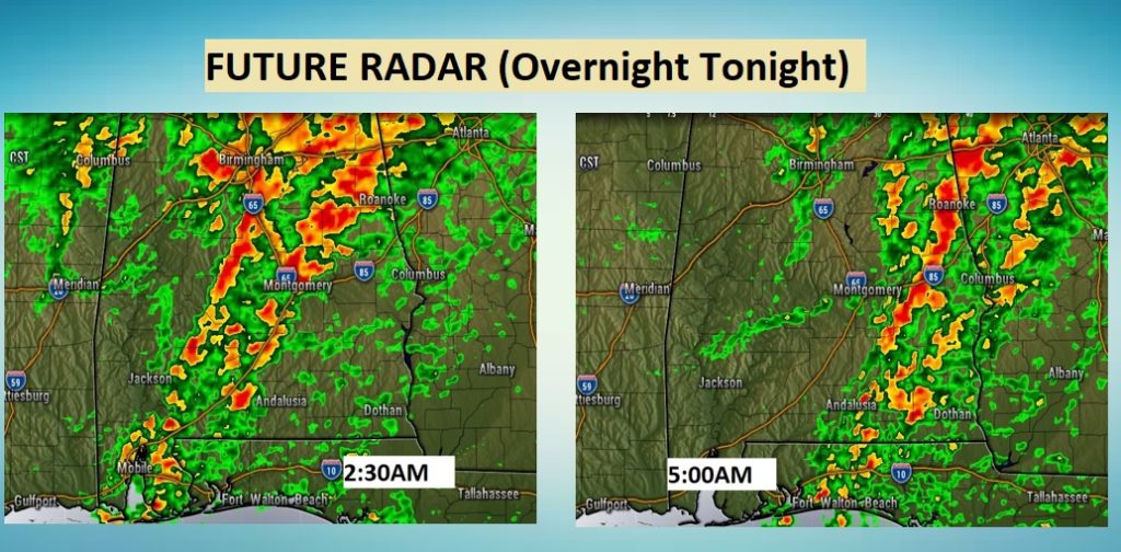
TODAY: Much of this day will be dry and very mild again. There will even be some sun mixed in with the clouds. High today 70. Risk of some spotty showers after about 2PM. Rain and thunderstorms will overspread the state tonight. Some of the heaviest rain will be in the overnight hours. (See Future radar below) It will be quite windy overnight. Most of the rain should be gone by Dawn Monday.
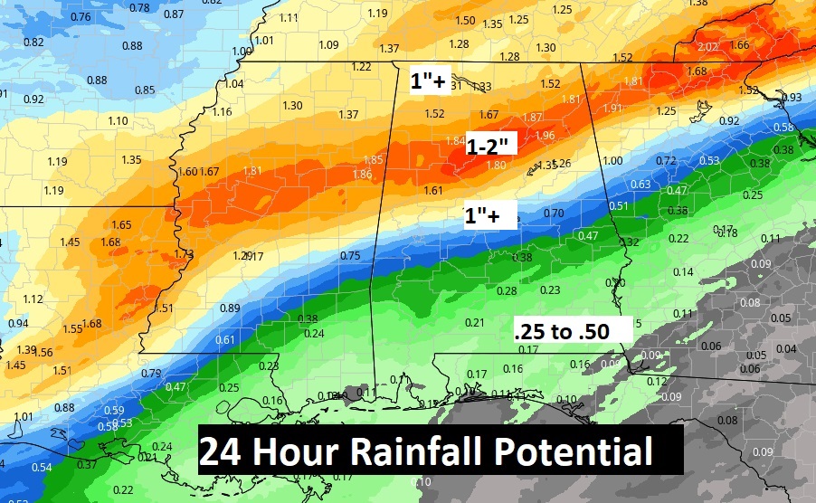
Rainfall will vary quite a bit from less than half an inch in the Wiregrass to 1-2” across north central Alabama.
NEXT FEW DAYS: Monday will be a raw day. Windy and colder. Temperatures in the 50’s will feel much colder with the wind. More rain arrives Tuesday night into Wednesday morning. We’ll be close to freezing Thursday and Friday. Thursday will be breezy and cold.
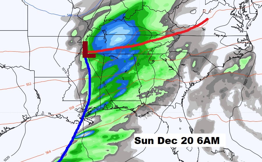
NEXT STORM SYSTEM: As this very active pattern continues, expect another storm system next weekend. Here’s a snapshot of next Sunday morning, December 20th. Then, it still looks like a potential significant storm system towards Christmas Eve day & night.
—
Have a GREAT Sunday! Enjoy the last comfortable day. I’ll have a complete video update in the morning.
–Rich