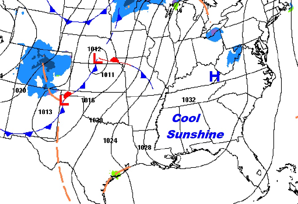
Good Morning! COLD air dominates Alabama this morning. But, gradually, the cold air will begin to retreat. There are some milder days ahead. The active pattern continues. Another storm system will bring showers to the area over the weekend. There are some new wrinkles in the Christmas Week forecast. The timetable of the next storm system has changed. I’ll unveil the details of a very interesting holiday week forecast.
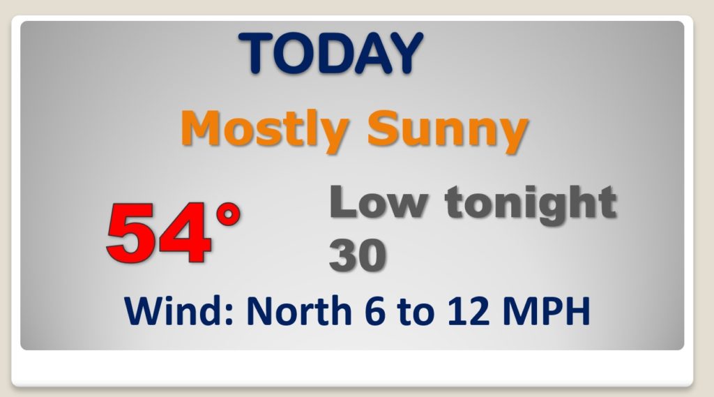
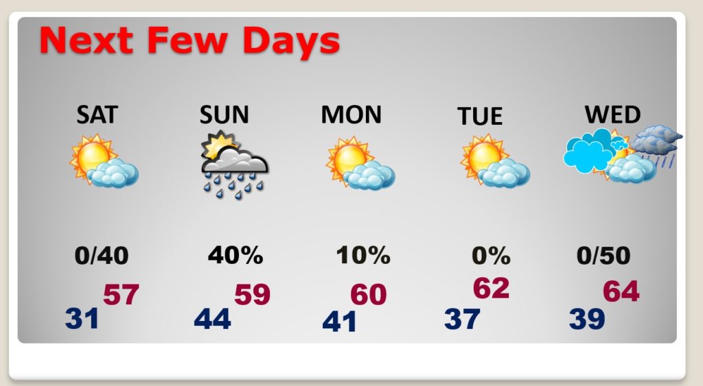
Not as cold today, compared to yesterday. Another freeze tonight.
Scattered showers are back Saturday night and Sunday. No Severe weather.
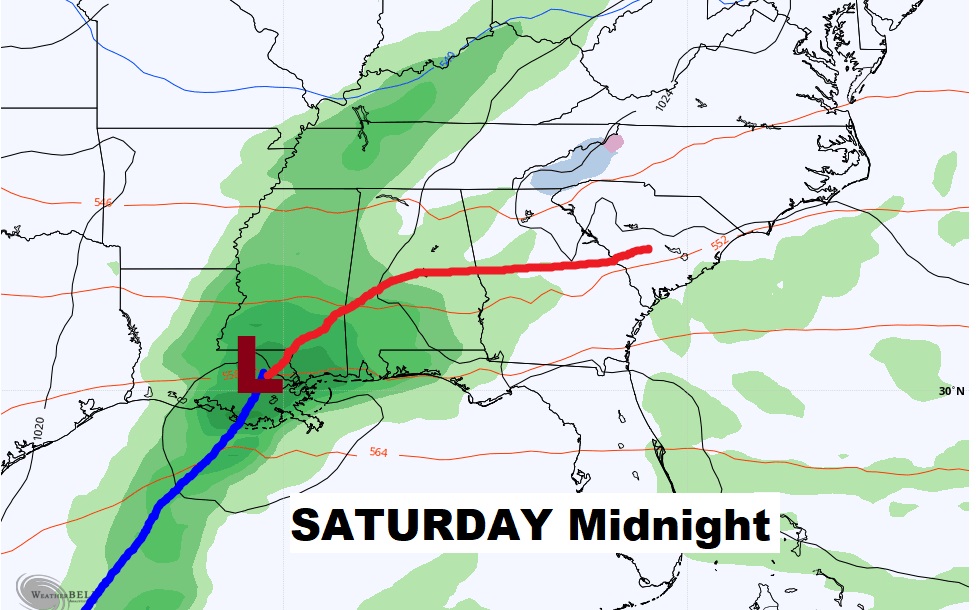
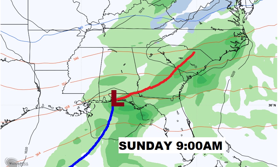
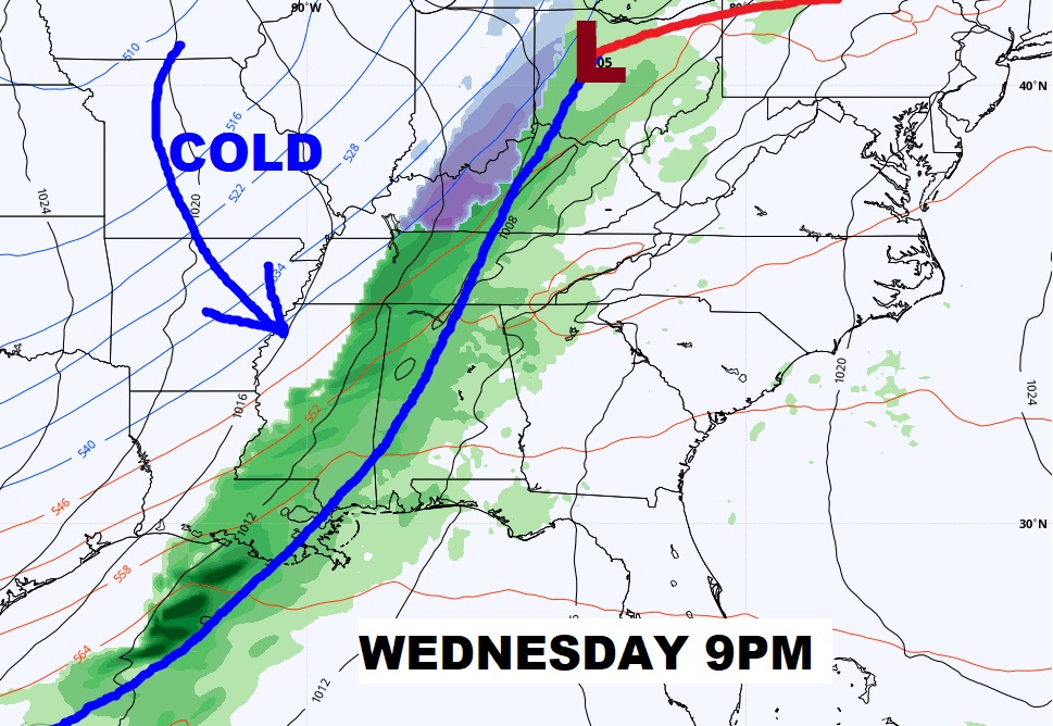
Milder temperatures. Rain risk Saturday night and Sunday. Nice Monday. Tuesday, Wednesday with a warming trend. The Christmas week storm system is moving faster now and could affect us by Wednesday night.
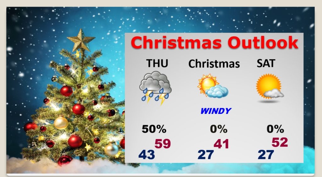
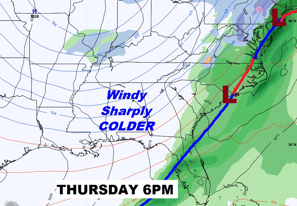
The Christmas week storm system is moving faster now and could affect us by Wednesday night. Rain and thunderstorms. On this new time table, the cold front moves through Thursday morning. Rain ends later. Windy & Drastically colder Christmas Eve night and Christmas Day.
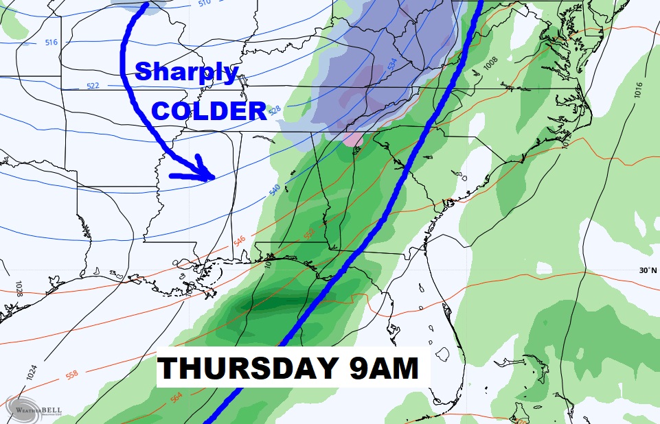
ARCTIC air for Christmas.
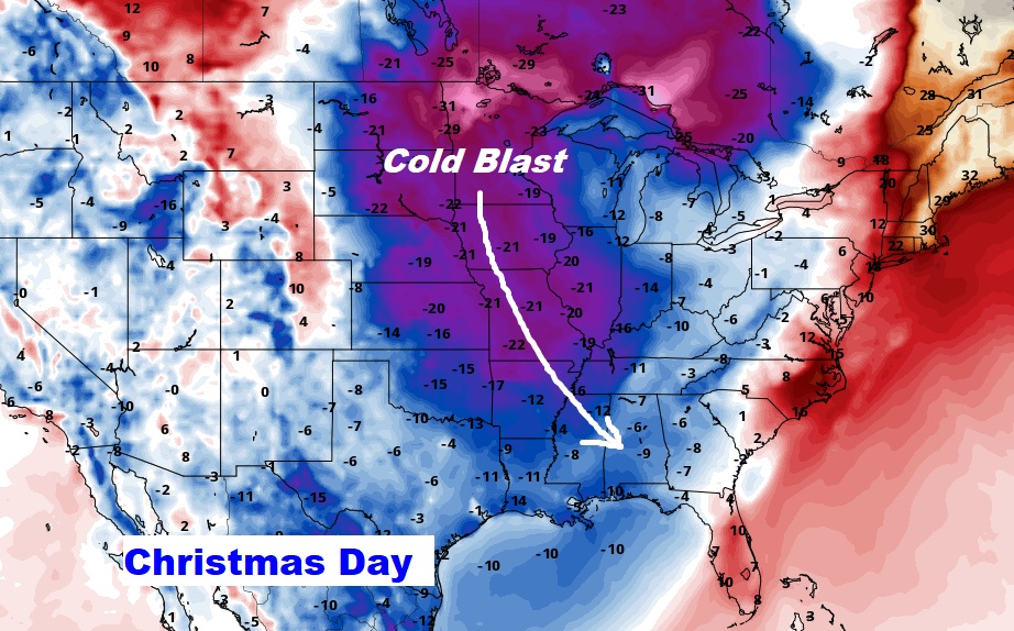
Here’s my early Christmas Outlook, subject to revision as we get closer.