
Good Morning! Today’s update will be short, because the weather for the next few days will be rather uneventful. After covering your weather for more than 43 years, let me tell you – UNEVENTFUL is a very good thing in January. I don’t see any “big ticket” weather in the next 10 days or so. That means, no arctic outbreaks, and no storm systems which appear to have a severe weather component.
A little disturbance, riding along the front that brought the rain yesterday, will brush by the area today with a tiny shower risk. Another frontal system will bring a another shower threat around Thursday, but it does not look severe.
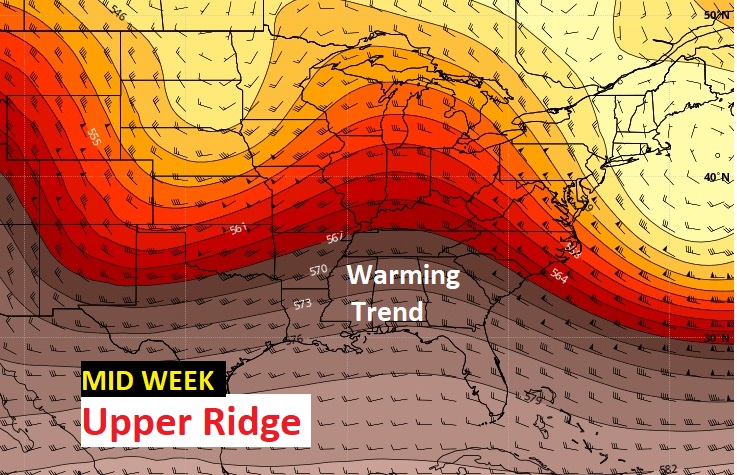
There will be some chilly nights in the 30’s. But, much of the days in the week ahead will be running 4-6 degrees above normal.
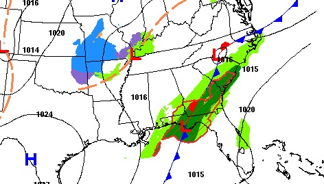
Today we are located in between two fronts. The front that brought yesterday’s storms is parked near the coast.
TODAY: I think there will be at least some partial sunshine. Clouds are more likely later in the day and towards evening and tonight. I’ll include a small mention of showers (20%) here in central Alabama, and a slightly better chance for scattered showers in south Alabama. Mid 60’s today. Upper 30’s tonight.
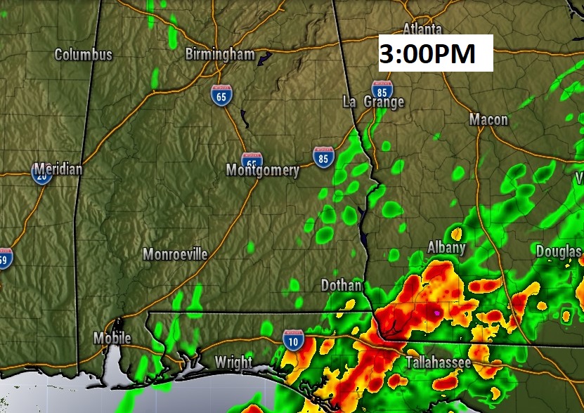
Here’s a Future Radar snapshot at 3PM.
NEXT FEW DAYS: The normal high is 57, normal low is 36. Sunday will be near normal, with a sun/cloud mix. Monday through Wednesday will feature a but of a warming trend with highs in the 60’s. Coldest morning will be Monday morning around dawn. Small rain chance begins Wednesday night, with a better chance of rain Thursday.
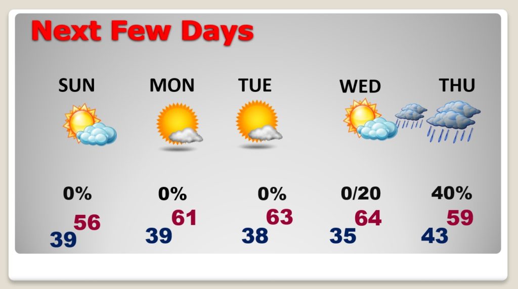
Best chance of showers this week will be Thursday as a front sweeps through the area. More showers are possible by Sunday the 10th.
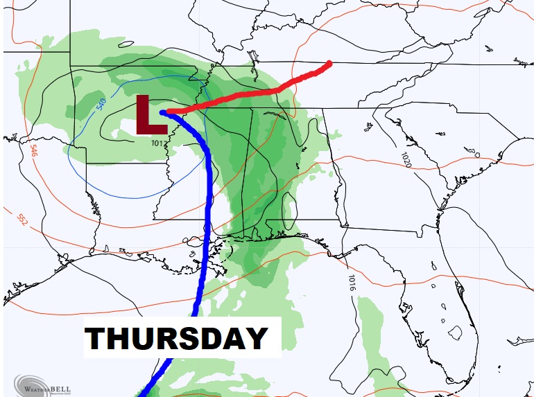
An upper ridge builds above us this week before the Thursday Storm system. That spells a warming trend.
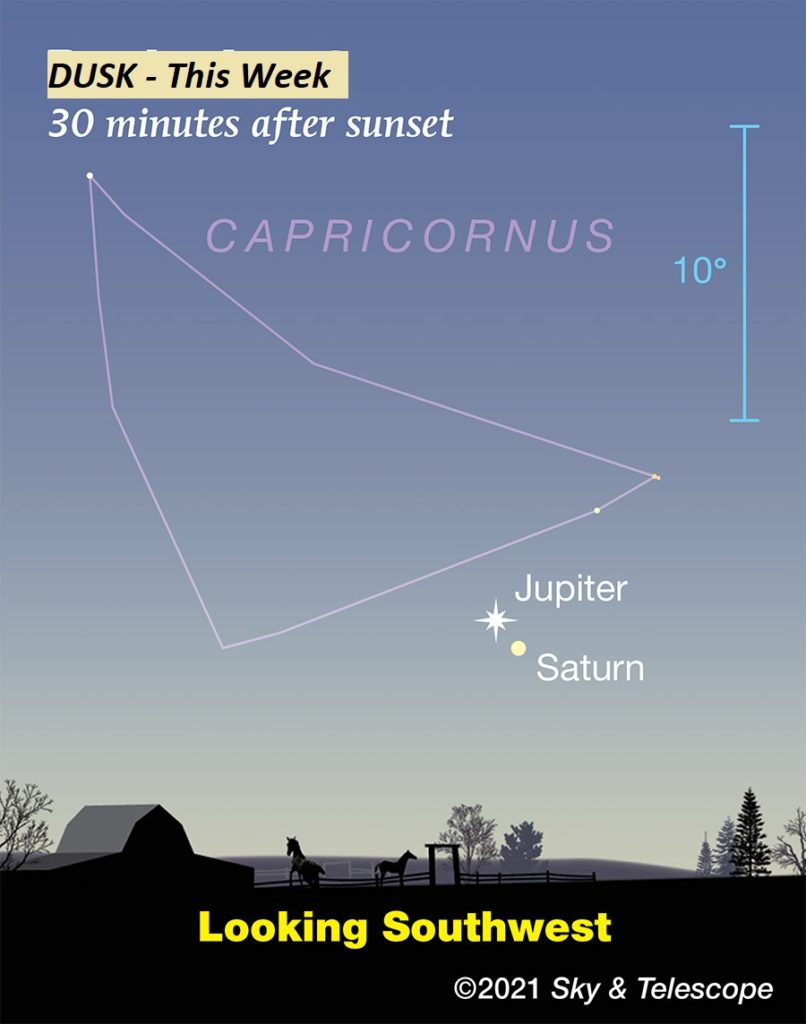
IN THE SKY: While Jupiter and Saturn continue to drift apart, they are still visible in the Southwest sky, just after sunset in the week ahead.
NWS 2020 YEAR IN REVIEW: We started the year off a little on the wet side with near-record rainfall occurring in February. By the end of spring, we had experienced a half dozen tornado and/or damaging wind events. We managed to get through the majority of the summer months mostly unscathed as we were able to avoid any major heat waves. However, we could not escape the very active tropical season, which was perhaps the biggest weather story of the year.
All in all, Central Alabama was directly impacted by two tropical systems, Hurricanes Sally and Zeta, and 35 tornadoes. There were no major winter weather events. Want to know more? Check out this link..
https://www.weather.gov/bmx/climo_2020review
By the way, Montgomery’s official rainfall in 2020 was 66.36″. That is 13.43″ above normal. We had about 20 more inches than last year. (47.66″)
.
I’ll have another Blog update early tomorrow morning. Enjoy the rest of the holiday weekend.
–Rich