
NATTIONAL WEATHER SERVICE UPDATE ON POTENTIAL WINTER WEATHER ISSUES IN ALABAMA MONDAY MORNING:
Overview: A storm system will bring moisture into the area with cold air in place after midnight Monday morning. Precipitation will likely begin as snow or sleet before sunrise on Monday morning across northern and northwest counties, then gradually mix with rain and become all rain by noon on Monday as temperatures rise across the area.
Changes from previous forecast: Updated risk area, time frame and accumulation estimates.
Highlights:
Where & When :
- Midnight through 6 am Monday morning: Generally along and west of a line from Haleyville (Marion Co) to Maplesville (Chilton Co) to Hayneville (Lowndes Co)
- 6 am through 10 am Monday morning: Generally along and northwest of a line from Marion Junction (Dallas Co) to Alabaster (Shelby Co) to Heflin (Cleburne Co)
- 10 am through noon Monday morning: Generally along and northwest of a line from Pickensville (Pickens Co) to West Jefferson (Jefferson Co) to eastern Walker Co.
EARLY MORNING UPDATE:
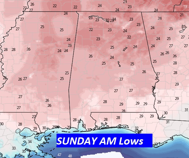
Good Morning! It’s quite COLD. Get ready for another brisk Winter’s day today. Tonight will be the coldest night. Lows will fall to the 20’s. Even with lots of sunshine, Sunday will be cold.
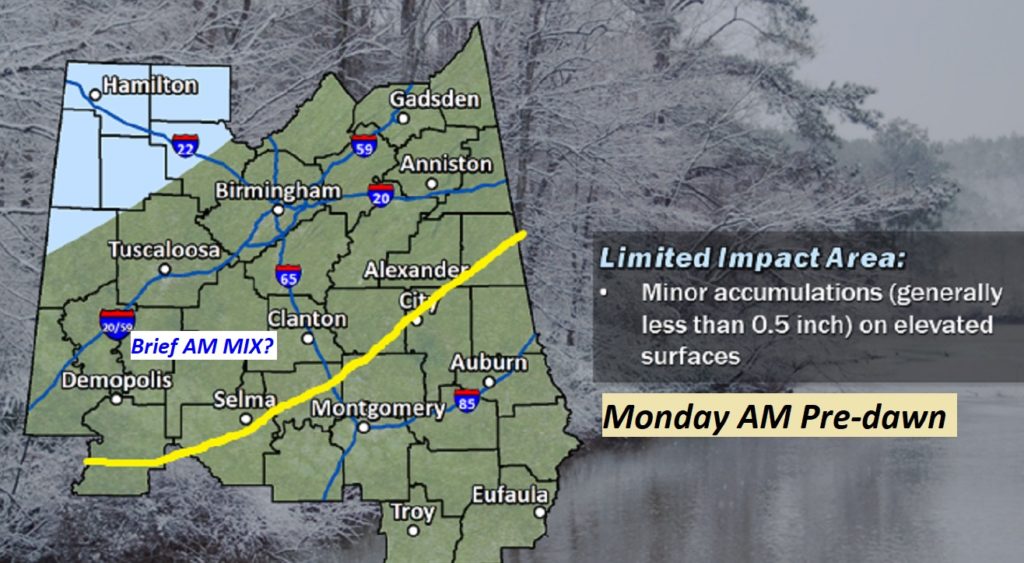
All eyes on that Monday storm system. Although it will generally be just a cold rain for most of us, parts of central and western Alabama could briefly see a winter mix in the Monday morning pre-dawn hours. Details below.
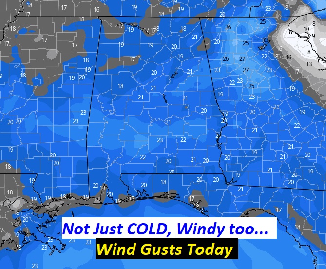
TODAY: Morning cloudiness will gradually give way to sunshine. It will be quite breezy again. Highs will barely struggle to reach the mid 40’s NW winds will occasionally gust to 20 mph later today. Winds die down tonight. We’re headed for the 20’s by Dawn.
Once again today, the winds will play a factor in the comfort level. Here’s a model forecast showing some wind gusts near of above 20 mph are possible by mid-day. Winds will die down tonight.
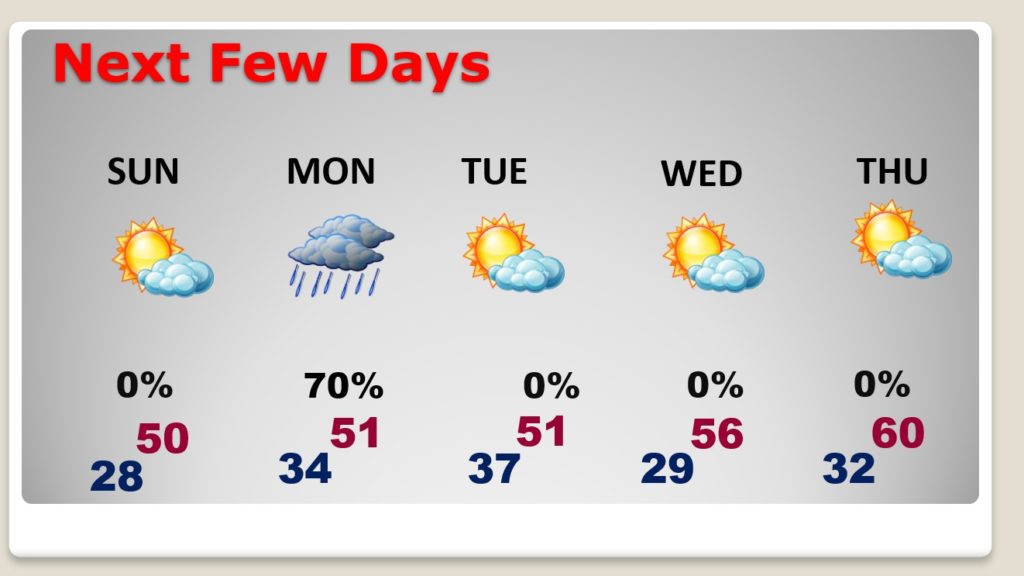
NEXT FEW DAYS: Sunday will still be WAY below normal. After a very cold start, the high will struggle to reach 50, even with sunshine. Rain Monday. Read more about that storm system below. Chilly Tuesday and Wednesday. Temperatures will moderate some by the end of the week.
MONDAY STORM SYSTEM: For almost all of us, the Monday storm system will be just a cold rain.
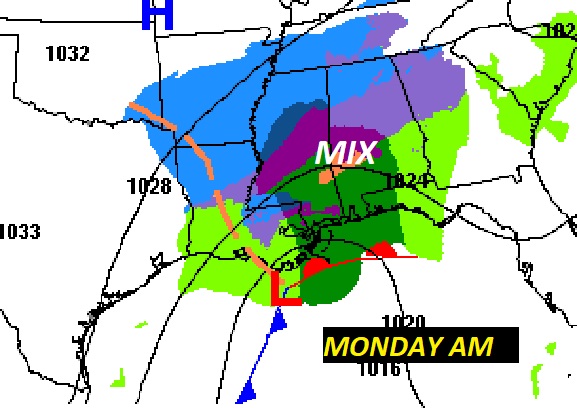
However, in the pre-dawn hours of Monday morning, there could briefly be a mix of perhaps, rain, sleet, snow in parts of west central and central Alabama. I have drawn a “guesstimated” line on the map showing the area that could see a brief pre-dawn mix, at the start, before the precipitation changes to all rain. No accumulations. However, parts of extreme NW Alabama could see a tiny accumulation of snow.
.
I’ll have another Blog update early tomorrow morning. Enjoy the rest of the holiday weekend.
–Rich