
Good Morning! Chilly air covers the state. In fact, like spokes on a wheel, more shots of cold air will rotate into Alabama through the weekend. The map below shows a giant upper low over Kentucky, with very cold air aloft.
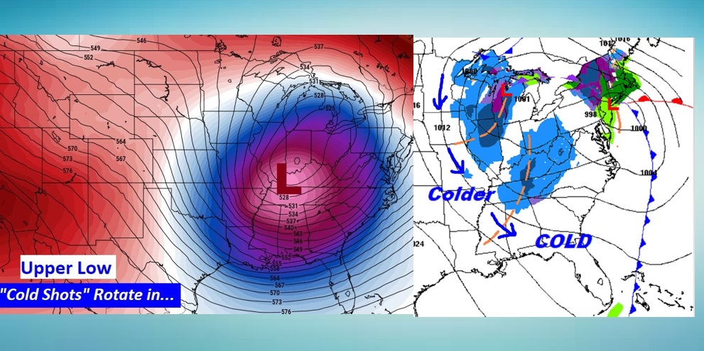
Some of those “spokes”, or shortwaves will bring a few snow flurries to the higher elevations on northeast Alabama. For the rest of us, expect shot after of chilly air on gusty winds.
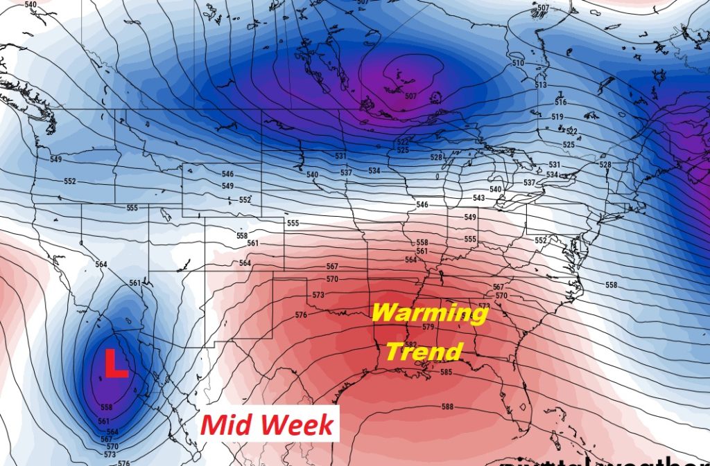
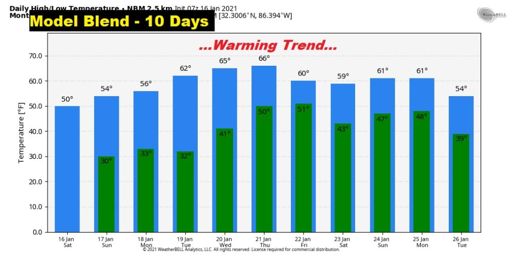
Hang on though. Major changes in the upper air pattern next week, spell a major warming trend, by Tuesday, Wednesday and beyond.
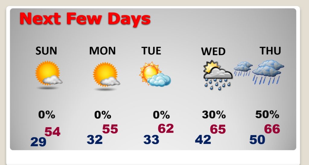
TODAY: Sunshine, breezy and cold. High in the upper 40’s. Northwest wind 12-25 mph could gust higher. Low tonight upper 20’s. Potential wind chill factor tomorrow morning in the lower 20’s. Dress in layers.
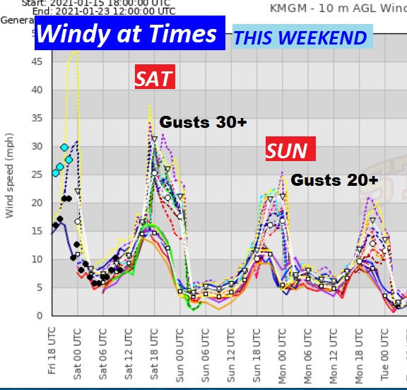
This graph shows the wind gust potential. Some places could see 30-35 mph wind gusts this afternoon. Even on Sunday, some 20-25 mph gusts are possible.
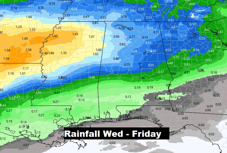
NEXT FEW DAYS: After a cold weekend, look for a major warming trend next week. Risk of showers return to the forecast Wednesday, with a better chance Thursday and Friday.
Here’s the 10 day trend.
Here’s the potential rainfall Wednesday through Friday.
I’ll have another Blog update early tomorrow morning. Enjoy the rest of the weekend.
–Rich