
Good Morning! On this Super Bowl Sunday, today will be a big improvement over yesterday. It will still be below normal temperature-wise, but hang on. Warmer temperatures are on the way. We’ll warm to the 60’s Monday and Tuesday, and maybe even the lower 70’s by Wednesday and Thursday.
A couple of storm systems will bring showers and thunderstorms. Storm system #1 Monday night into Tuesday. Storm system #2 looks like a bigger deal on Thursday. We could see some stronger storms. (Possibly severe? Too early to say for sure)
Looks like that Arctic Air may finally reach us just in time for the Valentine’s Day Weekend, but the models are still not in agreement on the details. More on this chilling subject below.
TODAY: Clouds will dominate much of the day, but there will be partial sunshine during the afternoon. Still cool today, but not as cold as yesterday. High today 54. Low tonight 36. (Normal high 60, normal low 37)
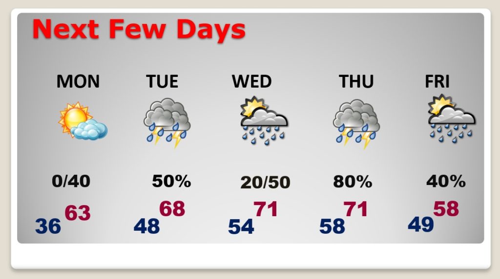
NEXT FEW DAYS: Warming trend this week. Monday will be the nicest day: sun/cloud mix. High 63. Scattered showers Monday night and Tuesday. A more significant storm system moves in late Wednesday night into Thursday. Perhaps some strong thunderstorms. Friday’s high temperature will likely happen early in the day before colder air starts to funnel into the state.
WHAT HAPPENS TO THE ARCTIC AIR?:
This morning, bitter cold arctic air covers much of the US Heartland. (I noticed a couple of Canadian Wind chills this morning of -79 and -82!)
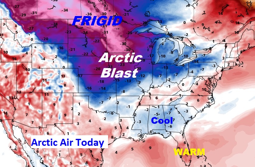
During the week, that strong ridge of high pressure over the Bahamas will keep the Arctic air at bay. But, the arctic air is heavy, and thick like molasses. The Arctic Air will eventually win out. The remaining questions are – WHEN, and how deeply do we get into the Colder air. Will the core of the coldest air fall short of Alabama? The GFS and the Canadian GEM models still strongly suggest the Valentine’s weekend will be quite cold.
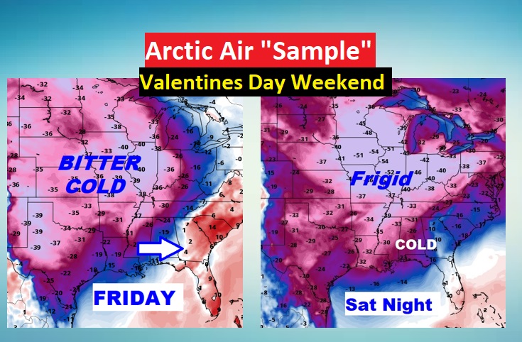
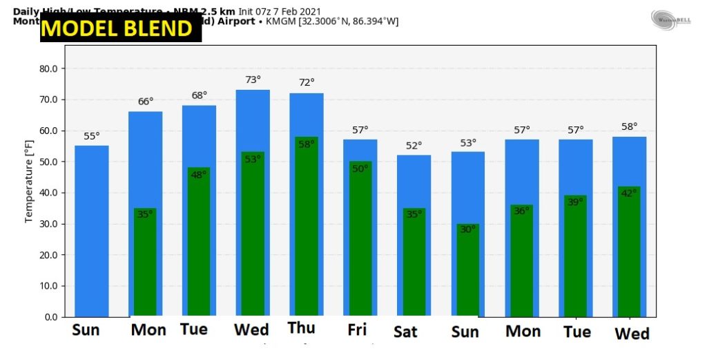
Let me show you some raw model output. The GEM and GFS are probably too cold.
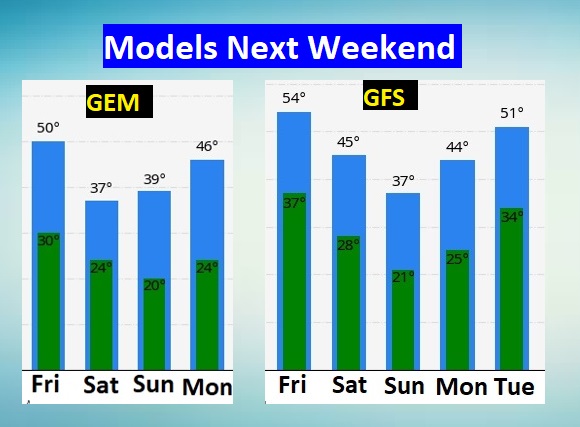
The model blend below may be not quite cold enough. The answer most likely lies in-between.
On my video tomorrow morning we’ll know more. Stay tuned. NO Winter Weather Frozen Mischief is expected, at this time. That’s the best news!
STORMY IN FLORIDA: Tampa Bay, home of the Super Bowl is under a tornado watch this morning. But, the front moves through by lunchtime, and it will turn windy and cooler. Gametime temperature 67.

I hope you have a nice Sunday. Enjoy the mild temperatures. I’ll have a complete video update in the morning.
–Rich