
Good Morning! It’s a very complicated, very active forecast for about the next 6 days, at least. There are many moving parts, as a series of storm systems swing through the Gulf States one after another.
I’ve made some temperature “tweaks” in the forecast But, the general idea of a very wet pattern remains.
Coldest Day and night will be Tuesday and Tuesday night. A late week storm system on Thursday has me a bit concerned about a potential severe weather threat.
TODAY: The most concentrated rain will be this morning. But showers and likely from time to time during the day, and tonight. High today 56. Low tonight 46.
SUNDAY: I made a few changes in the Valentine’s Day forecast. I think the best chance of showers will be before Noon. Much of the afternoon/evening looks dry. High 57. Low 47. (Normal hi/lo 61 and 39)
WINTER WEATHER WOES: Brutal winter weather continues to dominate much of America this morning. EXTREME arctic air, coupled with a progressive series of storm systems, are causing a variety of watches, warnings and advisories. Absolutely miserable winter conditions, cover much of our country.
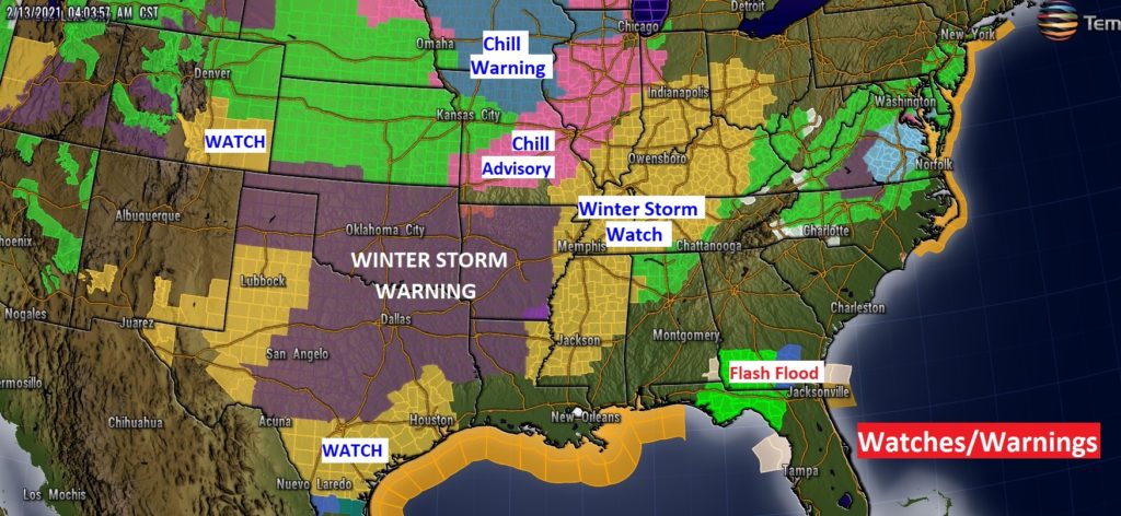
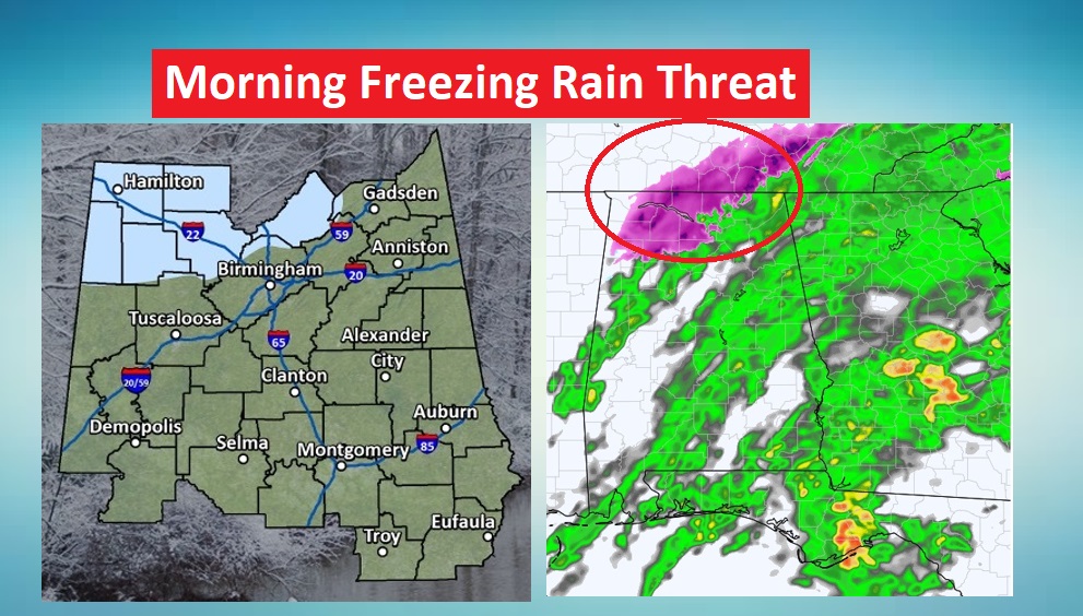
Even about a half dozen counties in northwest Alabama have a threat of freezing rain and slick roads through 10AM.
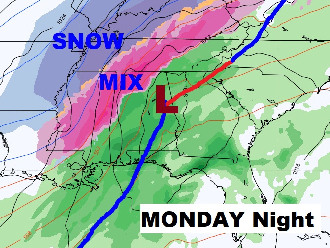
MONDAY STORM SYSTEM: Get ready for yet another round of rain for most of us Monday and Monday night. For parts of west and northwest Alabama, there could be a nasty mix of freezing rain and sleet which could cause a “high impact” travel problem. A Winter Storm Watch is certainly possible in future forecasts. But, for most of us reading this Blog….just rain.
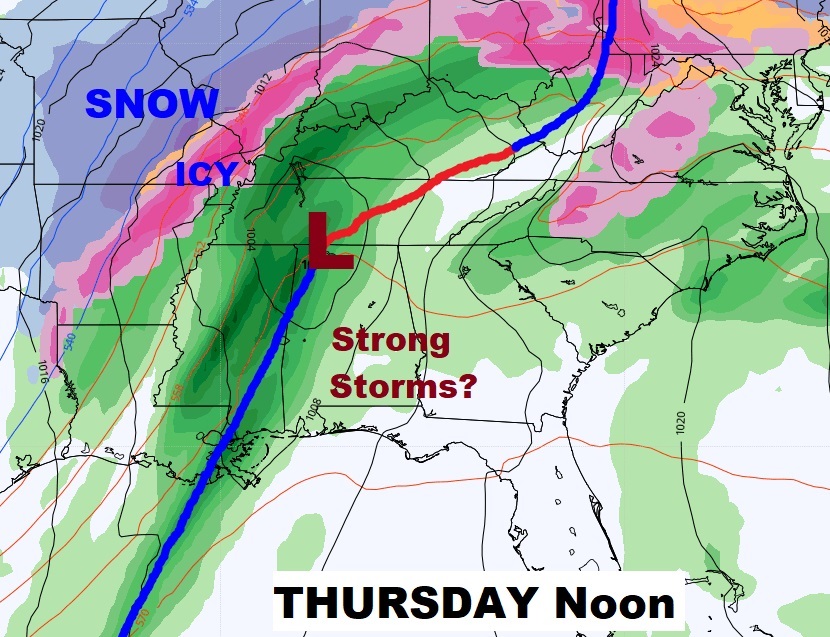
LATE WEEK STORM SYSTEM: I won’t say too much about the Thursday storm system, because it’s too early. However, this one has my attention. We will be in the Warm Air Sector. A future Severe Weather Threat may have to be added to the forecast. Stay Tuned. It may turn SHRAPLY colder behind this system by Friday the 12th.
NEXT FEW DAYS: Wet at times for the next several days. Coldest Day will be Tuesday. Windy and cold. High in the 40’s Lows below freezing Tuesday night.
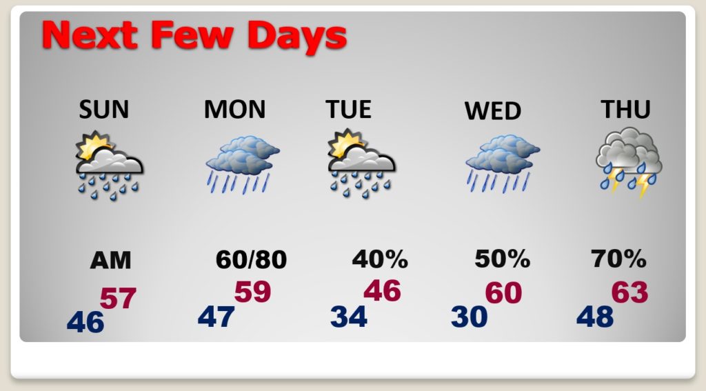
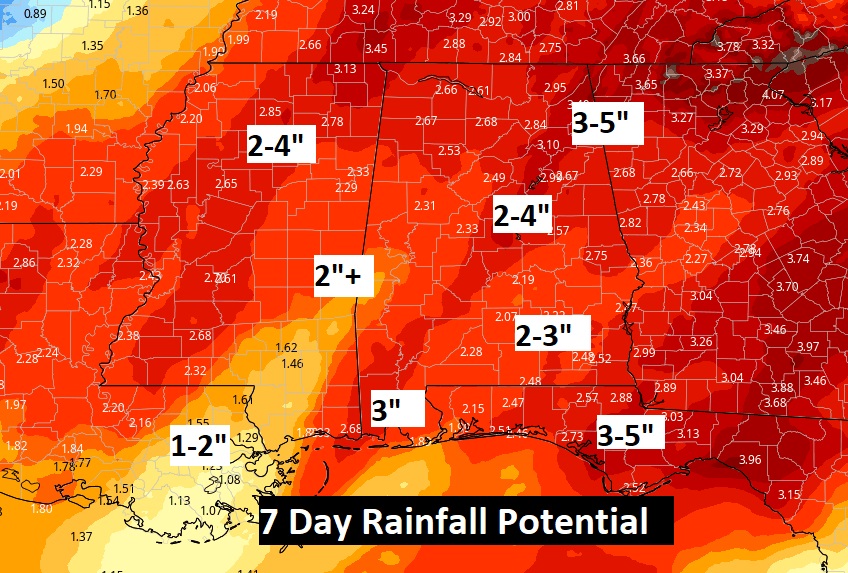
RAINFALL POTENTIAL: Needless to say…the potential for significant rainfall totals in the next seven days is high.
COLDEST DAY EVER: Today is anniversary of The Coldest EVER. February 13, 1899. Not just Montgomery’s coldest day (-5°), but Alabama’s Coldest Day and America’s Coldest Day ever recorded! Even Tallahassee recorded -2…Florida’s coldest temperature ever.
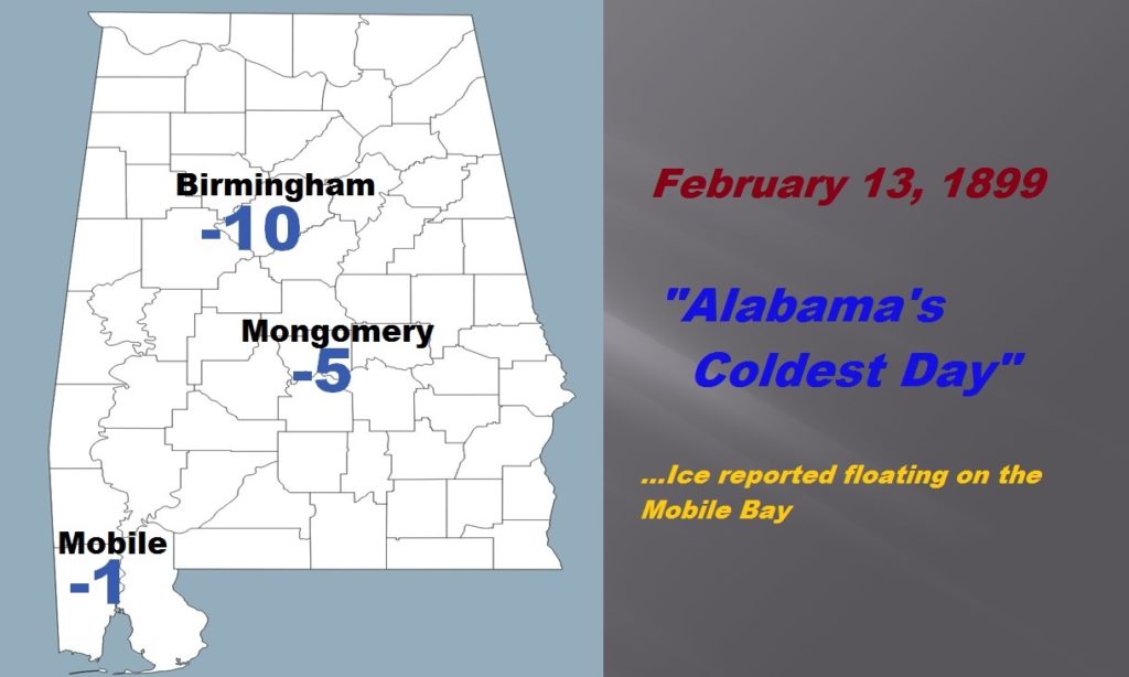
There was ICE floating on the Mississippi river near New Orleans. And, Ice reported spotted in the northern portion of the Mobile Bay.
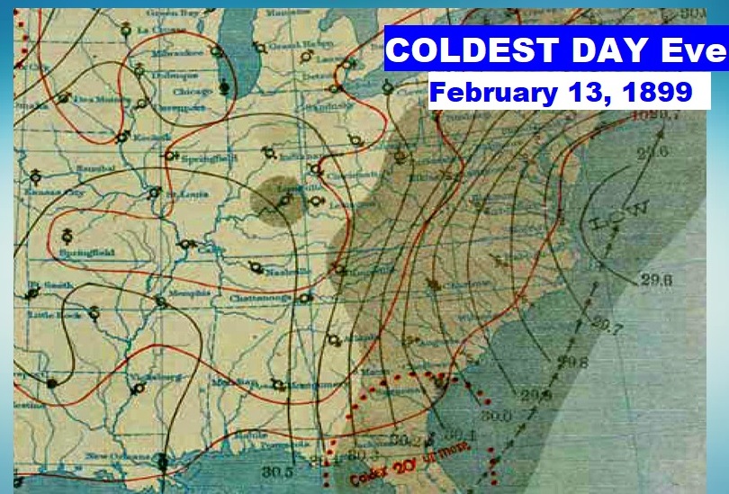
Then, with cold air in place, and monster blizzard moved up the east coast!
I’ll have another Blog update early tomorrow morning. . Have a nice weekend.
–Rich