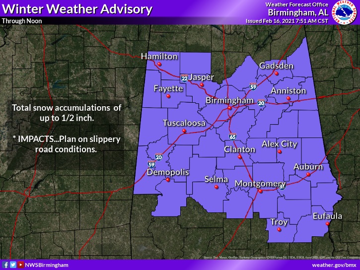
WINTER WEATHER ADVISORY continues for much of central Alabama until about Noon, as a few light snow flurries continue to fall across the area. Should be fairly minor.
EARLY MORNING UPDATE:
Alabama is in the Deep Freeze this morning. Morning wind chills range from the teens and single digits in central Alabama to below zero in northwest Alabama. Dress in layers. It’s going to be a Raw, windy, cold Winter’s day. We’re tracking the next storm system which will affect us Wednesday Night and Thursday. More cold air follows. But, on this video, I’ll tell you about light and the end of the tunnel. I’ll show you a nice warming trend a few days away.
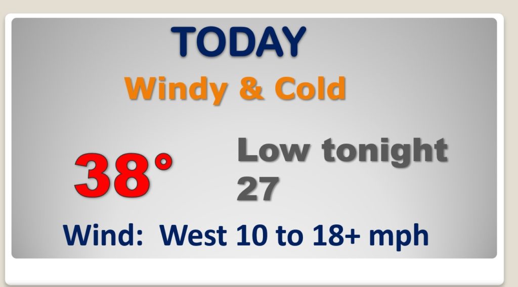
RAW day. Windy and cold. High temperature will not make it out of the 30’s. Winds die down tonight. Back to the 20’s for lows.
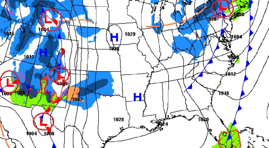
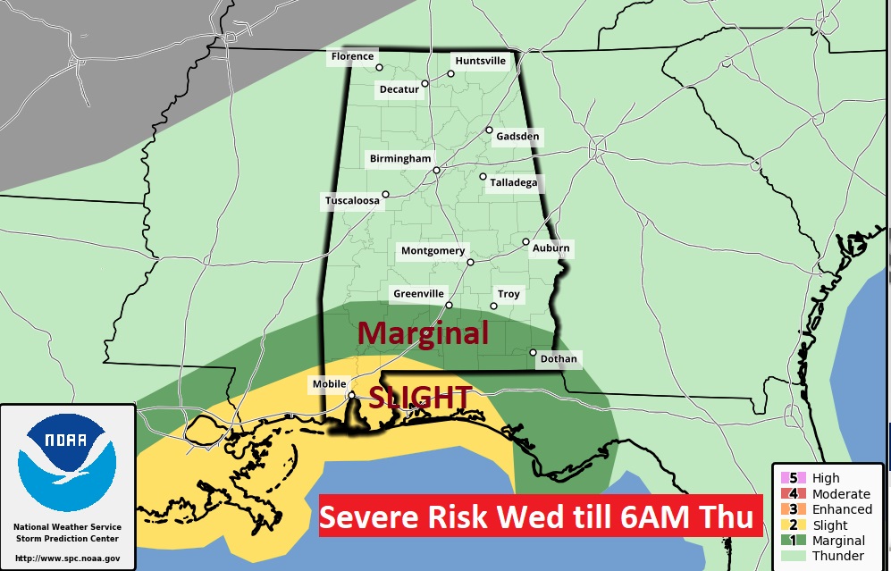
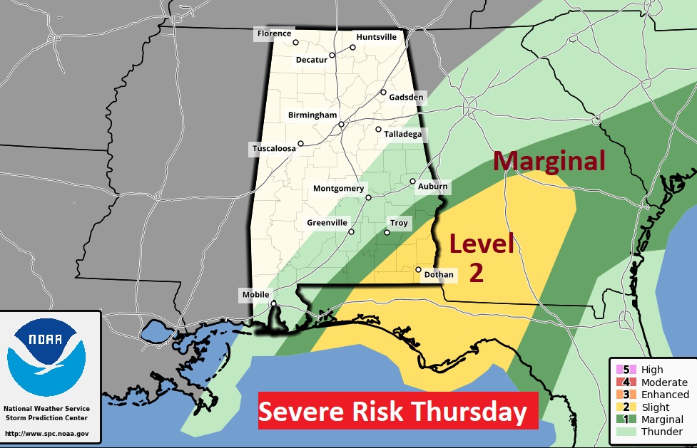
Next Significant storm system to effect the region Wednesday night and Thursday.
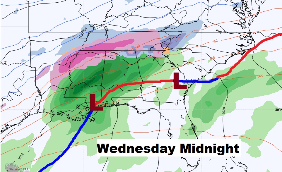
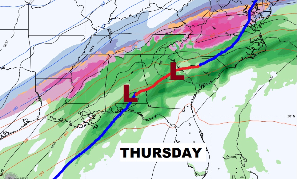
South and southeast Alabama will briefly in the warm air sector Wednesday night and Thursday. Severe weather risk, including a tornado threat.
After the storm, windy and sharply colder Thursday night and Friday. Temperatures start to recover Saturday afternoon and especially Sunday.
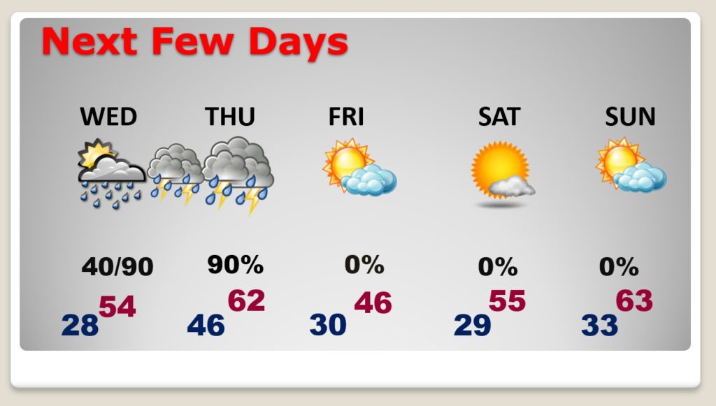
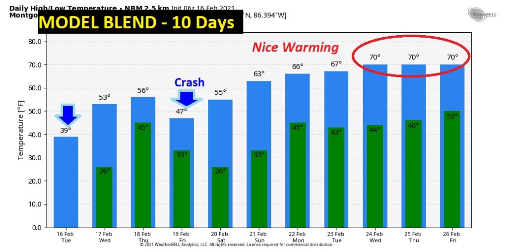
Who’s ready for a warming trend? Into the 60’s by Sunday afternoon. FINALLY the Arctic Air will retreat from the United States.
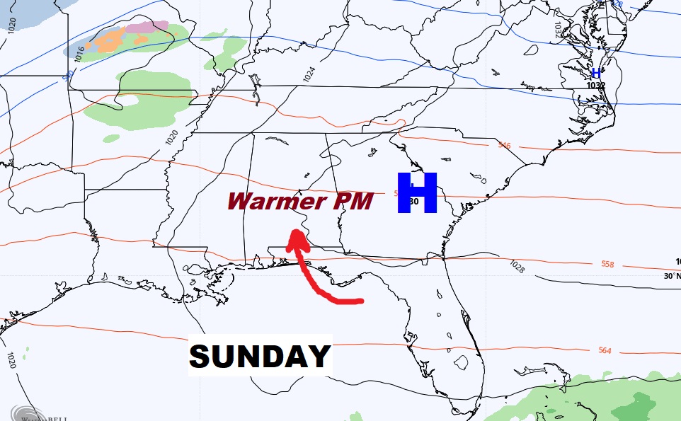
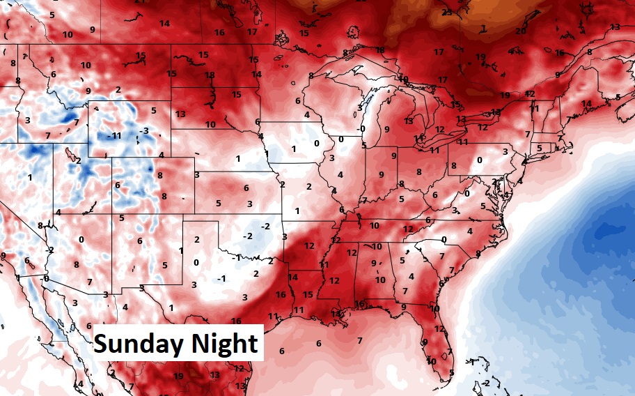
Check out that warming trend from Sunday through Friday the 26th! We deserve it,