
Good Morning! Yesterday was a little warmer, but still below normal. Today, after the morning chill fades, we will actually warm to near or just above average for the first time in several days. Get ready for a rather beautiful Sunday.
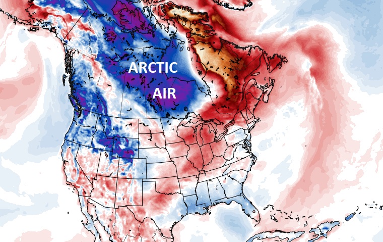
The harsh Arctic Air which has dominated much of the country for more than a week has receded back to Canada and the Polar region.
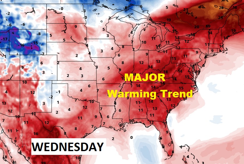
Our warming trend will continue through the week ahead, and the warmer air will dominate most of the eastern half of the country.
Meanwhile, a frontal system will bring showers back to the state late tonight and part of the day Monday. Expect more showers late in the week. But, no severe weather is expected.
TODAY: The morning chill fades quickly. Sunshine will dominate. High 64. (Normal high 63). Southeast winds at 5 to 15 by afternoon. Becoming cloudy tonight. Showers late tonight, mainly after 3AM. Low 48.
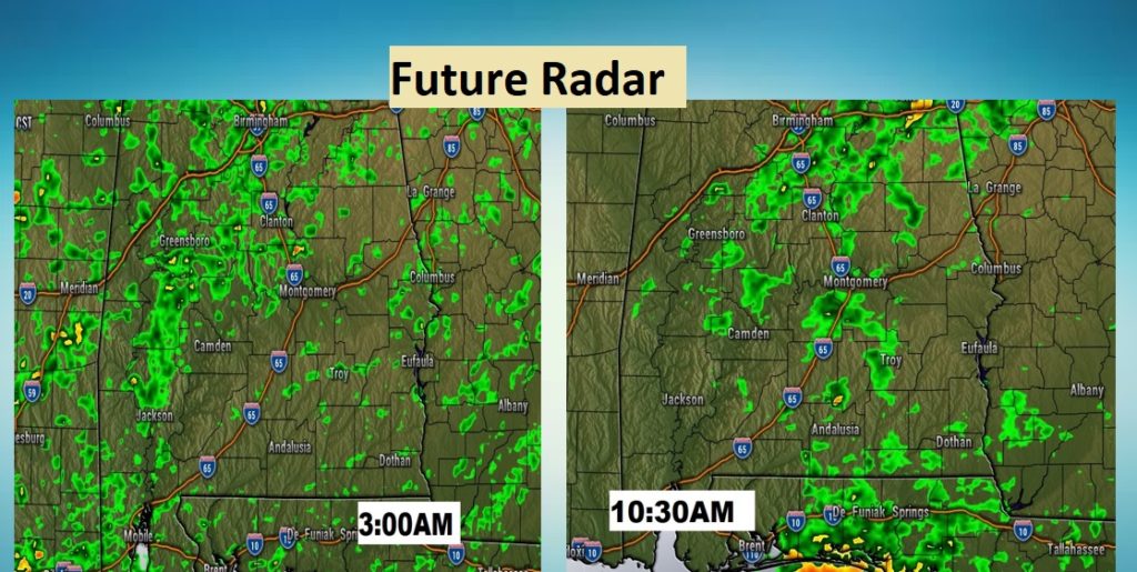
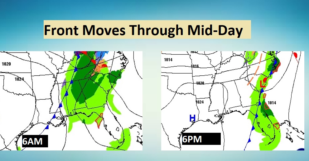
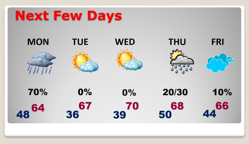
MONDAY: Scattered showers mainly during the morning hours. Most of showers should exit by lunchtime. High 64. Here’s a couple of future radar snapshots.
By afternoon, look for big improvements as the front exits the state.
NEXT FEW DAYS: Tuesday and Wednesday will be simply beautiful, as the warming trend continues. 70 degrees seems like a major benchmark after the cold February we have endured. Risk of showers by Thursday.
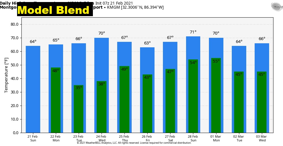
Looks like the Arctic Flood Gates are closed for now. Here’s the Model Temperature Blend for the next 10 days.
I’ll have a complete video update in the morning. Enjoy this beautiful Sunday.
–Rich