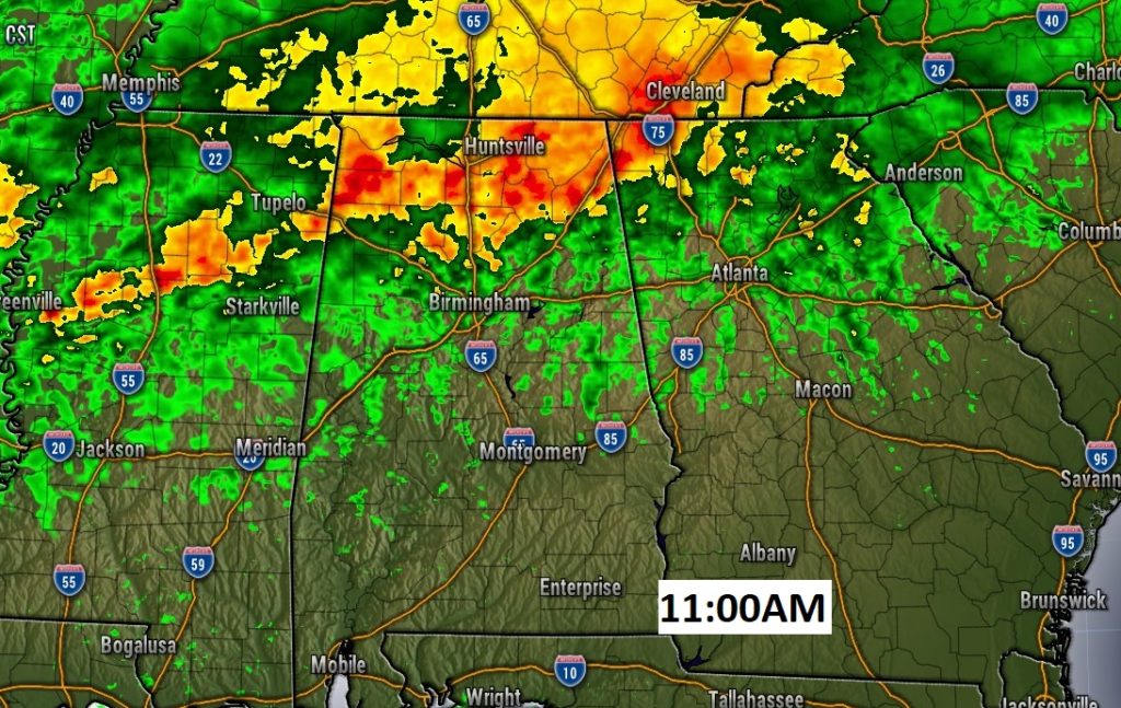
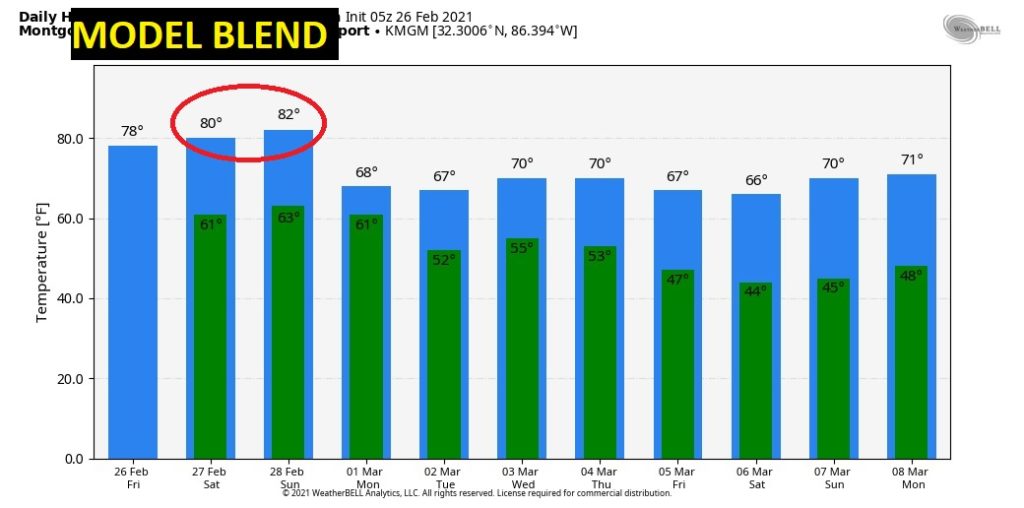
Happy Friday! A frontal system, draped across the state, will move northward today. The concentrated rain will be in north Alabama. For the rest of us, today will be another above normal day, with highs in the 70’s. It looks like we are headed for a remarkable last weekend in February, with highs near or above 80 degrees. In fact, we may be in record high territory by Sunday. I’ll update the details on this video and we’ll look ahead to a wet start to the month of March. Any severe weather?
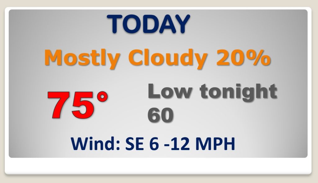
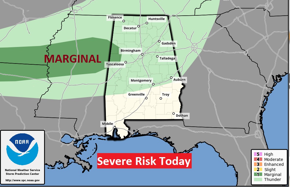
A stray shower or two can’t be ruled out, but the rain chance in our part of the state is small today. Highs will be well above normal again .
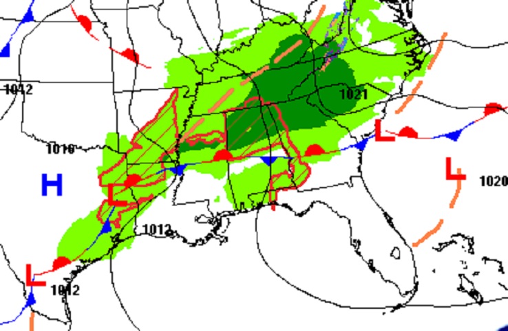
Today most of the active weather in our state will be confined to north Alabama. Some storms could be strong.
Highs 80 or above this weekend. (Normal high 64) On Sunday we could tie or break the record high of 83 in 1948.
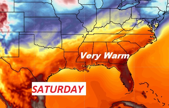
Very warm weekend. Tiny rain chance, as February comes to an end. Wet start to March. Good Morning! A frontal system, draped across the state, will move northward today. The concentrated rain will be in north Alabama. For the rest of us, today will be another above normal day, with highs in the 70’s. It looks like we are headed for a remarkable last weekend in February, with highs near or above 80 degrees. In fact, we may be in record high territory by Sunday. I’ll update the details on this video and we’ll look ahead to a wet start to the month of March. Any severe weather?
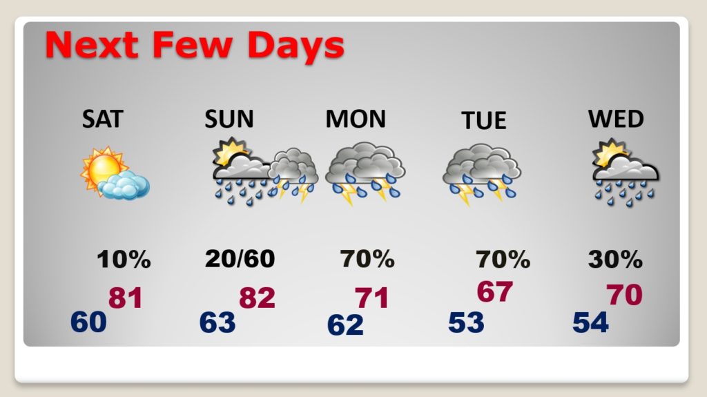
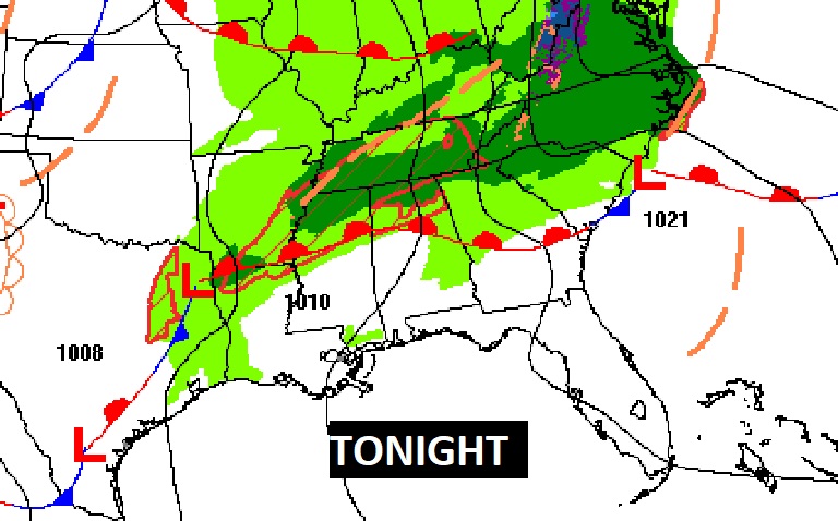
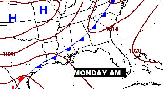
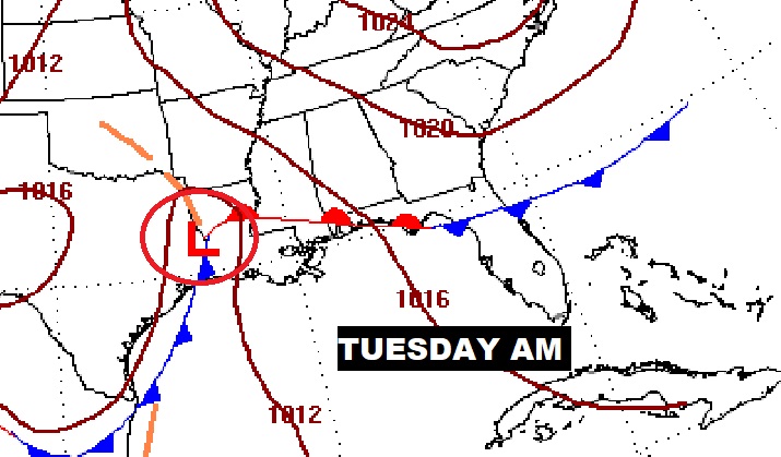
Wet start to March. Showers and thunderstorms. Any severe weather Tuesday? Still not clear. The models disagree on the details.
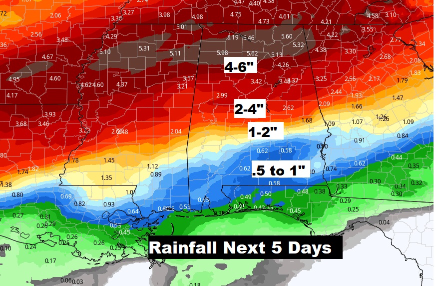
Significant rainfall potential possible (next 5 days) across the northern teir of the state. But, the expected rainfall amounts taper dawn quite a bit in south Alabama.
The first week of March will be cooler but not cold. No Arctic Air.
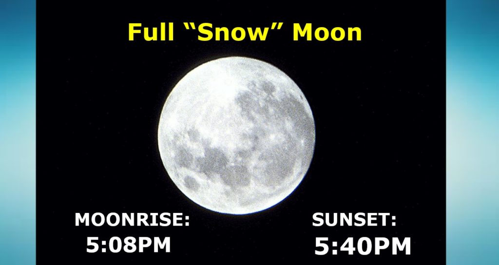
Full “Snow” moon tonight.