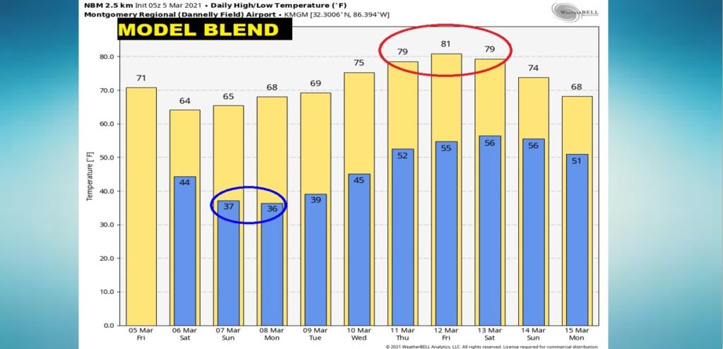
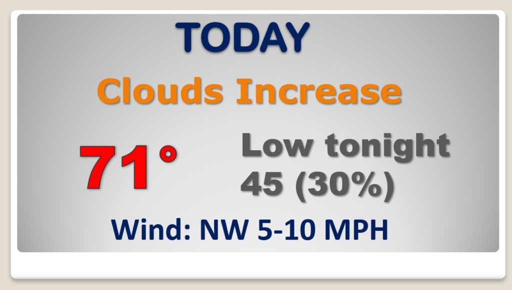
Happy Friday! Yesterday was perfect. Today will be another very mild day, as clouds increase. A Gulf coast disturbance will brush by the area overnight, with a few spotty showers. There will be a weekend temperature set-back. Saturday and Sunday will be much cooler. Nights will fall back to the 30’s. But, stand by for a major warming trend next week. I’ll walk through the details on today’s video. We’ll look ahead to the next storm system.
Dry and mild today. Clouds increase. Spotty showers overnight.
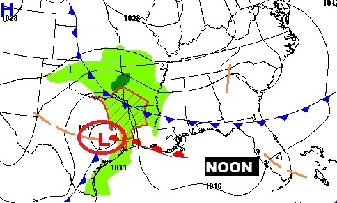
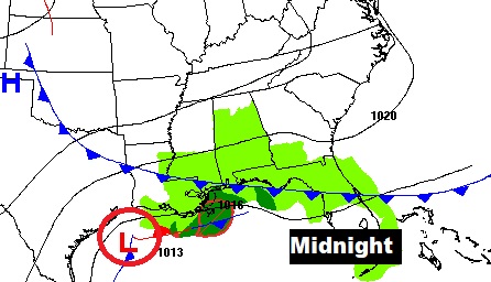
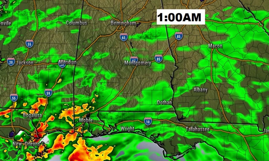
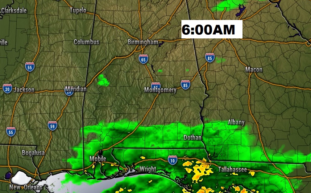
Disturbance brushes by the state overnight. The best rain chance will be across the southwest counties. Saturday morning, the showers will be confined to mainly south Alabama, moving into the Gulf.
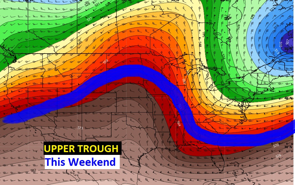
A sharp upper trough of low pressure will allow some much cooler air to funnel into the state. Saturday will be about 10 degrees cooler than today. Nights will fall to the 30’s Saturday and Sunday night.
Below normal weekend temps, but storm-free. Cold nights. Warming begins Monday. Much warmer Tuesday and Wednesday.
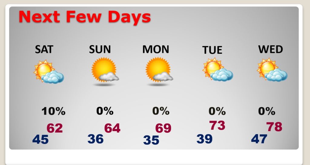
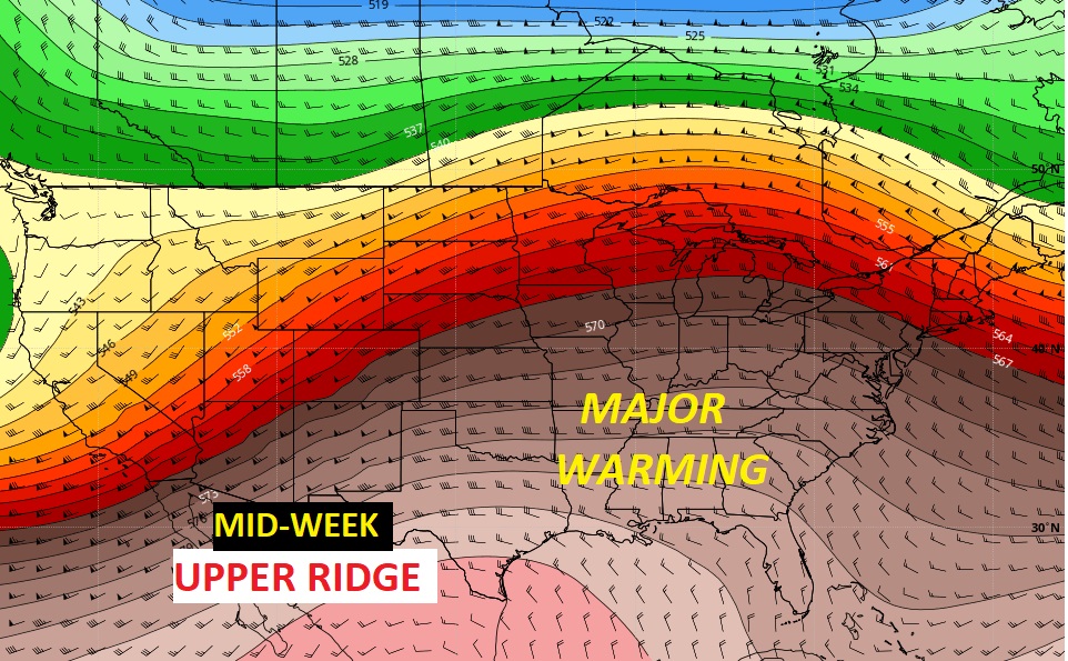
A BIG upper ridge builds next week. We’ll be in the upper 70’s Wednesday and near 80 Thursday through the end of the week.
Cool weekend. then, much warmer next week.