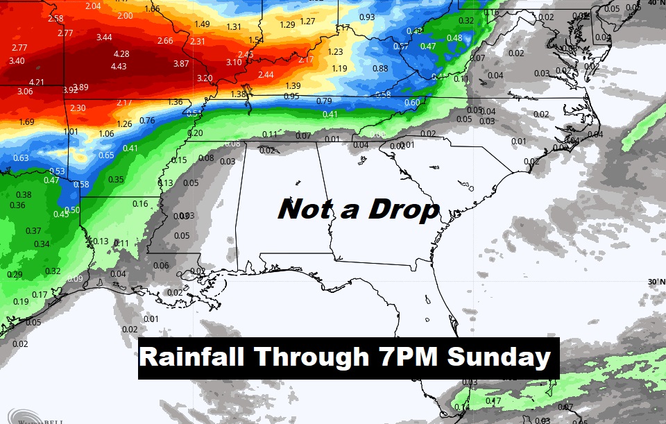
Good Morning! May-Like warmth will continue through the weekend. The dry pattern continues at least until Sunday night. That would be the 12th day without rain during the wettest month of the year, on average. (The new drought monitor map comes out later this morning, and that will show an expansion of the Drought.) So, it’s still winter for 8 more days, but our Spring-like warming trend and dry pattern rolls on. On this video, I’ll show how next week will be wetter and more active.
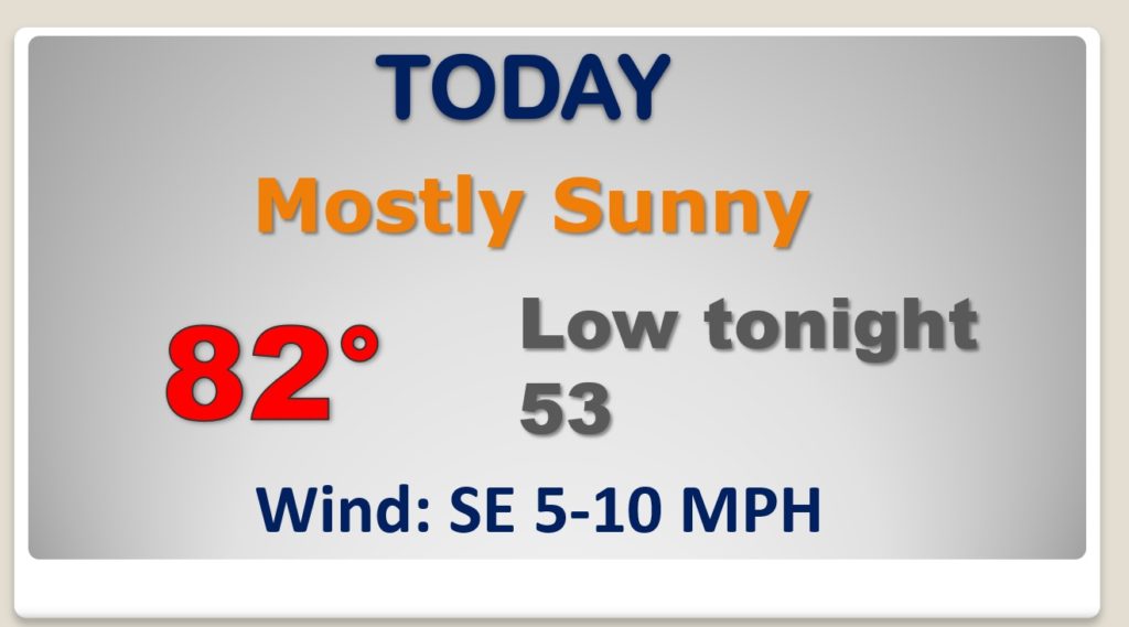
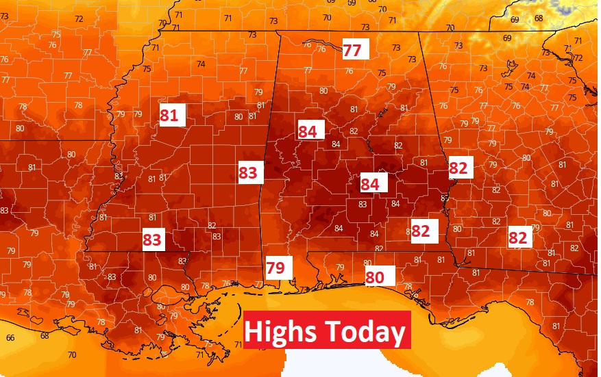
It’s still winter but it will feel more like May today. Normal high 68. Today’s high in the lower 80’s. Not as cool tonight.
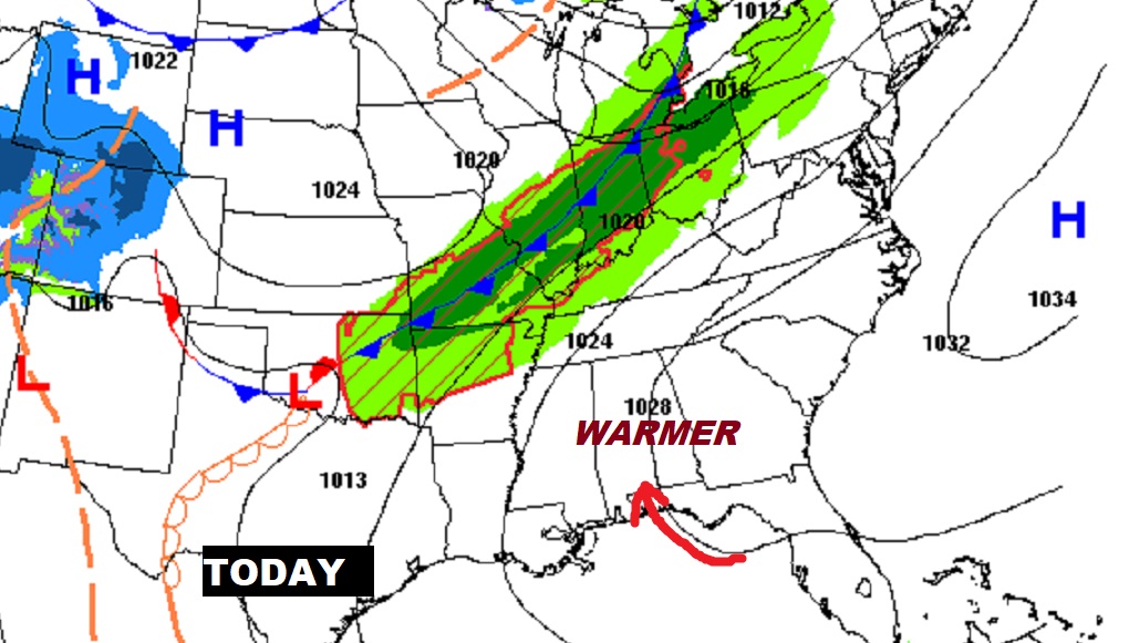
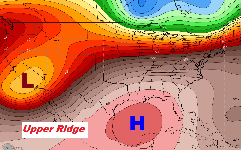
The strong upper level high will tend to keep us dry as the warming trend continues.
During what is usually the wettest month of the year, we should be dry through Sunday at 7PM. That would be the 12th day without rain.
VERY Warm through the weekend …and DRY. Risk of showers and thunderstorms begins late Sunday night.
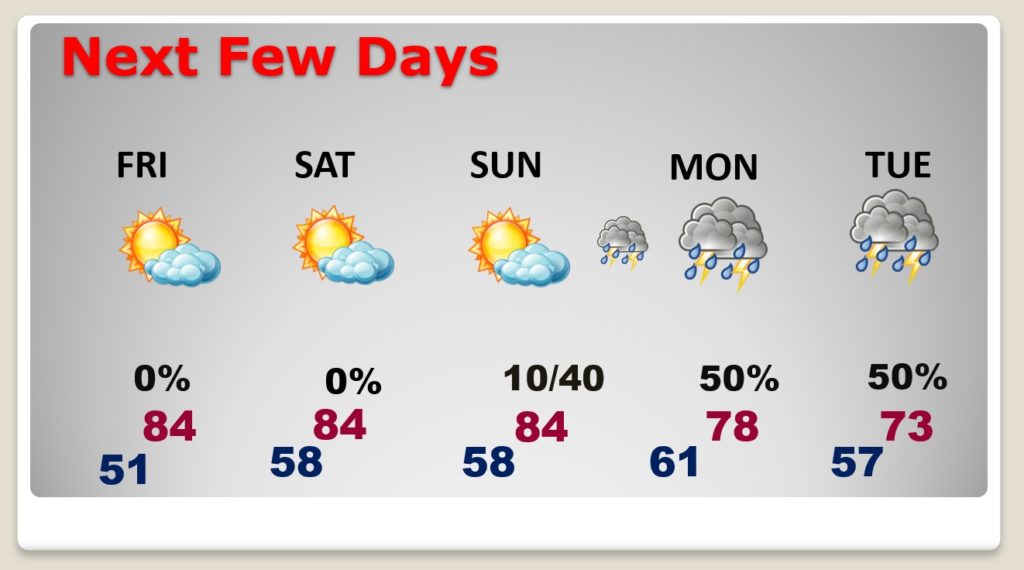
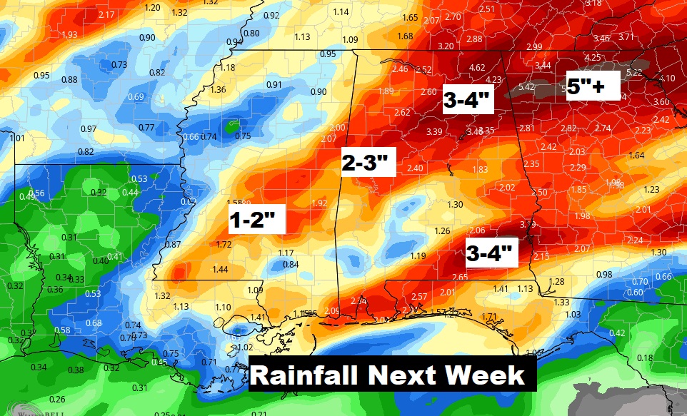
Look for a much more active weather pattern next week. There could be a few stronger storms Monday. But that Wednesday storm system could be severe. Too early to be sure. This is obviously the heart of the tornado season.
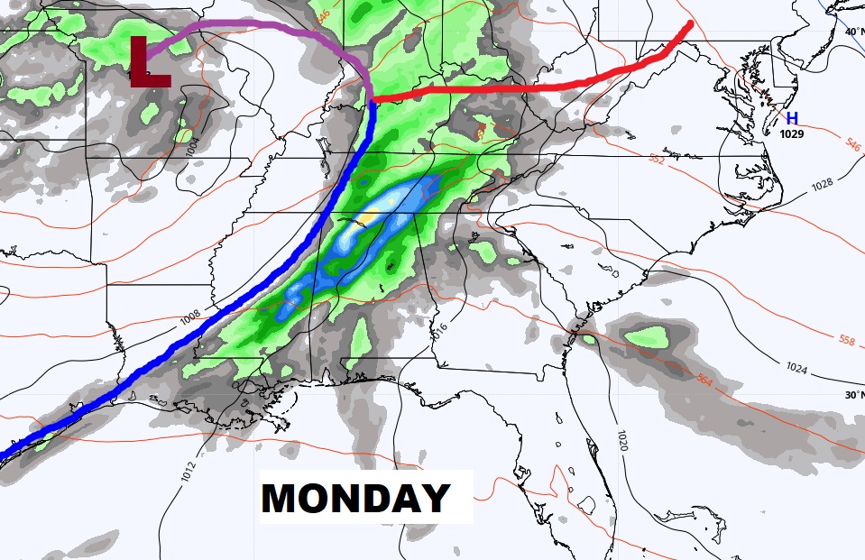
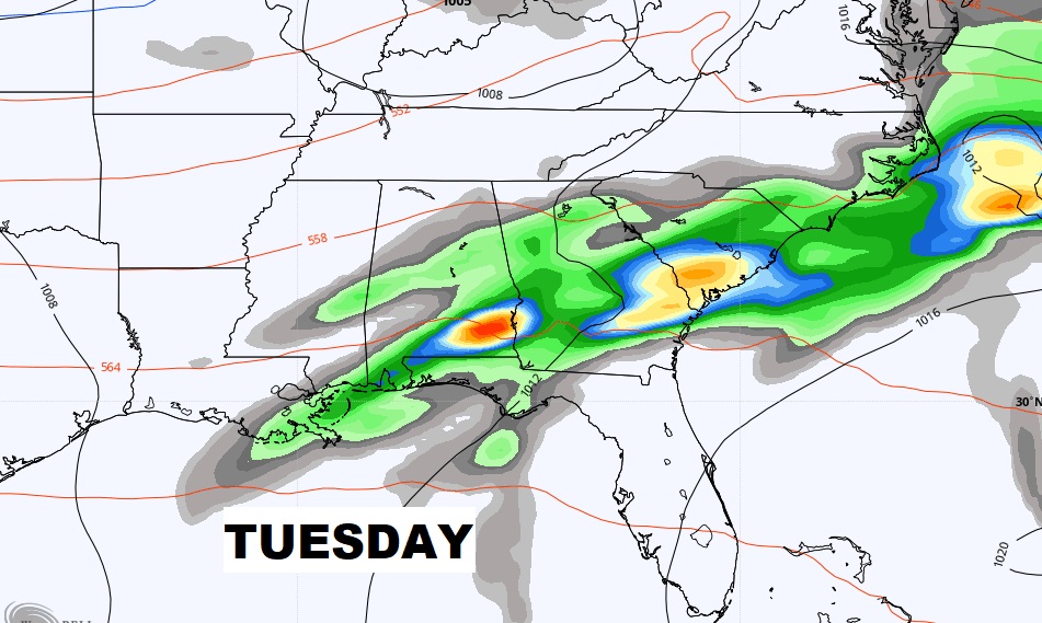
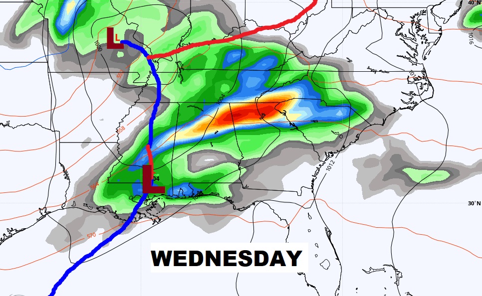
Next week will be much wetter.
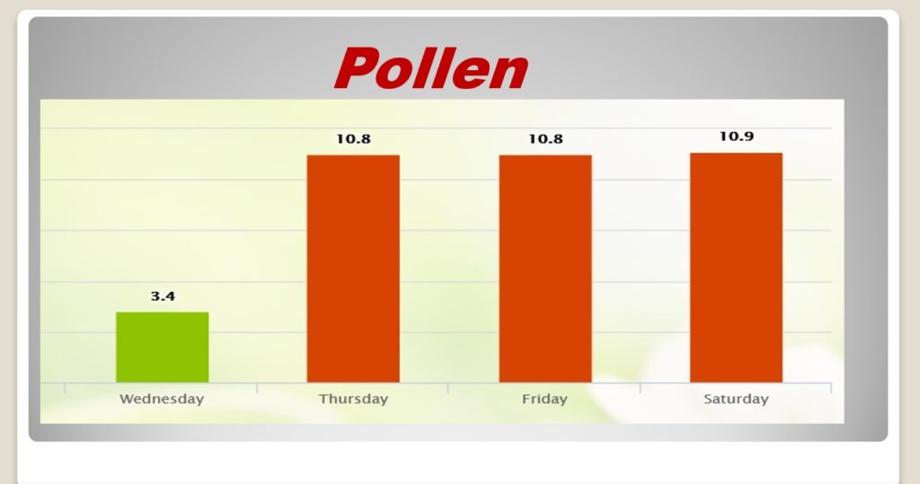
Pollen will be in the High Range today through Saturday.
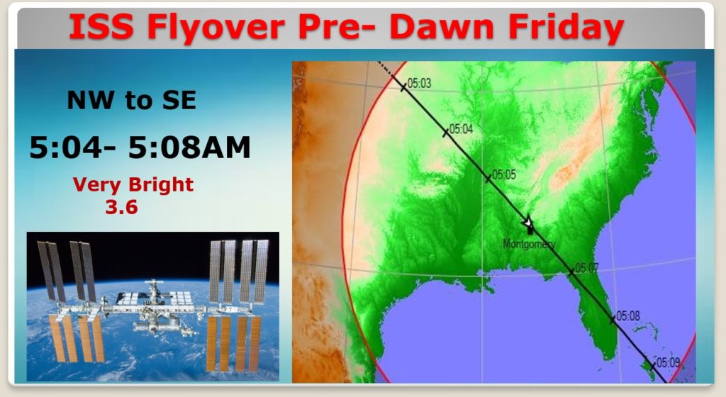
Excellent ISS Flyover pre-dawn tomorrow morning, for you early morning risers. Very bright. Set the alarm on your phone. 5;04 to 5:08 AM