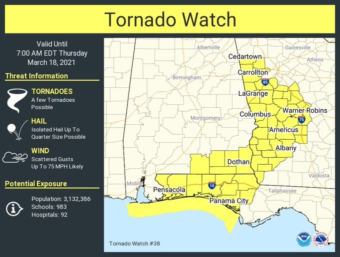
11:45 PM:
For many of us the Tornado Threat is over for tonight, but a new Watch has been issued for Southeast Alabama and into Georgia. It has been a very busy tornado day in Alabama. Thankfully we know of no fatalities. Look for big improvement behind the storm tomorrow.
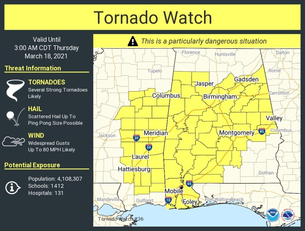
6:45 PM:
Latest Tornado Watch covers much of the same area as the old watch. It covers a big chunk of the state except for southeast Alabama until 3AM. This is another very rare PDS Watch….Particularly dangerous situation. We’re going to be busy through the wee hours of the AM.
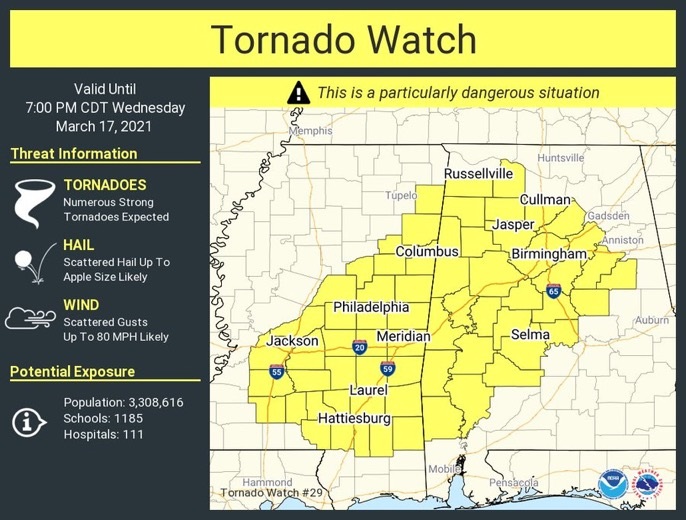
11:45AM:
Current Tornado Watch covers much of central and west Alabama until 7PM tonight. While it does not include Montgomery at the moment, it includes areas from Prattville to Selma west and northwest. Later watches will undoubtedly include all of us. Numerous strong tornadoes are expected. Scattered wind gusts to 80 mph. Hail up to apple size. The extremely dangerous tornado risk will continue for all of Alabama through the overnight hours tonight until tomorrow morning.
11:10AM:
EARLY MORNING UPDATE:
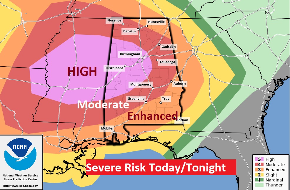
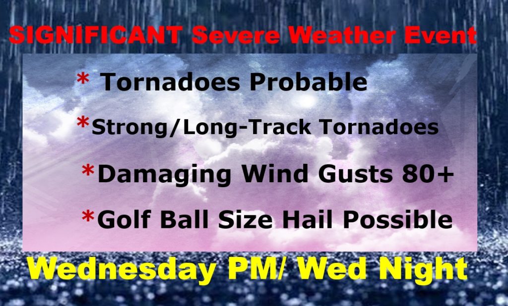
All the right ingredients are coming together at the wrong time for what appears to be a significant and dangerous severe weather event today and tonight. Most of us are in a Level 4 Moderate Risk. Parts of west Alabama are in an extremely rare HIGH Risk. Severe weather is possible as early as this afternoon. But, the tornado risk will ramp up much higher in the overnight hours. A few strong/long-track tornadoes are possible, perhaps likely. Thunderstorm wind gusts up to 80 mph and large hail area also possible. I’ll outline the details on this video, including the timeline. Stay Weather Aware.
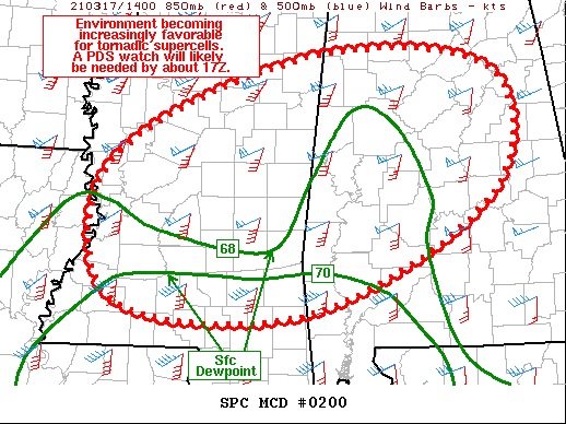
A PDS Tornado Watch will be issued about Noon from the Storm Prediction Center from central Mississippi to central Alabama. Particularly Dangerous Situation. SPC: The environment is becoming increasingly favorable for tornadic supercells” #alwx#mswx
EARLY MORNING UPDATE AND VIDEO:
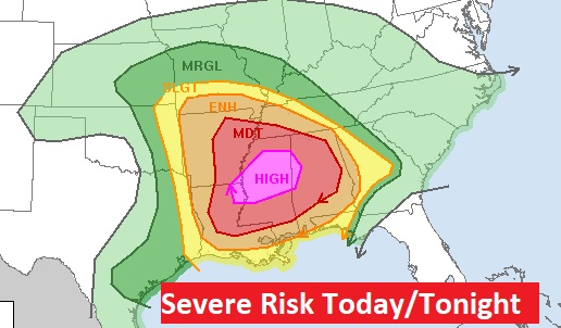
It’s rare to see the HIGH risk, but even the MODERATE risk (Level 4) covers a huge chunk of the state. The risk level is even a high level 3 in SE Alabama.
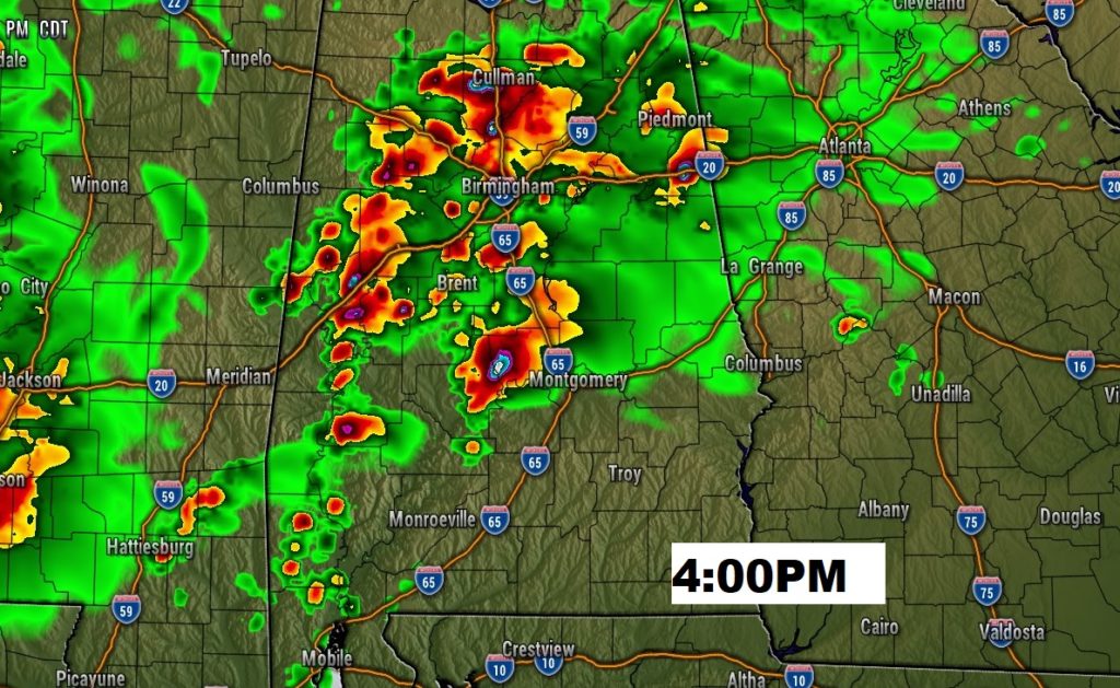
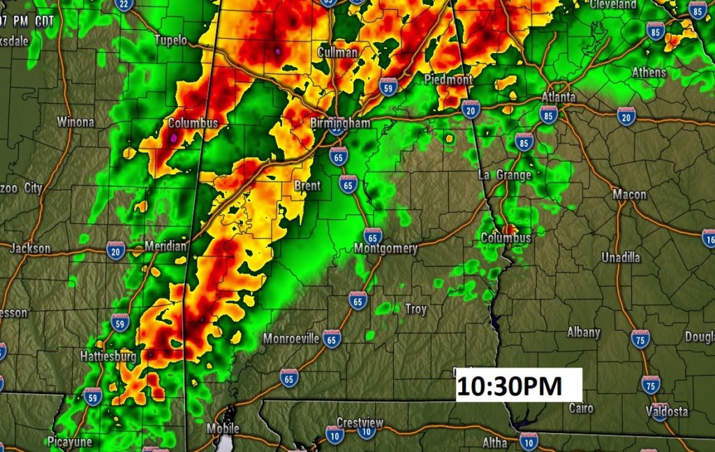
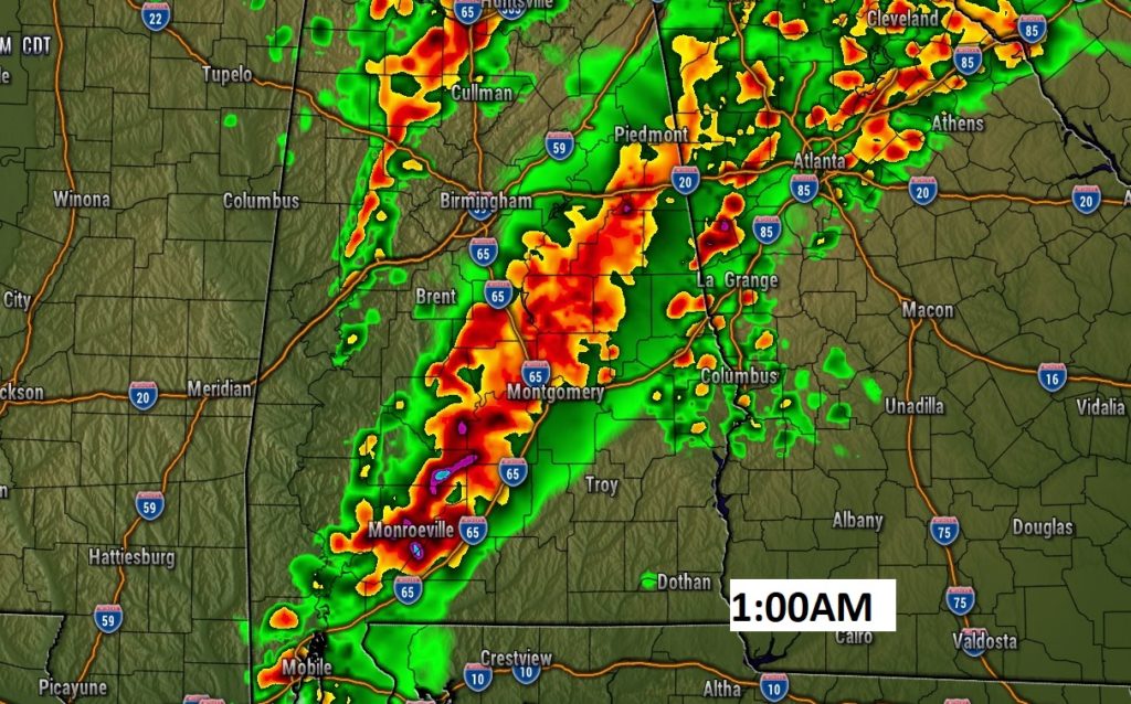
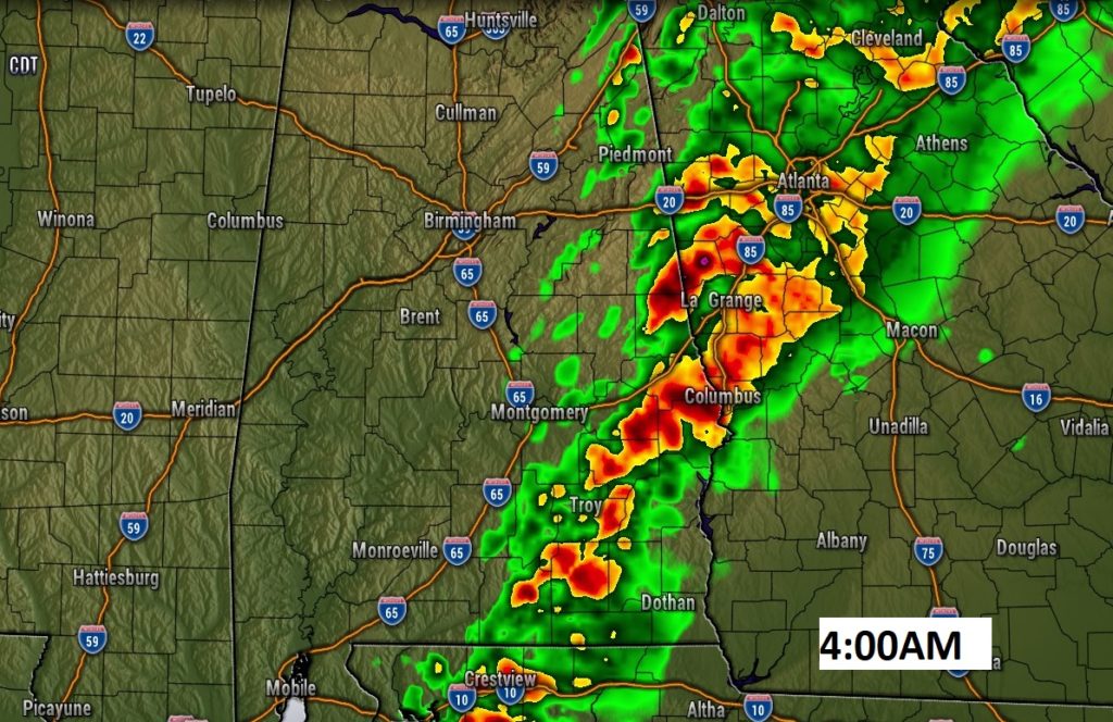
TWO Phases of Severe Weather Today.. Phase 1 this afternoon Phase 2 is even more dangerous in the overnight hours tonight. A few selected Future Radar snapshots. Don’t take the times litterally.
Here’s a summary of the main risks, particularly for the overnight event.
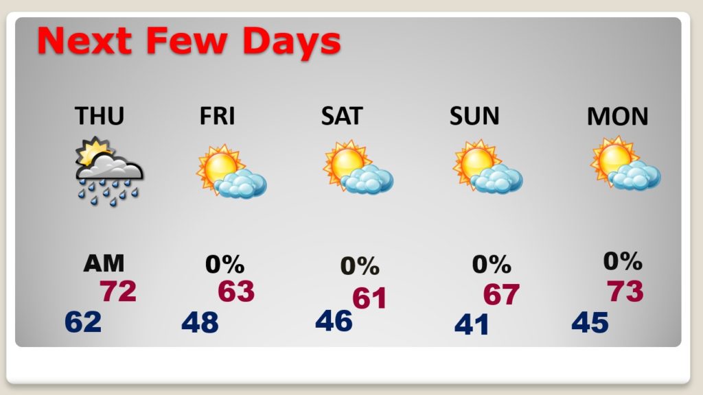
It turns much cooler behind the storm system…BUT a storm-free weekend. Warmer Monday.