Good Morning! We are getting into a very wet & active pattern for the next several days, as a series of storm systems move through. The risk of rain will be in the forecast each day from today through Sunday. Rainfall amounts could be excessive in some locations. Another round of severe weather is expected by late Thursday and Thursday night. Tornadoes are possible. On this video, I’ll walk you through the details of a complicated week ahead.
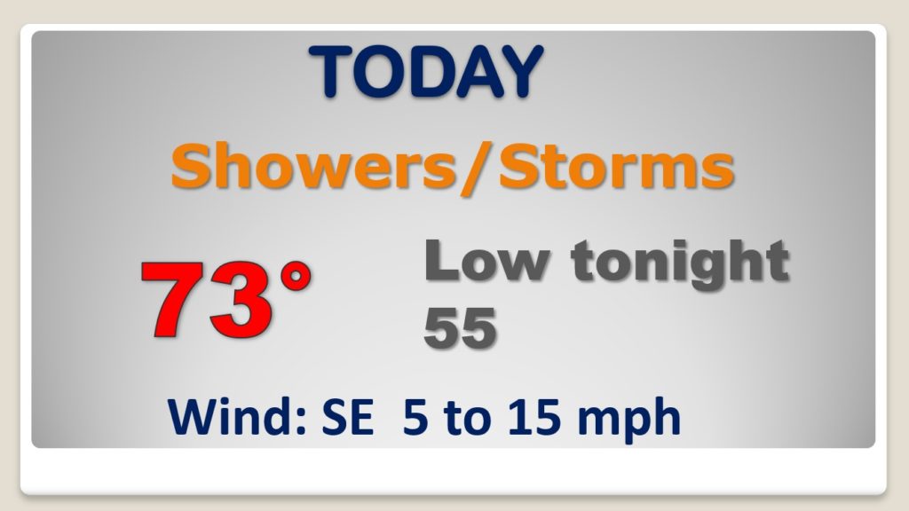
The risk of rain and thunderstorms are in the forecast for several days….through Sunday, as a series of storm systems swing through.
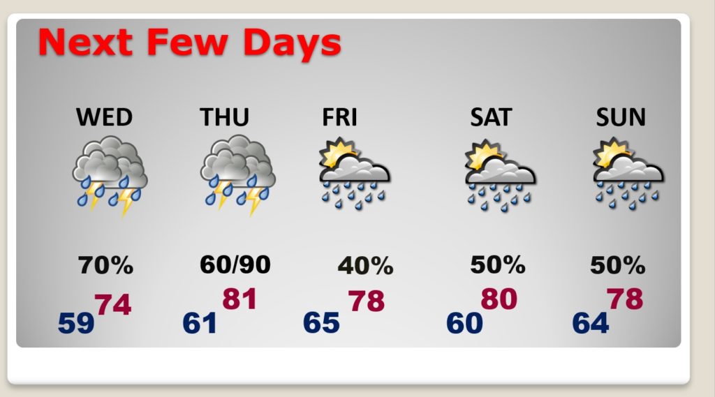
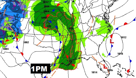
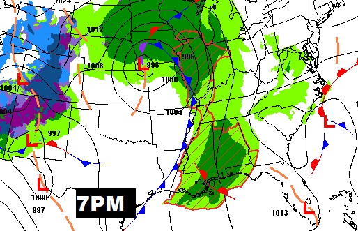
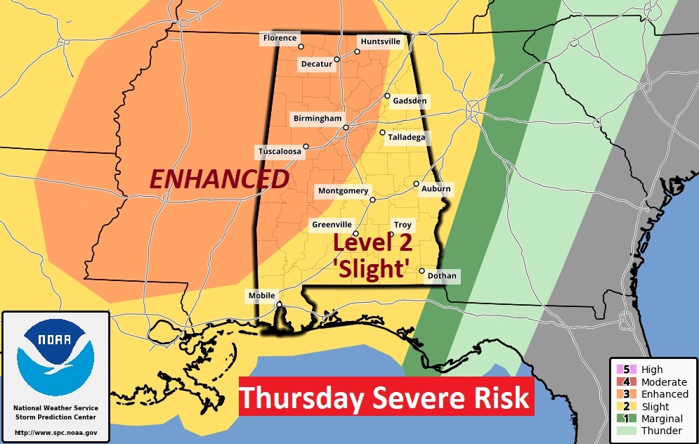
Thursday’s Severe Weather Threat will most likely be strongest by late Thursday afternoon through Thursday night. Tornadoes are possible.
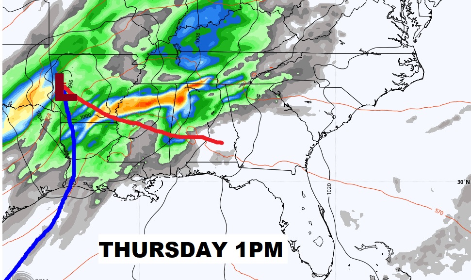
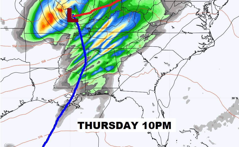
Once again, a rather significant Level 3 Enhanced Severe Weather Threat covers much of Alabama Thursday. All modes of severe weather are on the table, including tornadoes, especially from the late afternoon into Thursday night.
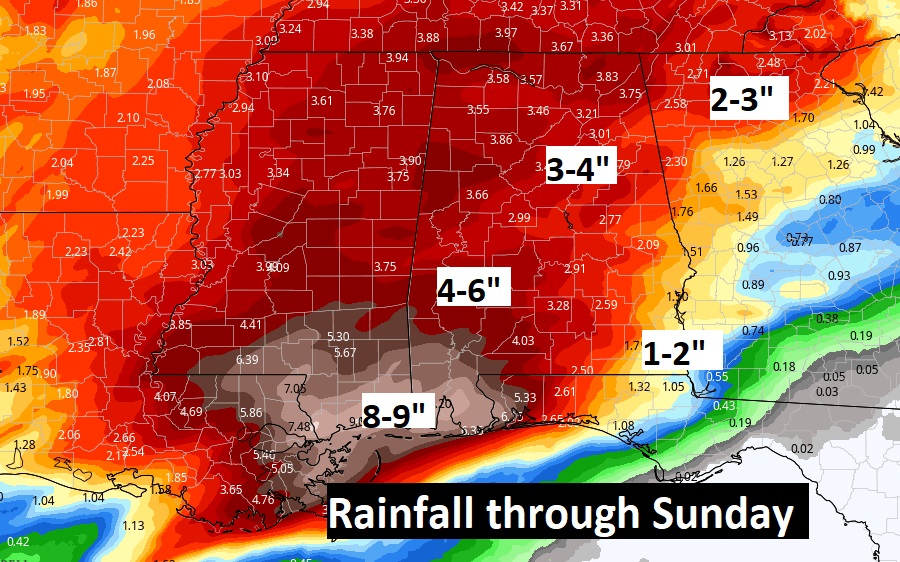
Several days of rainfall will likely lead to excessive rainfall amounts in spots, especially in southwest Alabama and closer to the coast. Flooding is certainly possible.