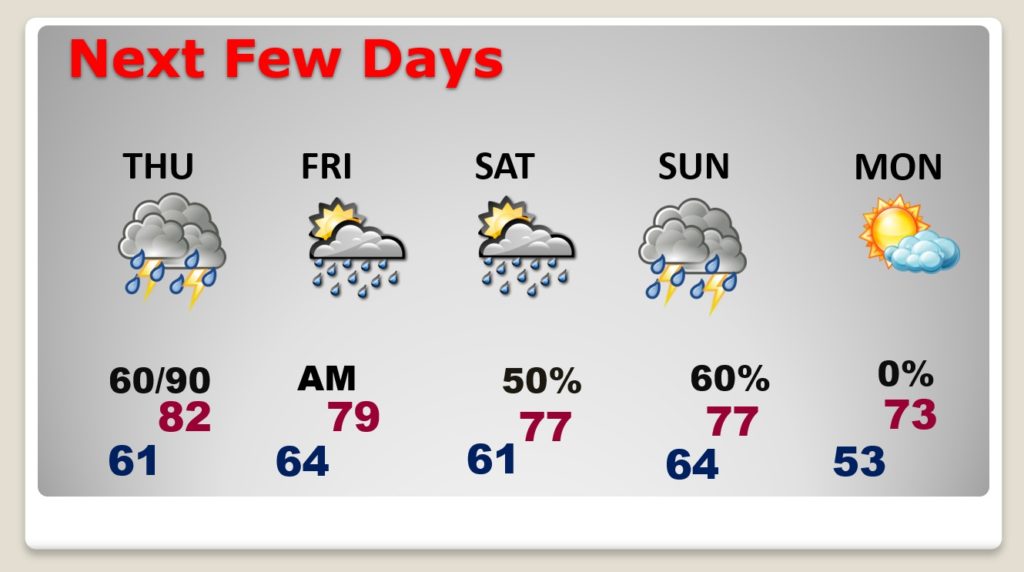
Good Morning! Our wet and active pattern will continue for a few more days. There will be periods of showers and storms. The main event arrives Thursday as potent storm system approaches the state. Once again, parts of our state are in rather significant Level 4 severe weather risk. All of the state is under at least some risk level, including a tornado threat. On this video, I have an update on the timing and the updated risk levels. We’ll ahead to the weekend and beyond.
Today the main severe weather threat stays west of Alabama. Only far west Alabama is in a Marginal Risk.
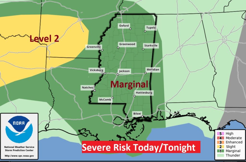
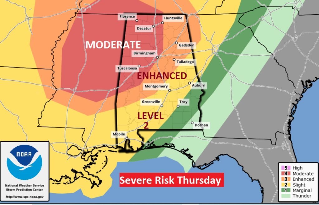
Thursday, parts of northwest Alabama are in a rather significant Level 4 Moderate Risk. In fact the Level 3 Enhanced Risk extends as far east as a Talladega/Selma line. Much of central and south Alabama are in the level 2 risk. All modes are severe weather are possible including tornadoes. Northwest Alabama could see some strong, long-tracked tornadoes.
Risk of rain and thunderstorms remain in the forecast for the next few days, through the weekend. Monday looks dry.
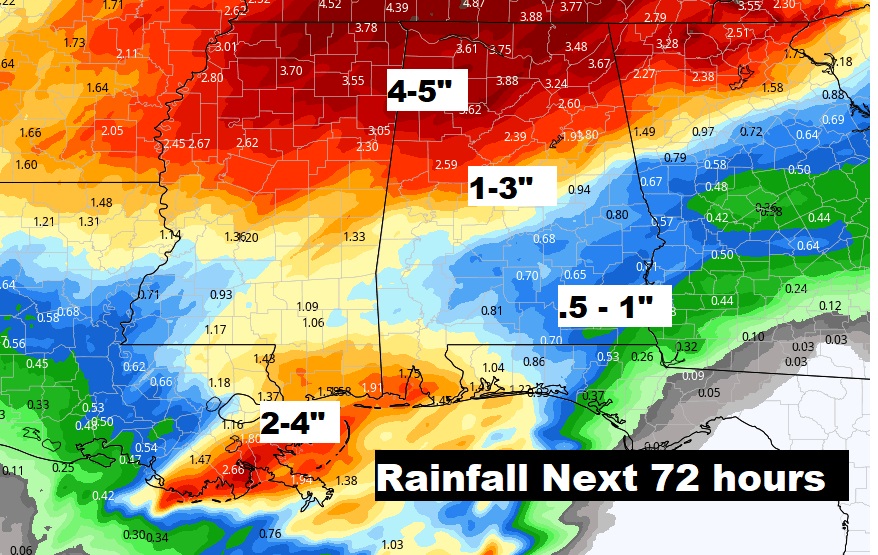
Parts of the state could see significant rainfall. The least amounts are expected across southeast Alabama.
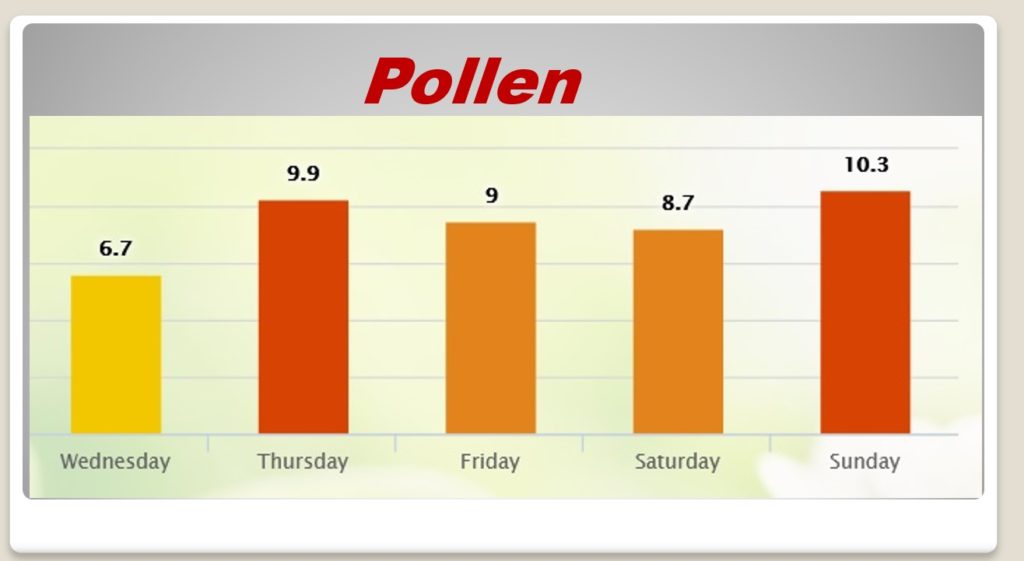
Pollen forecast for the next few days.