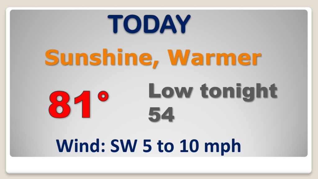
Good Morning! Our extended storm-free days continue today. Yesterday’s high was 78, today we should be 80 or above. On this video, we’ll look ahead to weather changes. Showers and storms will overspread the area Wednesday night and Thursday. Once again, the Storm Prediction Center says some of the storms could be severe. The wet pattern continues Friday & Saturday, and total rainfall amounts this week could be rather significant.
This great pattern continues today. More sun. A little warmer. Great Day.
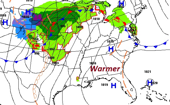
An approaching front will bring a risk of strong to severe storms across the area Wednesday night & Thursday. It’s the start of a very wet and active pattern which will stick around through Saturday.
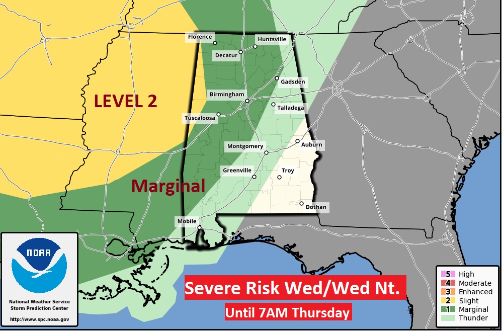
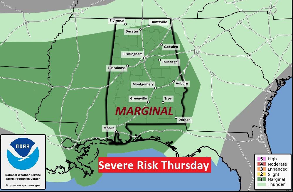
The Storm Prediction Center has much of the state in a Marginal Severe Weather Risk, Wednesday night through 7AM Thursday morning. All of the area is in a Marginal Risk Thursday. Damaging wind gusts are the main risks. A tornado or two can not be ruled out.
Wednesday daytime should be dry and warm. An approaching front will bring a risk of strong to severe storms across the area Wednesday night & Thursday. It’s the start of a very wet and active pattern which will stick around through Saturday. The Sunday forecast is subject to review, based on timing.
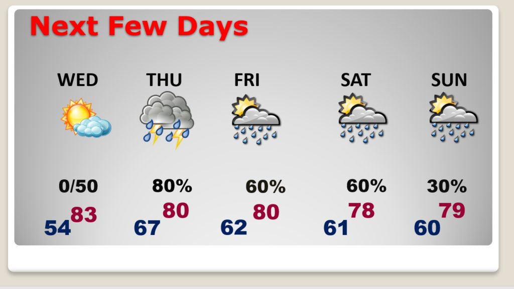
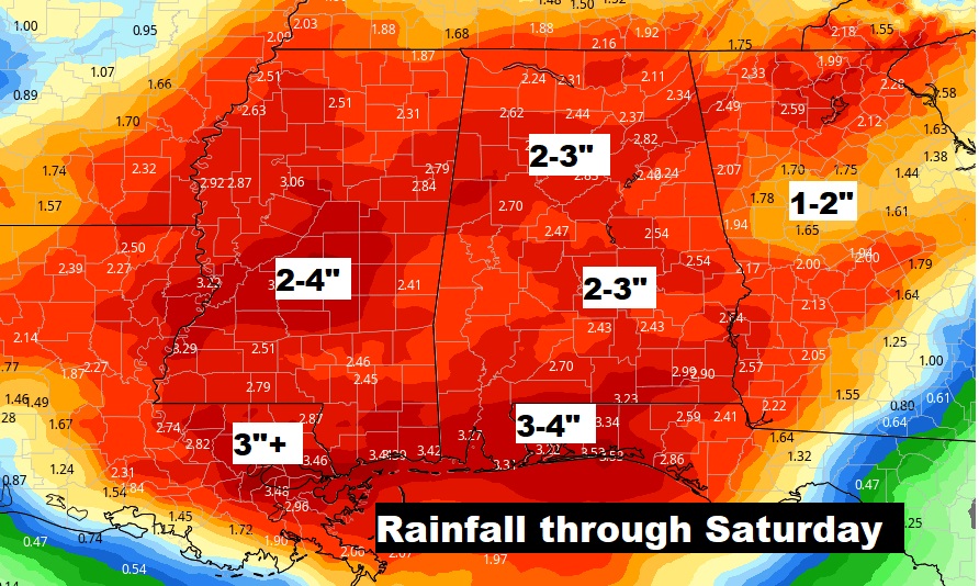
As you can see from the map below, rainfall amounts could be rather excessive Wednesday night through Saturday.