
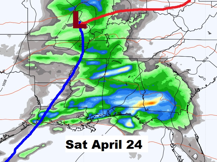
Good Morning! The Gulf Coast storm system which brought showers to the state in the overnight hours will exit quickly.
Clouds early will give way to lots of sun. Get ready for a very nice Sunday. We have an extended string of really nice, storm-free days ahead. Monday & Tuesday will be beautiful.
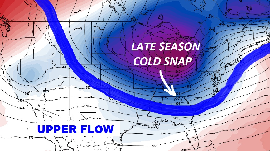
An unusual late-season chunk of chilly Canadian air will overspread much of the eastern half of the nation by mid-week. But, the chill will not last long in this part of the country.
TODAY: Should be a nice day. Clouds early, give way to mostly sunny skies. High 75. NW wind 6 to 12. Partly cloudy, chilly tonight. Low 49.
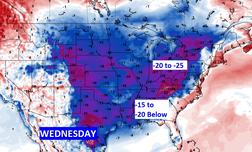
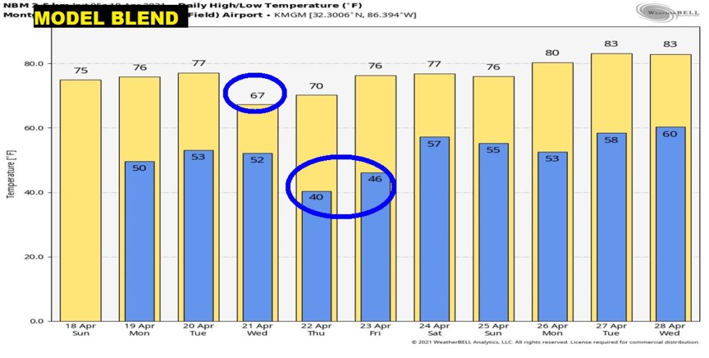
MID-WEEK COOLD SNAP: Another chunk of unusually cool air for this late in the season will funnel out of Canada, through most of the eastern U.S. by Mid-week. Boy, if this January…this would be serious business. Our coldest morning will be close to 40° on Thursday morning. The chill won’t last long;
Parts of the Ohio valley will see temperatures running 20 to 25+ degrees below normal. That’s a big deal. The chill will funnel all way down into the Deep South. It’s a good thing this is not January. This would be brutal.
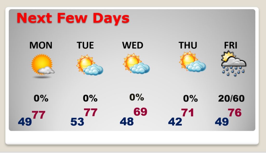
NEXT FEW DAYS: Nice string of storm-free days. Comfortable Monday and Tuesday with cool nights. Much cooler Wednesday. Our coldest morning will be close to 40° on Thursday morning. Recovery begins Friday afternoon.
Here’s a profile of the next 10 days.
Next big deal storm system will affect us by next Saturday.
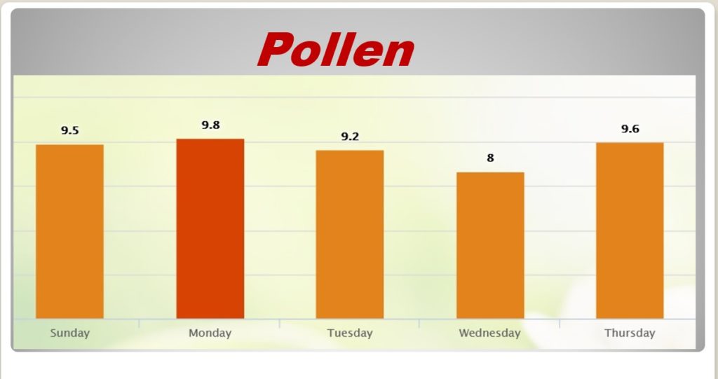
POLLEN: We’ll be in the medium to high range fro the next few days according to the folks at pollen.com.
.
I’ll have a complete video update tomorrow morning. Have a nice Sunday!
–Rich