
Good Morning! We have an important storm system on the way, with multiple rounds of severe weather beginning in the overnight hours tonight. Another round of severe storms is possible by Saturday afternoon & evening.
In the meantime, enjoy a quiet day today. It will be warmer. If you have evening plans, we should stay dry through late tonight.
You are going to love the Sunday weather. Details below.
TODAY: A warmer day. Partial sunshine. (not much sun) High 75. South to Southeast winds 6 to 12. If you have evening plans, we’re dry through at least Midnight. Showers and storms arrive in the overnight hours.
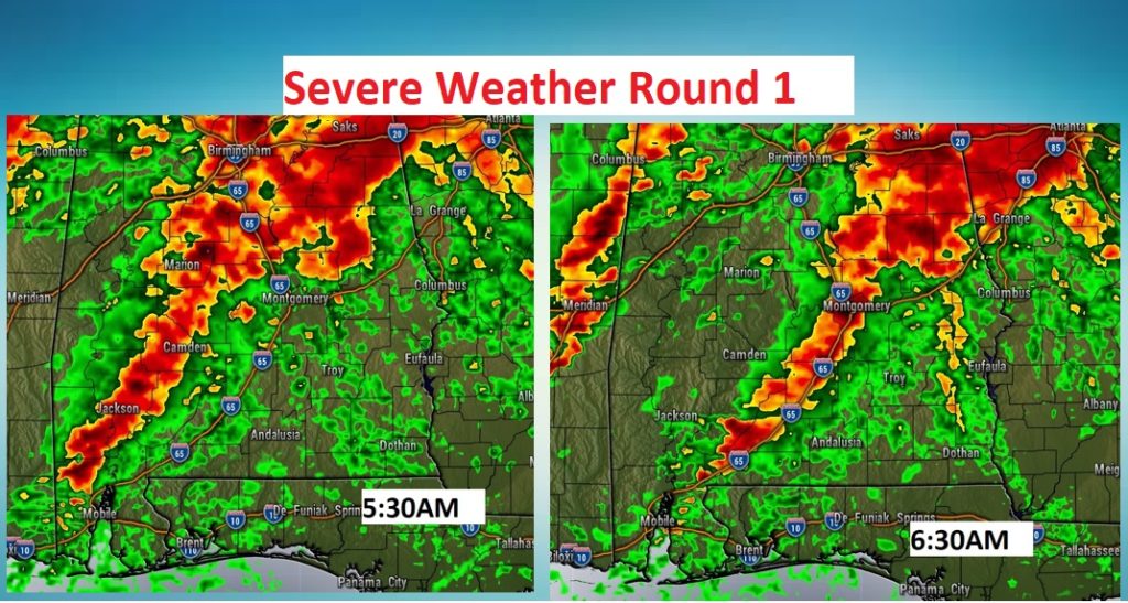
SEVERE WEATHER ROUND ONE: A band of strong storms could enter west Alabama by about 3AM and spread eastward, out of southeast Alabama by 10AM, if not before. Damaging wind gusts and hail will be the main risk, but tornadoes can’t be ruled out. I hesitate to show you Future Radar snapshots, because each model is showing different scenarios and very different timing. Nevertheless, here’s a sample of one model on Round one.
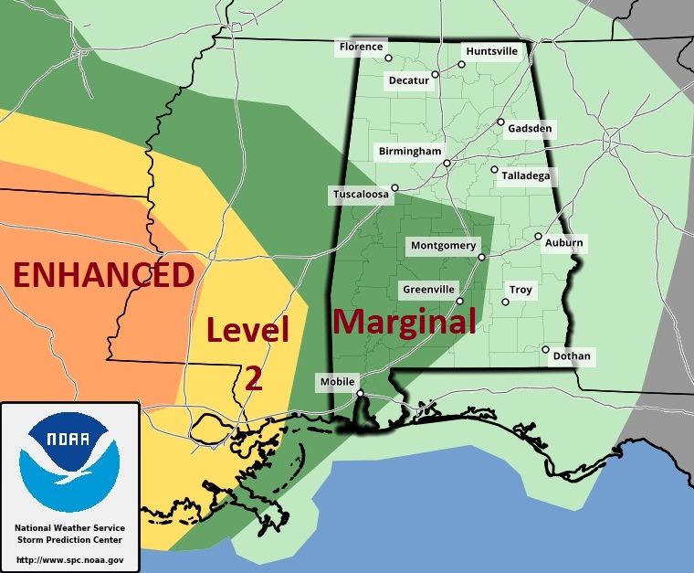
Here’s the Severe Weather Risk from the Storm Prediction Center through 7AM Saturday.
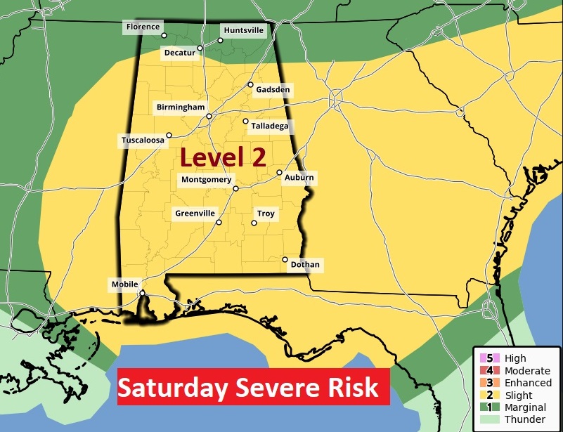
Here’s the Day 2 threat map after 7AM Saturday. SPC may have to raise the threat level to ENHANCED (3 out of 5) in later forecasts. I would day that’s likely.
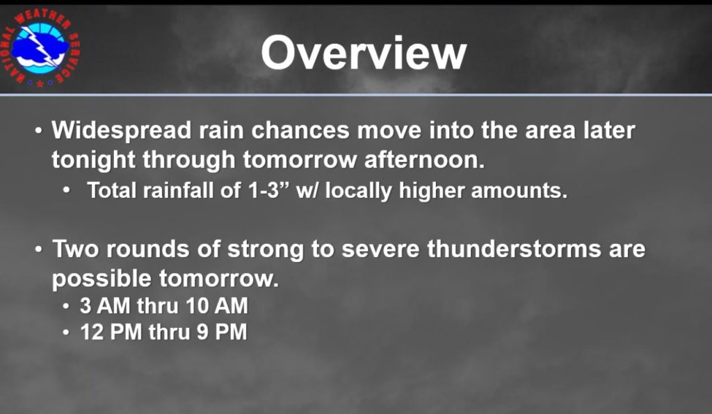
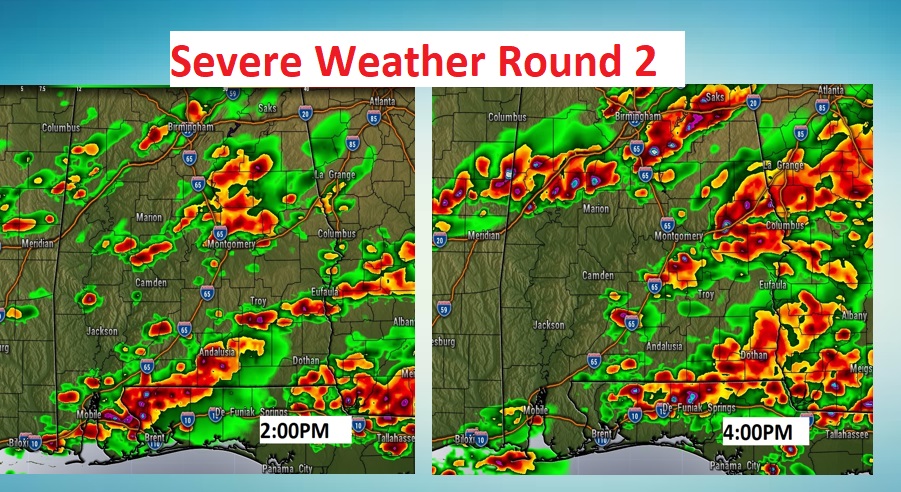
SEVERE WEATHER ROUND TWO: Sometime Saturday afternoon, perhaps by mid-afternoon, the atmosphere may recover enough for a second severe weather round…perhaps 1PM till about 7PM. Scattered strong to severe storms along and south of a Warm Front, draped across north central Alabama. The threat from these storms will be damaging winds and particularly large hail, larger than golf ball size. Maybe larger. The tornado threat during Round Two appears to be rather low.
Again, I’ll show you a future radar snapshot, just to give you the “flavor” of how the afternoon could play out.
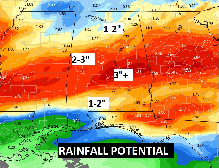
POTENTIAL RAINFALL: Take a look. Some spots, especially in central Alabama could have 2 to 3” or more. Locally heavy amounts.
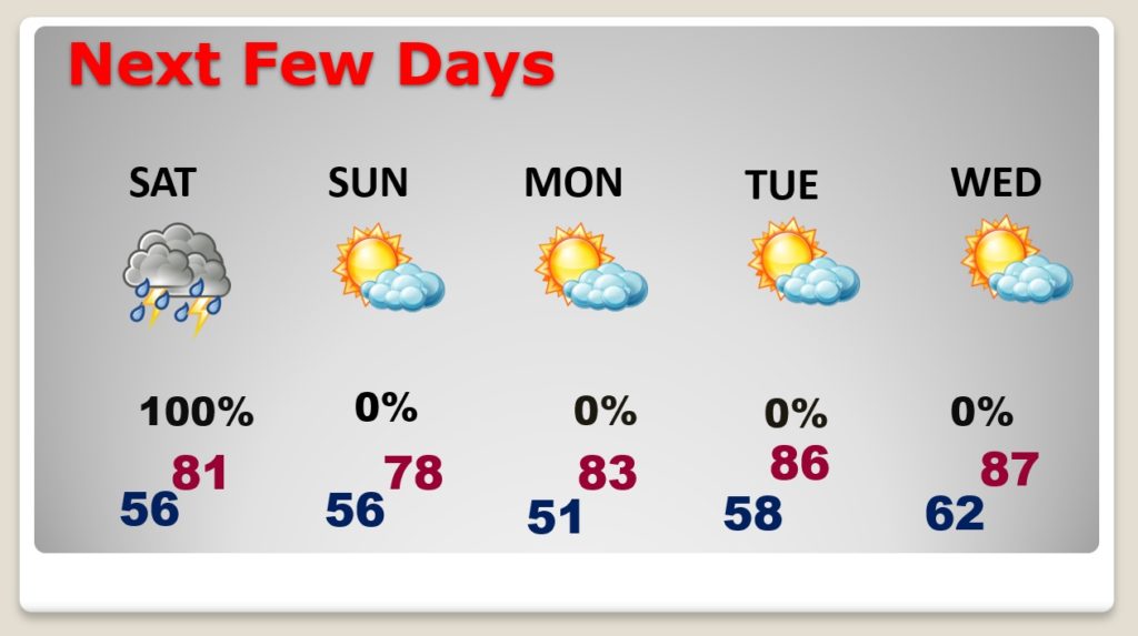
NEXT FEW DAYS: Severe Storms Saturday ending by late Saturday night. Perfect Sunday. Warming trend begins. Storm-free Sunday through Wednesday.
STORM SYSTEM LATE NEXT WEEK: Two early to say if Next Thursday’s storm system will be severe. But, ‘tis the season. The models disagree on the details on the arrival time and evolution. Stay tuned. We’ll take these one at a time.
- –
I’ll do my best to keep you up to date with any new details. Stay weather aware.
–Rich