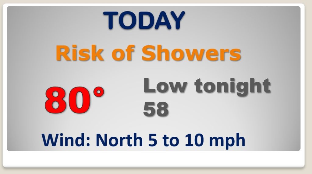
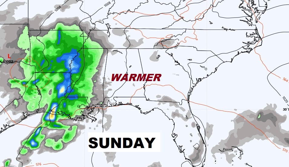
Good Morning! A stalled front in the state today will be focus of a few scattered showers. But, weekend news is not bad. Saturday is dry and comfortable. Much of Sunday looks dry. But, get ready for a rather active pattern ahead. The first wave of showers and thunderstorms move into the area Sunday night. Then, look for waves of showers and storms at times next week. As you will see on this video, rainfall amounts could be rather excessive, and some storms could be strong to severe at times.
That stalled front draped through the state will be the focus for s few scattered showers and maybe a thunderstorm today and tonight. Warm day.
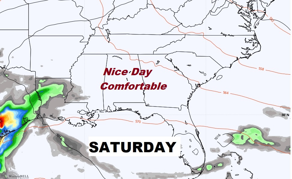
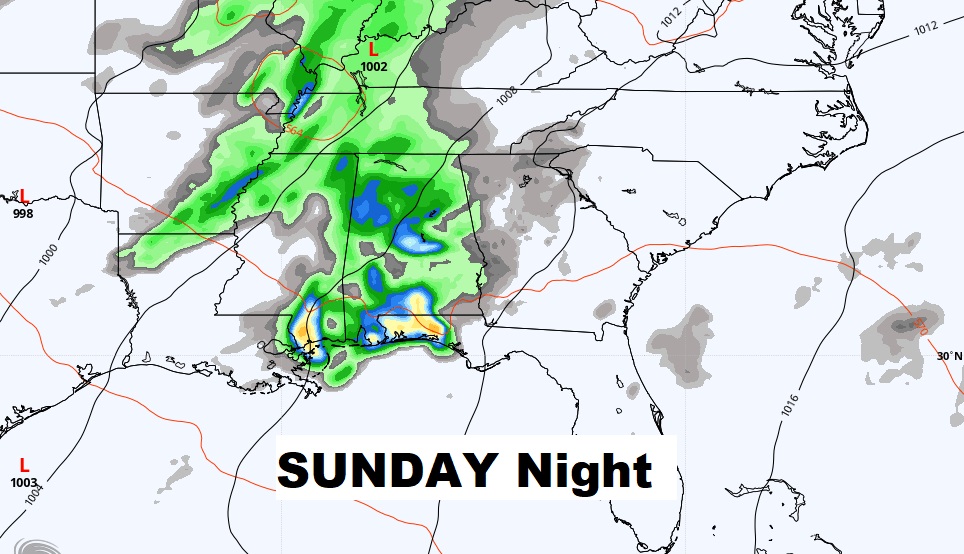
Much of the weekend will be dry until Sunday night. Sunday night is the start of a rather active few days.
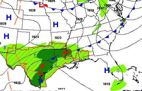
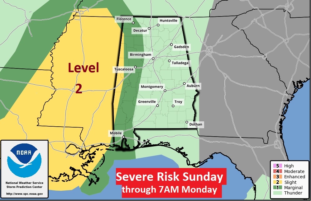
The SPC Sunday Severe outlook (through 7AM Monday) includes the western part of our state. Level 2 risk covers Mississippi.
Starting Sunday night we get into a VERY active pattern for much of the week ahead.
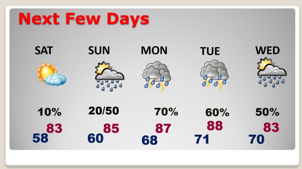
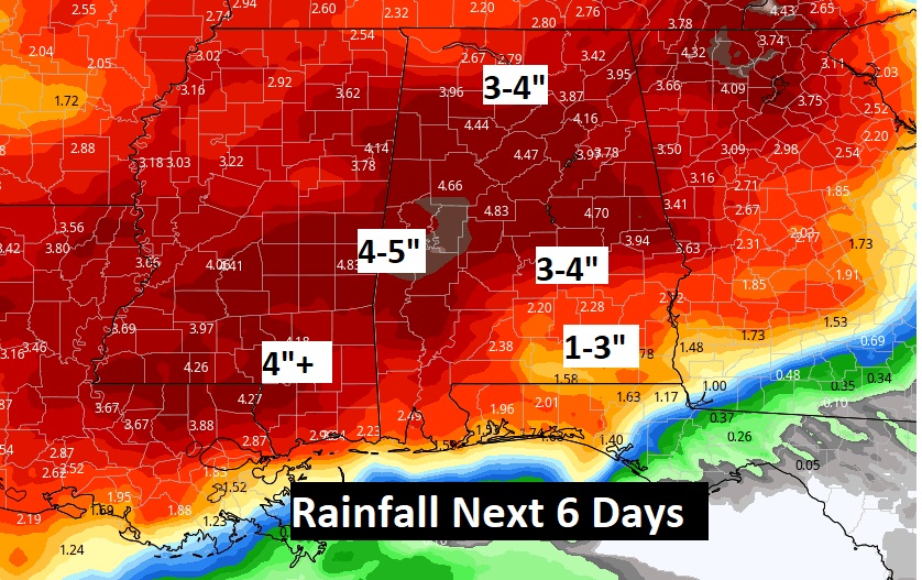
Rainfall amounts over the next 6 days could be rather excessive in spots.
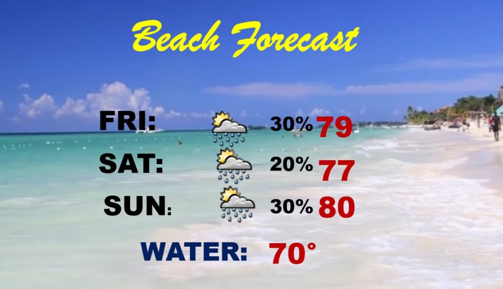
Here’s your weekend beach forecast. Next week will be rather stormy at times on the coast.