SEVERE THUNDERSTORM WATCH
(11:45AM 5/3/21)
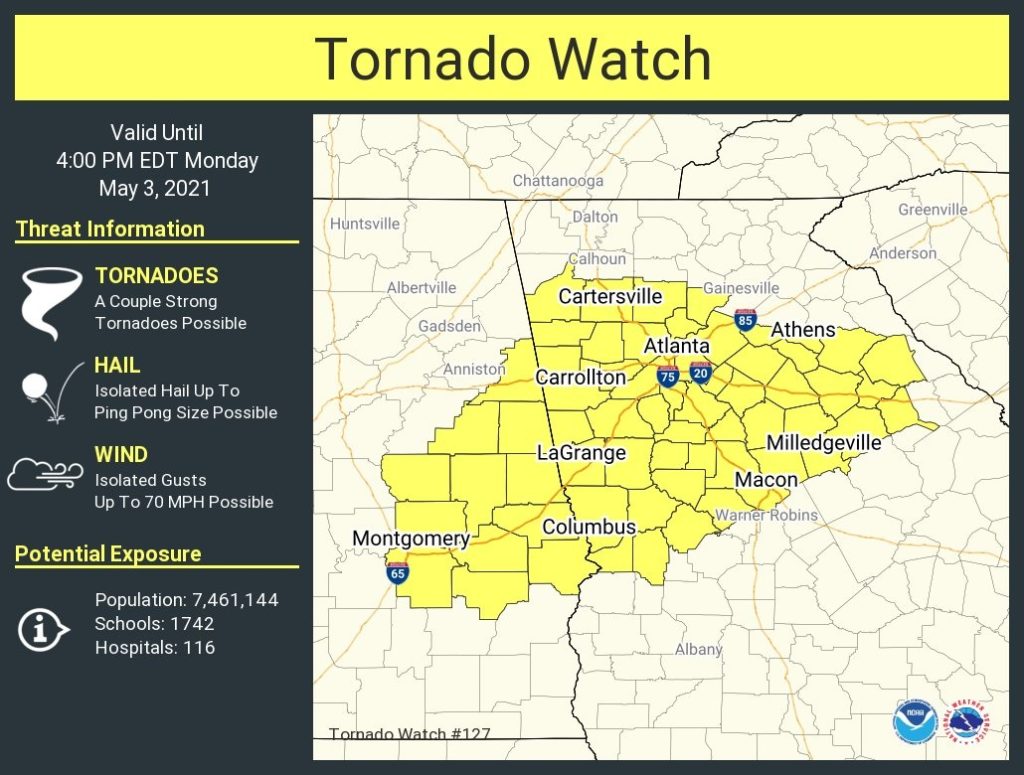
The Tornado Watch issued earlier for east central Alabama has been replaced. Now, a Severe thunderstorm Watch covers much of the state until 8PM. Damaging winds up to 65 mph and ping pong size hail is possible. A couple of tornadoes can’t be ruled out.
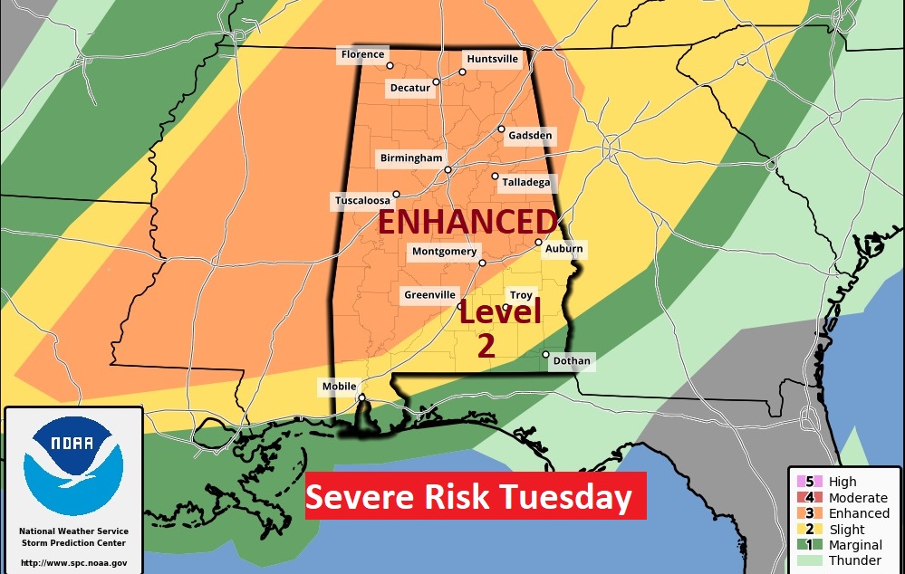
Expect a couple of bumpy days today and tomorrow. Tomorrow, we are in a Level 3 Enhanced Severe Weather Risk. All modes of severe weather are possible. Stay Weather Aware.
EARLY MORNING UPDATE:
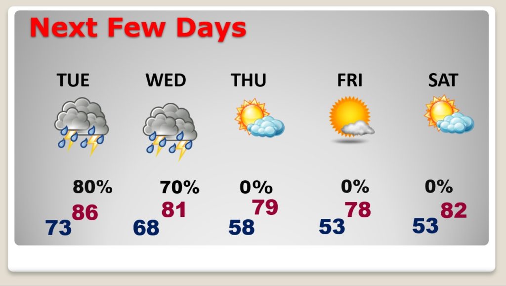
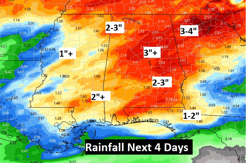
Good Morning! The next 3 days or so will be quite active. Wet & stormy at times. Showers and thunderstorms will be quite numerous. The Storm Prediction Center has us in a Severe Weather Risk Today, Tuesday and Tuesday night. Rainfall amounts through mid-week could be heavy spots. We’ll look ahead. Late in the week, cooler and less humid air will arrive. We’ll also take an early look at what’s shaping up to be a nice Mother’s Day weekend.
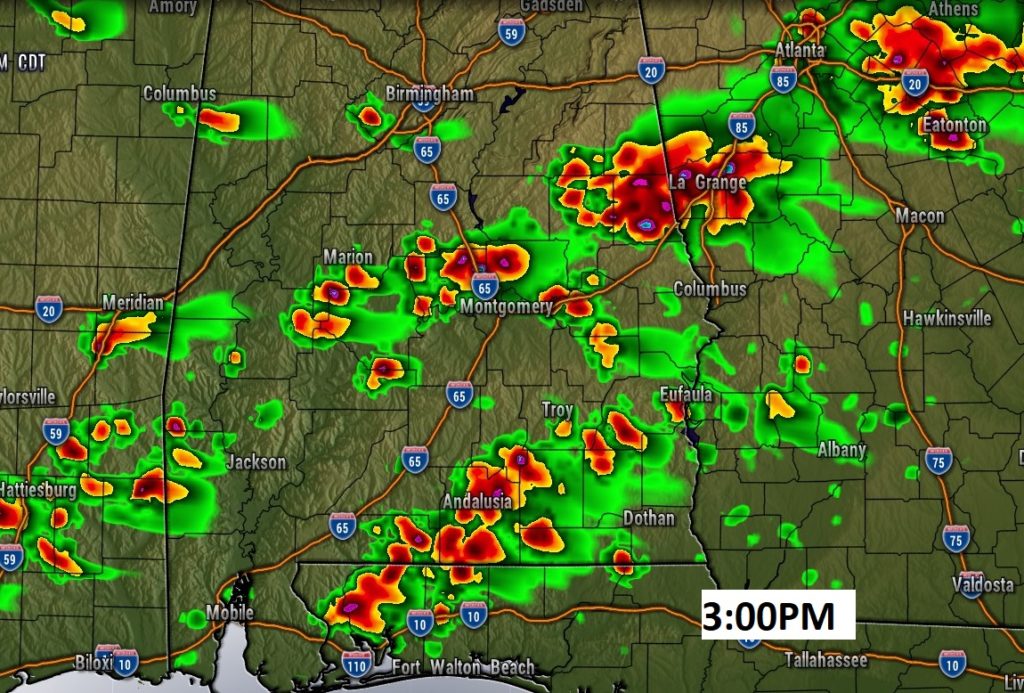
Warm & humid today. That will be fuel for the fire. Showers and storms likely. Some storms could be severe this afternoon and this evening.
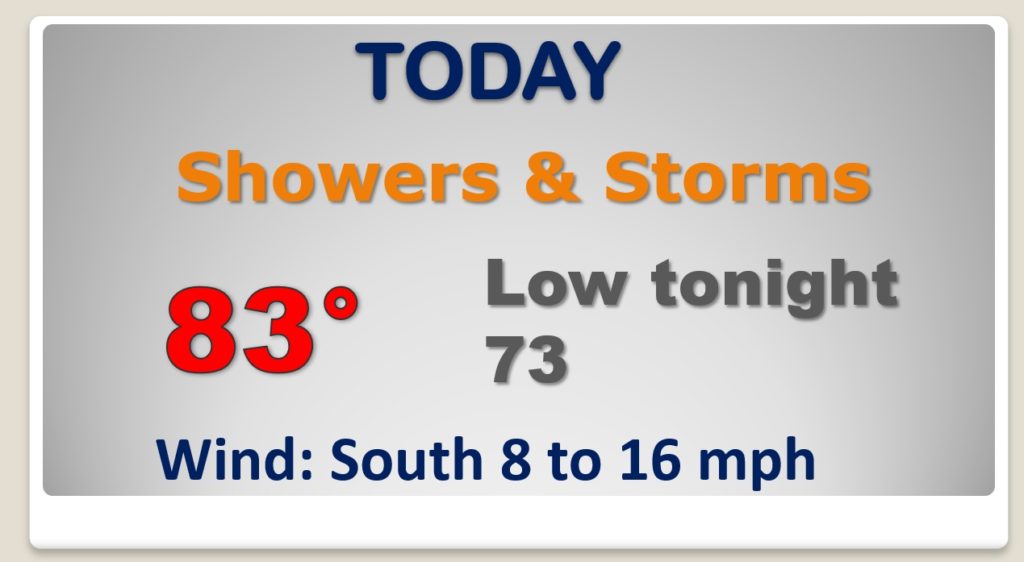
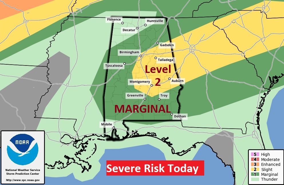
Level 2 Severe Weather Risk Today. Damaging wind gusts and hail are the main threat. Couple of tornadoes possible.
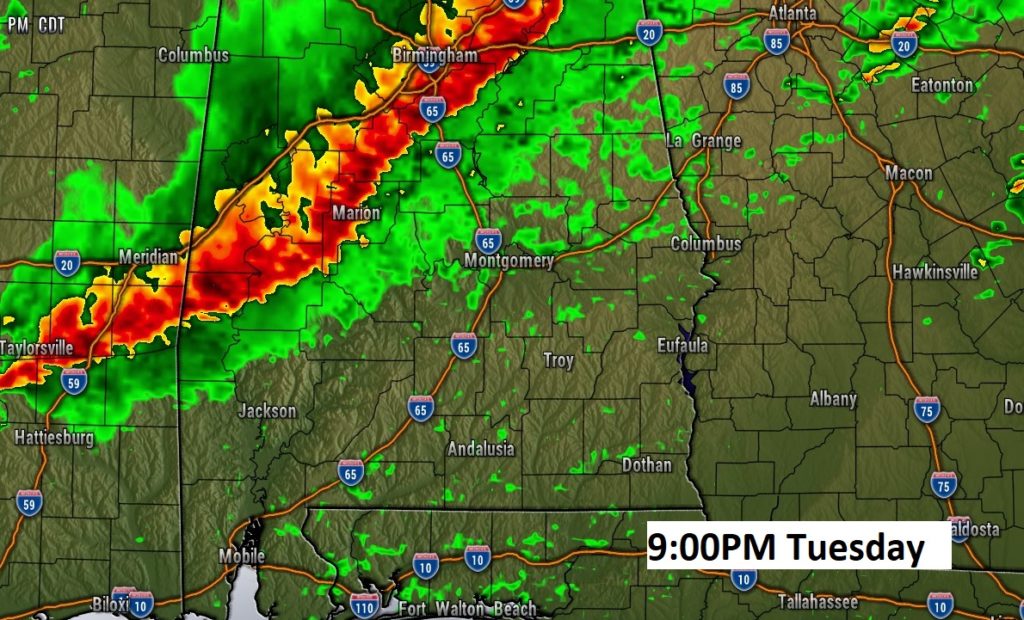
ENHANCED Severe Weather Risk Tuesday and Tuesday evening. Level 3. Damaging wind gusts, Large hail. Risk of a few tornadoes.
Locally heavy rainfall totals over the next 2-3 days.
Showers and storms will be numerous through Wednesday. Cooler and less humid Thursday and Friday. So far, the Mother’s Day weekend looks good