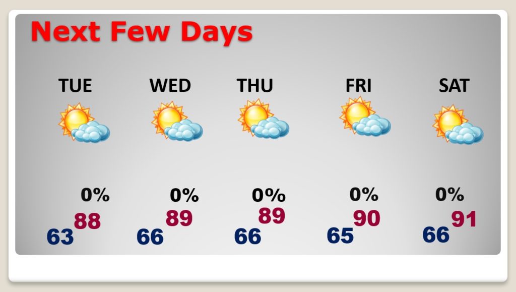
Good Morning! Are you ready for summer? This week will feel more and more like summer, each day. We are likely to be near or above 90 by late week and into the low 90’s by the weekend. And, with a strong “bubble” of upper level high pressure over us, we should be high and dry. It might be time to get out the garden hose. How long will this pattern last? We will check well into the future for clues. Plus, a check of the tropics as hurricane season gets closer.
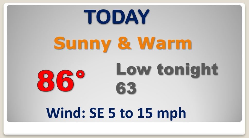
Each day is getting warmer. Mid 80’s today. But humidity still relatively LOW.
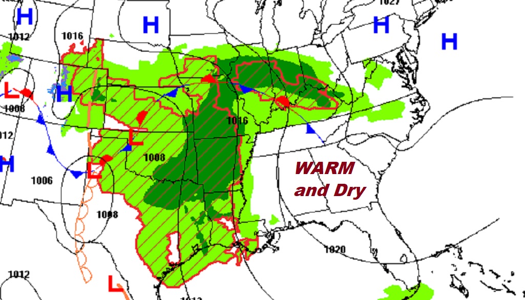
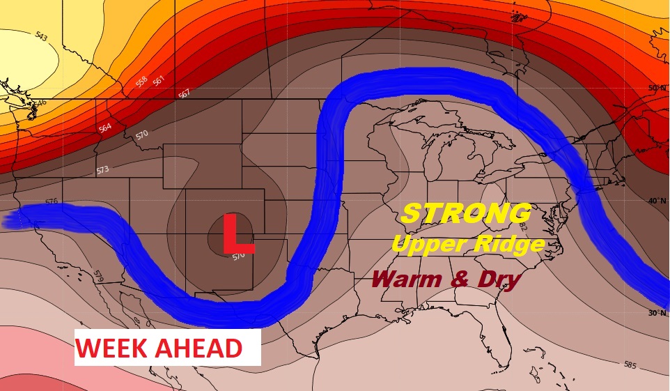
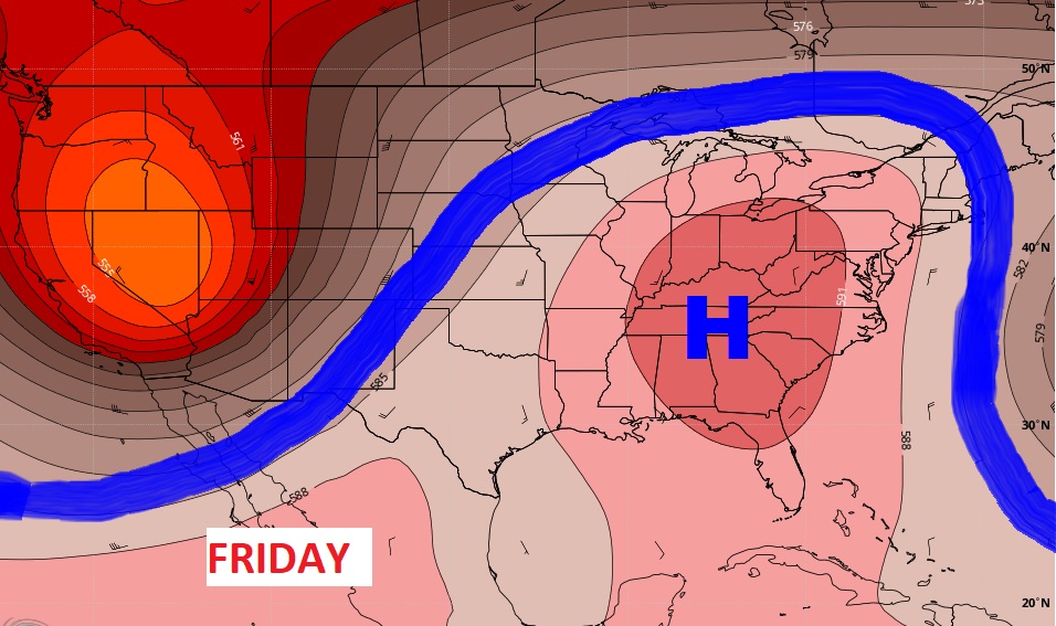
The key to our weather this week? A massive ridge of high pressure in the upper atmosphere. It’s strong now, but it even gets stronger by late week. It also acts as a protective dome, keeping storm systems away. High and dry.
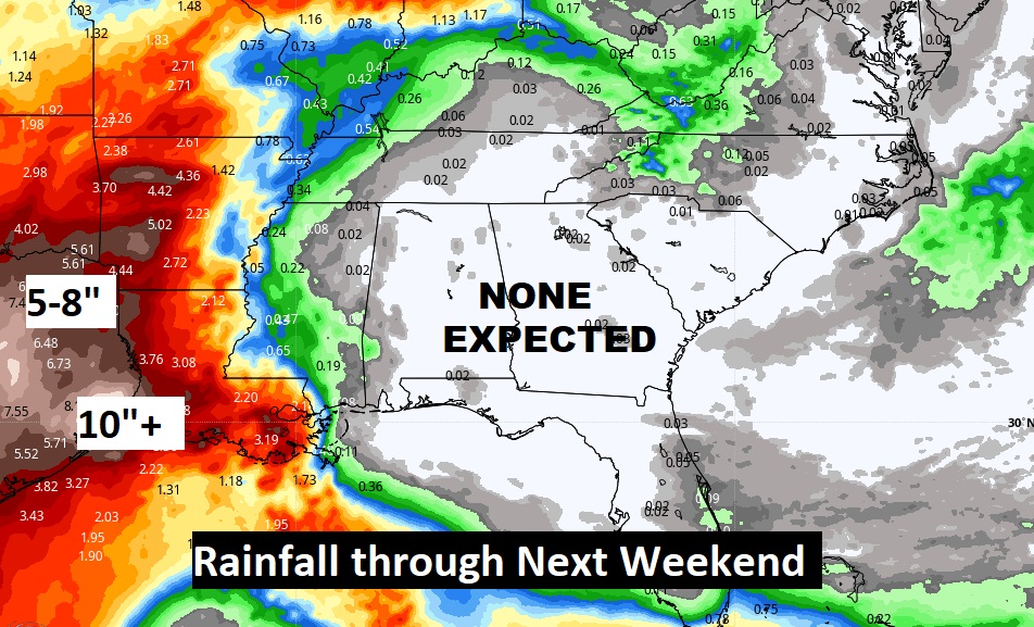
This is amazing. The upper high keeps us dry. LOOK at the rainfall west of us this week. Incredible map.
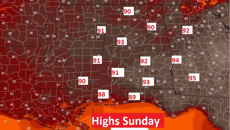
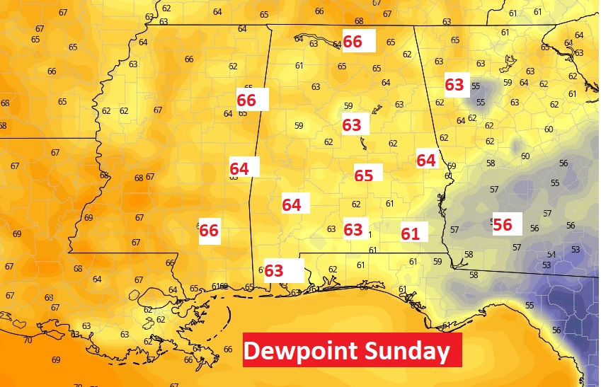
Could Sunday be our hottest day so far? With highs in the lower 90s and dewpoints in the mid 60’s…potential Heat Index in the upper 90s. Ready for summer?