
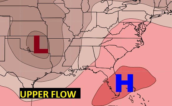
Good Morning! If you didn’t get rain at your house yesterday, today may be your day. Certainly there will be a lot more rain to go around for the next 2-3 days. We’re on the west side of a “cut-off Low” over the ArkLaTex region. By mid-week, that storm system will migrate to Ohio and our rain chances will return to a summertime normal.
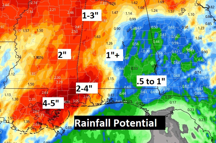
Today and Monday, the heaviest rainfall amounts will be across the western half of the state and especially SW Alabama. The southwest counties will not see nearly as much. Parts of Louisiana could see 5 to 8″
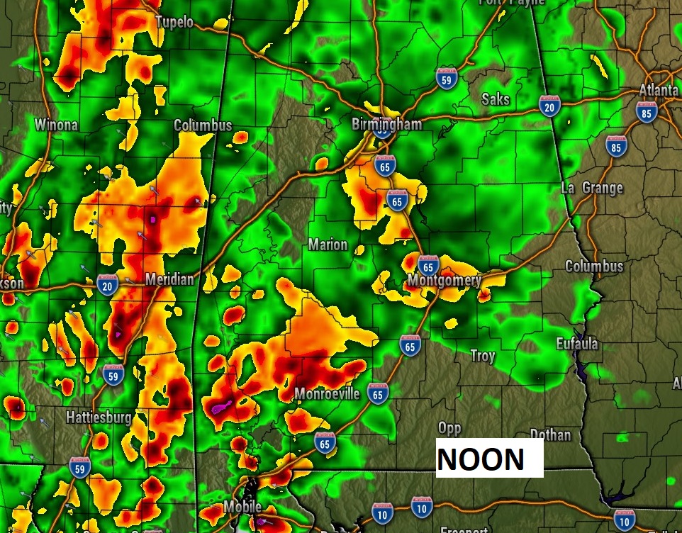
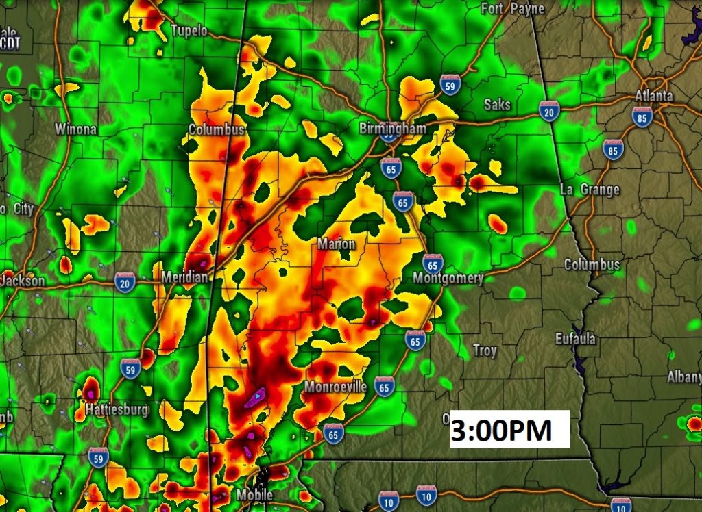
TODAY: Very humid. Cloudy. Light winds early, then SE wind 10 to 18 in the afternoon. Showers and storms become likely today and tonight. High today 84. Low tonight 70. Here’s a couple of Future Radar snapshots.
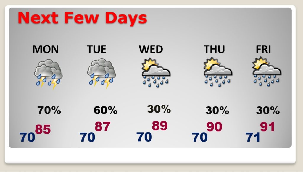
NEXT FEW DAYS: Showers and storms will be widespread Monday and Tuesday. The rain chances will return to a more typical for June 30% Wednesday through Friday. Highs back to near 90 by Thursday and Friday.
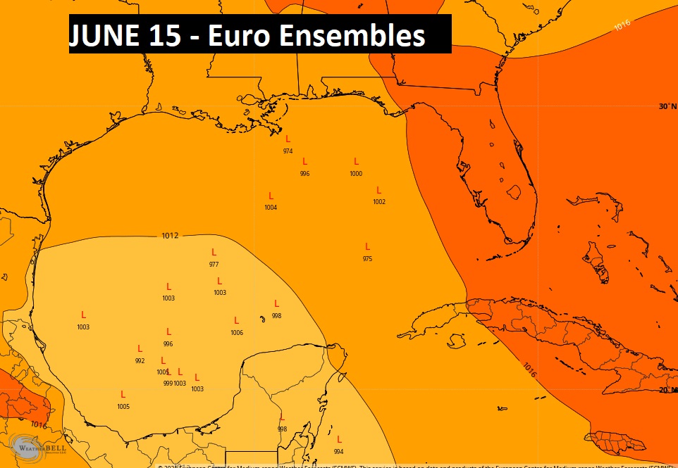
TROPICS: The Atlantic basin is quiet now. But, the longer range Euro ensemble models suggest that the Gulf may need to be monitored closer to the middle of the month. Particularly the southwest Gulf.
I’ll have a complete video update tomorrow morning. Enjoy the rest of the weekend!
–Rich