
Good Morning! It’s been an interesting 24 hours. Some towns have seen some very heavy rainfall amounts. Montgomery Regional Airport has had .85”, with .03 coming since Midnight. I’m still down here in Orange Beach….BUT, my home rain gauge in East Montgomery reports 2.20” since Midnight and 2.64” last 24 hours.
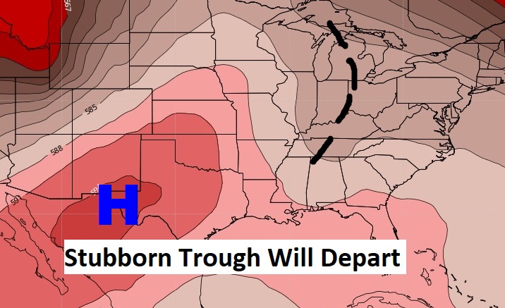
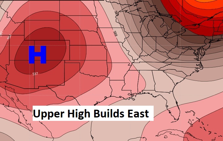
Today, showers and storms will be rather numerous again. However, the trend will be for few storms over the next few days, especially Sunday through Wednesday as a ridge of high pressure builds above us.
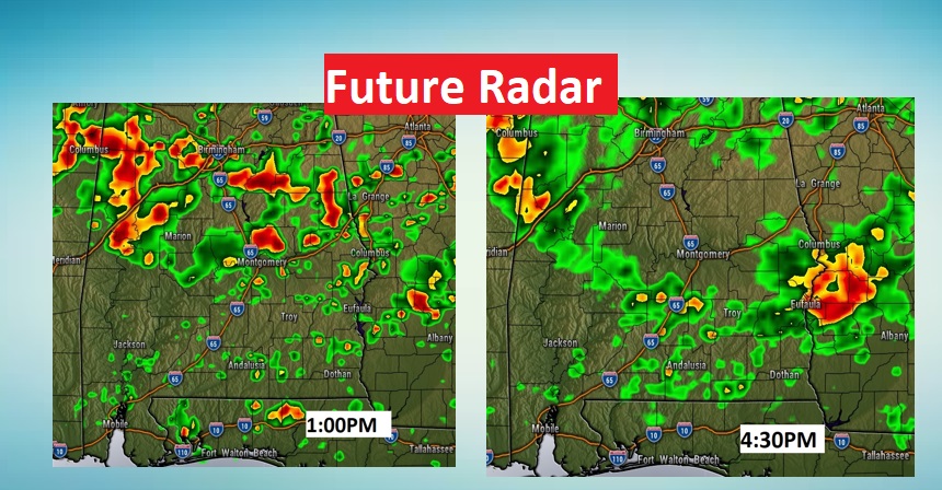
TODAY: Random, scattered to numerous showers and storms will develop again. Very humid. High in the upper 80’s. Storms will fade out overnight tonight. Low in the low 70’s. Here’s a couple of Future Radar snapshots.
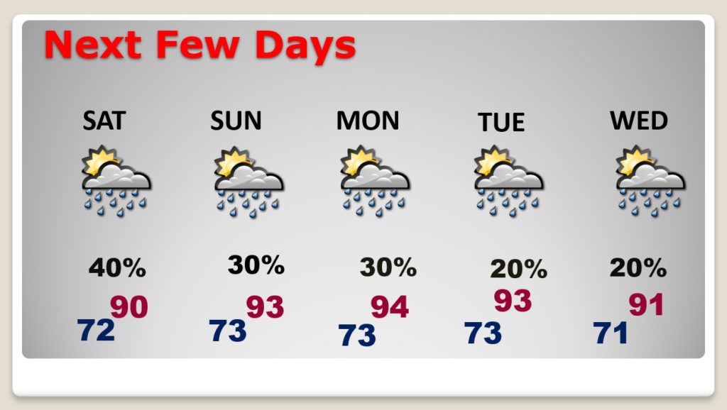
NEXT FEW DAYS: Scattered random storms Saturday. But, storms will become widely scattered by Sunday through Wednesday. More isolated in nature. Highs will be at or above 90.
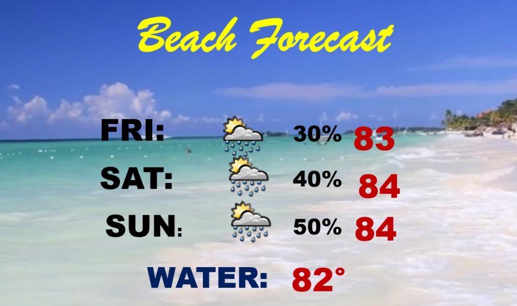
BEACH FORECAST: Moderate rip current risk today. Lower risk is indicated over the weekend. Scattered storms at times. Highest coverage and the best chance will be Sunday. Gulf water temperature 82.
TROPICAL UPDATE: NHC says: For the North Atlantic...Caribbean Sea and the Gulf of Mexico:
Tropical cyclone formation is not expected during the next 5 days.
However, the computer models continue to suggest that the western Gulf will need to be watched closely next few days.
Chase and I are still in Orange Beach. The weather has been very nice. No storms.

Enjoy the weekend I’ll have another Blog Update un the morning. . Have a nice day!
–Rich