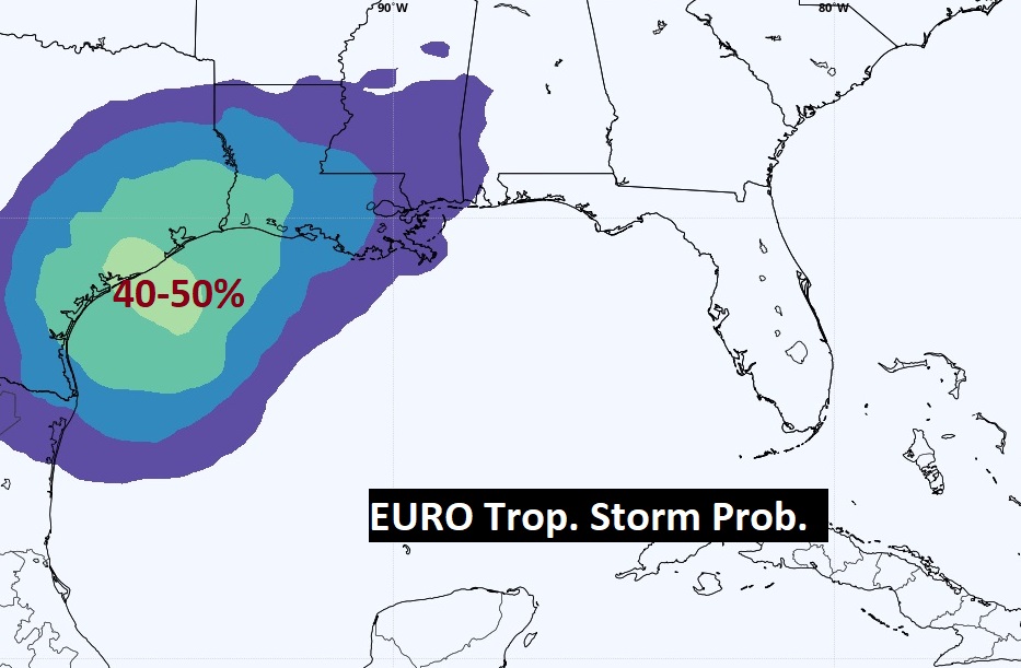
2:30 PM UPATE:
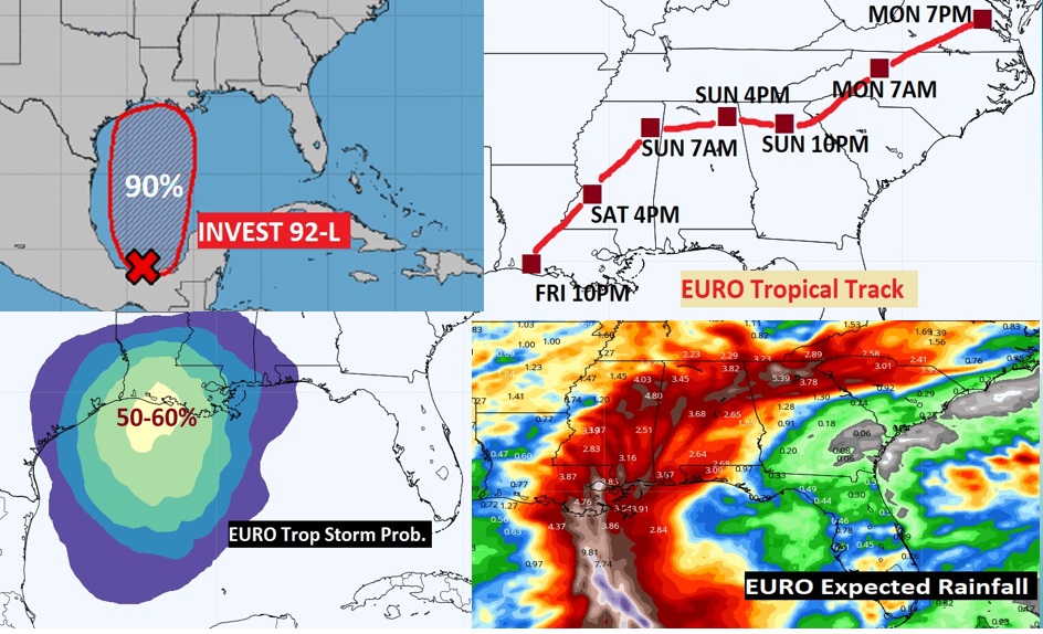
Will Invest 92L just be a Depression or a Tropical Storm? The EURO now gives it a 50-60% chance of becoming Claudette, tracking from the LA coast through MS, north AL into Georgia by Monday. Look at the swath of extremely heavy rain just east of the forecast track.#alwx
EARLY MORNING UPDATE:
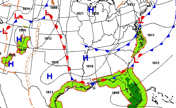
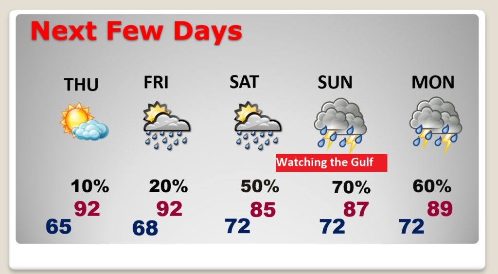
Good Morning! The news in the short term is getting better. Yes, it will be hot today and tomorrow. But, the dewpoints will be down, meaning the humidity will be rather tolerable. But, as we look toward the Father’s Day weekend, the forecast is more difficult. That system in the Gulf, Invest 92-L, could be a tropical depression or tropical storm by Friday, as it approaches the upper Texas/Louisiana coast. Over the weekend, it heads it curves and tracks across the Gulf states. That will almost certainly lead to a lot of potentially heavy rain over the Father’s Day weekend. The exact details of the track of this system are still quite uncertain. On this video, I’ll do my best to sort out what we know and what we don’t know. I’ll show where the heaviest rain is expected, and the updated timeline.
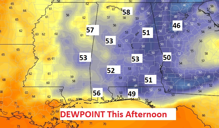
Today will, not be as hot as yesterday. It will be sunny and dry with tolerable humidity.
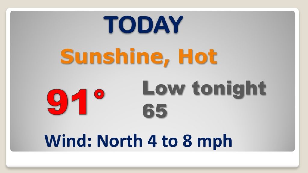
The dewpoints this afternoon will be in the 50’s this afternoon. In this part of the world in June…this is a TREAT
Dry through Thursday. Isolated storms Friday with more humidity. Rain chances escalate over that weekend, as that tropical system tracks eastward across the Gulf states.
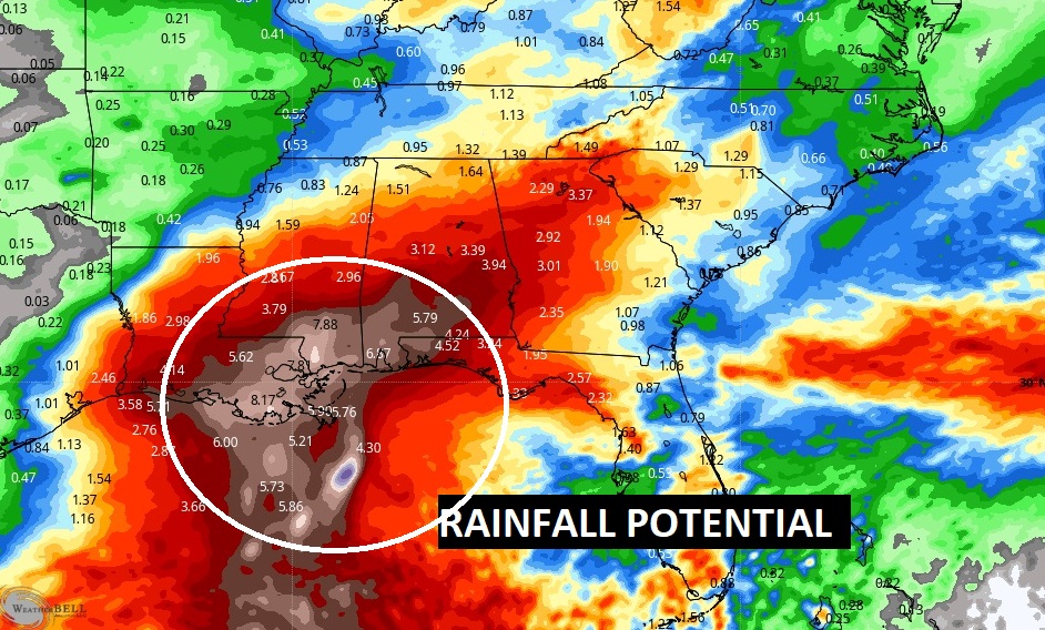
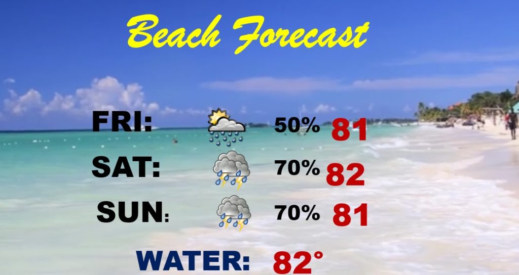
Needless to say this NOT a good beach weekend on any level.
Invest 92-L now has a 90% chance of development, according to NHC.
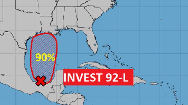
The EURO model says there is a 50-60% chance the Gulf system will become Tropical Storm Claudette,
Rainfall amounts could be quite excessive this weekend across the Gulf South.