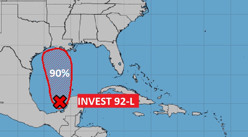
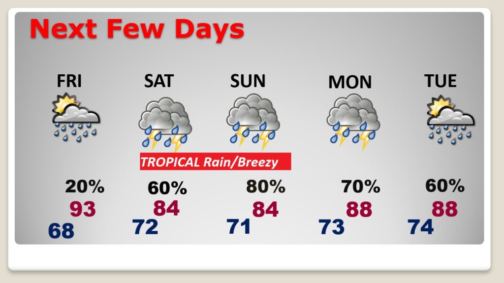
Good Morning! Enjoy today. Humidity will be tolerable, again. But, we have some “big ticket Weather” to deal with this weekend. Tropical Trouble. Invest 92-L, in the SW Gulf will be investigated by Air Force RECON today. This system will become a Depression, and possibly Tropical Storm Claudette, as it migrates towards the northern Gulf Coast, crossing the Louisiana coast, and then bending northeastward across Mississippi, Alabama and into Georgia. On the active EAST side of this system, excessive rainfall totals are expected, along with at least a threat of some spin-up tornadoes. On this video, I’ll break down the details of a very active Father’s Day weekend.
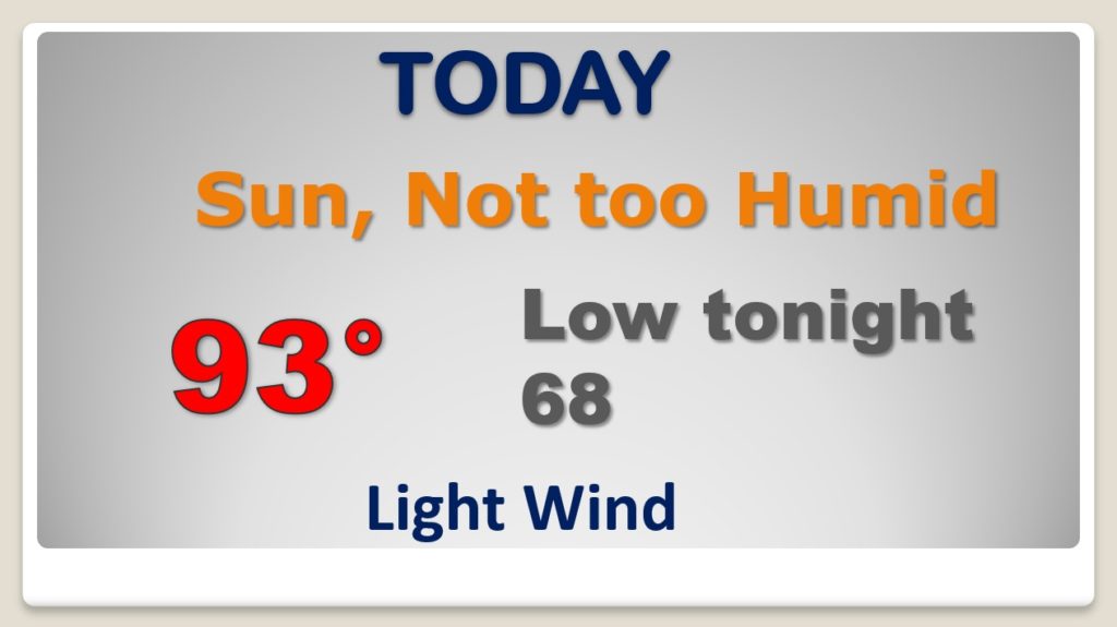
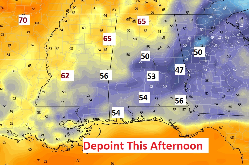
Today will be routine and very much like yesterday It will be HOT, but, the humidity will be tolerable, Afternoon dewpoints in the 50’s is a treat.
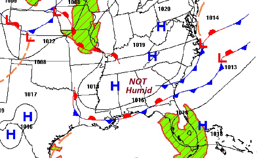
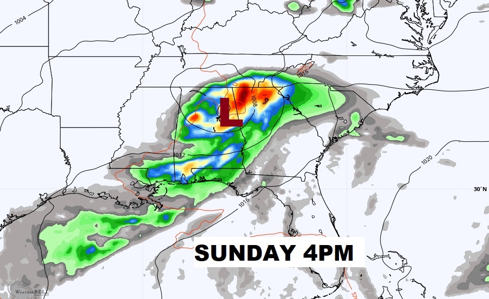
NHC still says Invest 92-L will likely develop soon. It will be a Depression almost certainly and maybe Tropical Storm Claudette. Most models show it reaching the LA coast late Friday night, then curving across MS Saturday and through Alabama Sunday, on it’s way to Georgia. WE will be on the ACTIVE east side.
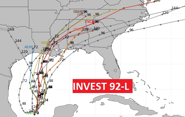
Here’s a flavor of the EURO model solution. A few snapshots. The rain could begin affecting us by Friday night or early Saturday.
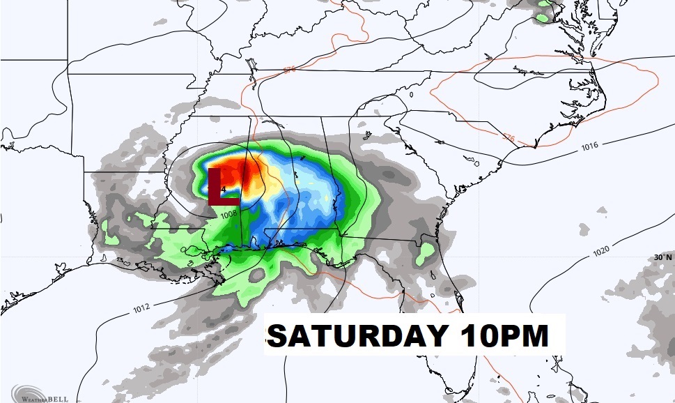
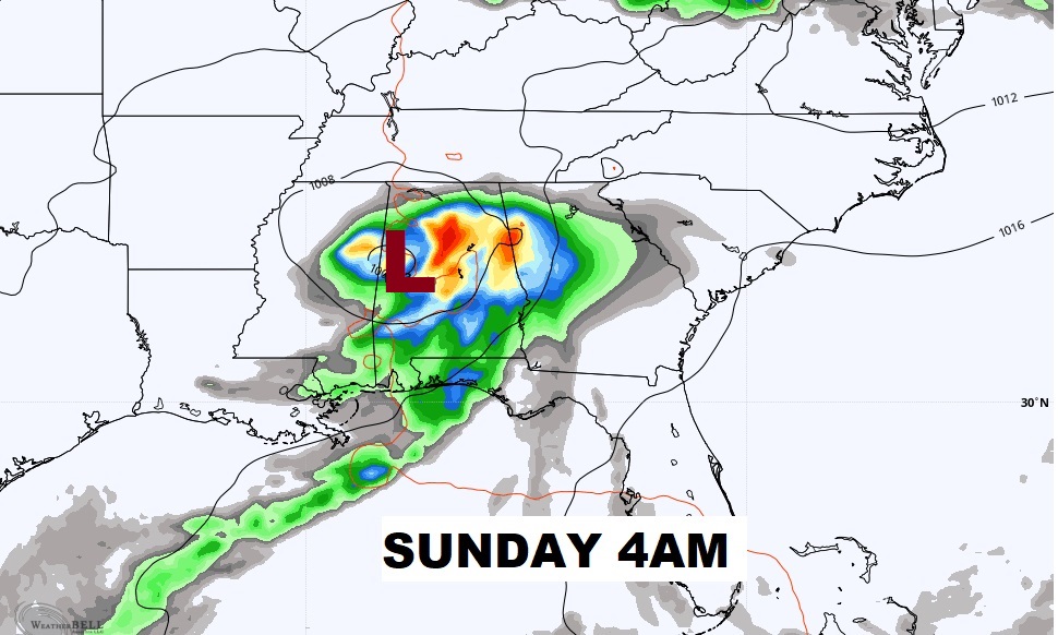
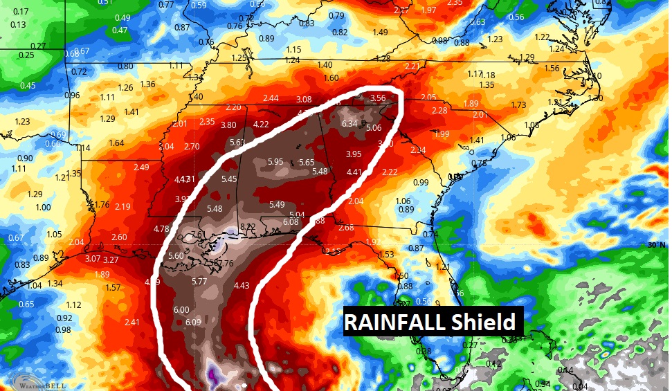
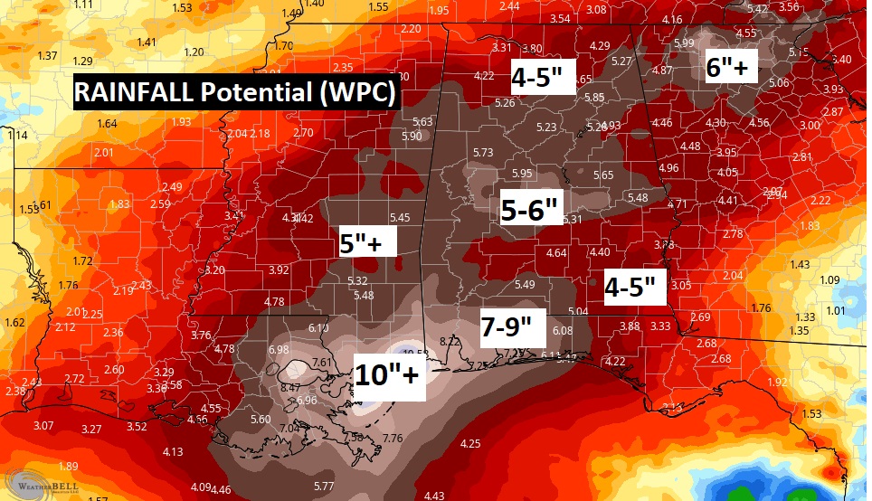
Rainfall amounts are expected to be excessive along and east of the track of the tropical system. Some of us could easily see 5 to 8 inches of rain, if not more. Flooding rainfall.
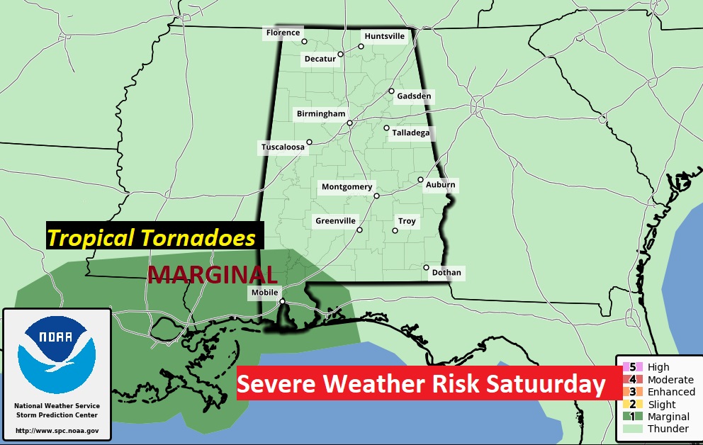
The threat for spin-up tropical tornadoes will begin in SW Alabama Saturday and spread across much of the state Sunday.
Big Ticket Tropical Excessive rain will dominate the weekend… It will be breezy as well. Risk of showers and storms will continue Monday and Tuesday, too, even though the Tropical System will be gone.
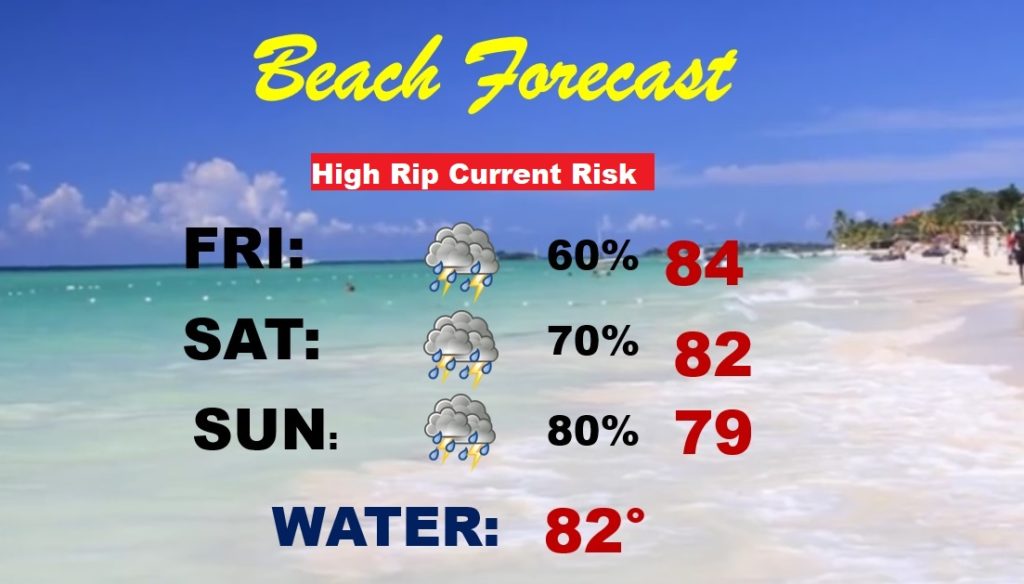
Needless to say, this is NOT the weekend to go to the Beach. Spin up tornadoes, excessive rain, windy and dangerous Rip Current Risk.