
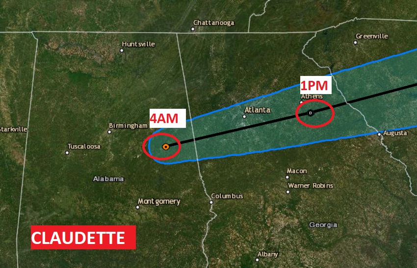
Good Morning! Claudette has been a very unwelcomed visitor to Alabama. This morning, ongoing flooding is occuring across the I-20/I-59 corridor, especially in Jefferson county. In south Alabama, the clean-up continues after some spin up tornadoes in a few south Alabama towns, including Brewton and Castleberry. There were six tornado reports in south Alabama, and just over the border in SW Georgia. Multiple wind damage reports.
Tropical Depression Claudette is still in Alabama this morning. It will depart into Georgia today. The risk for more rain and storms from Claudette will continue through mid morning, but we should see big improvements during the afternoon. That’s good news. Many Father’s Day BBQs may actually be dry. We’ll see the sun later.
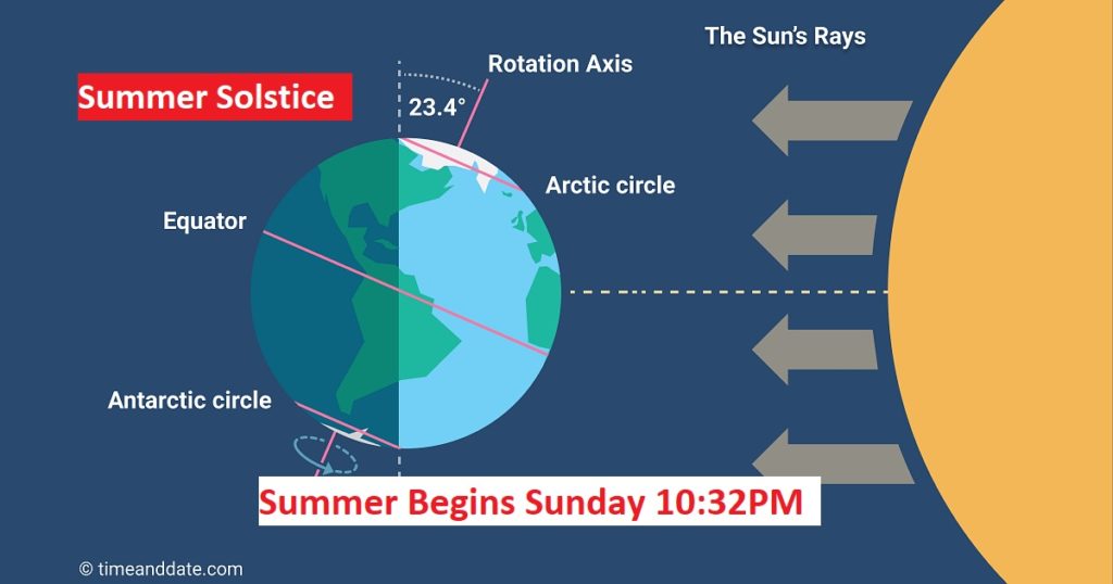
But, there’s a lot of rain in our future during the week ahead. Showers and storms will be widespread, as a frontal system approaches the area. Some of the storms could be strong, and once again, we could be facing some very heavy rainfall totals in the next 4-5 days. Welcome to Summer. It officially begins late tonight.
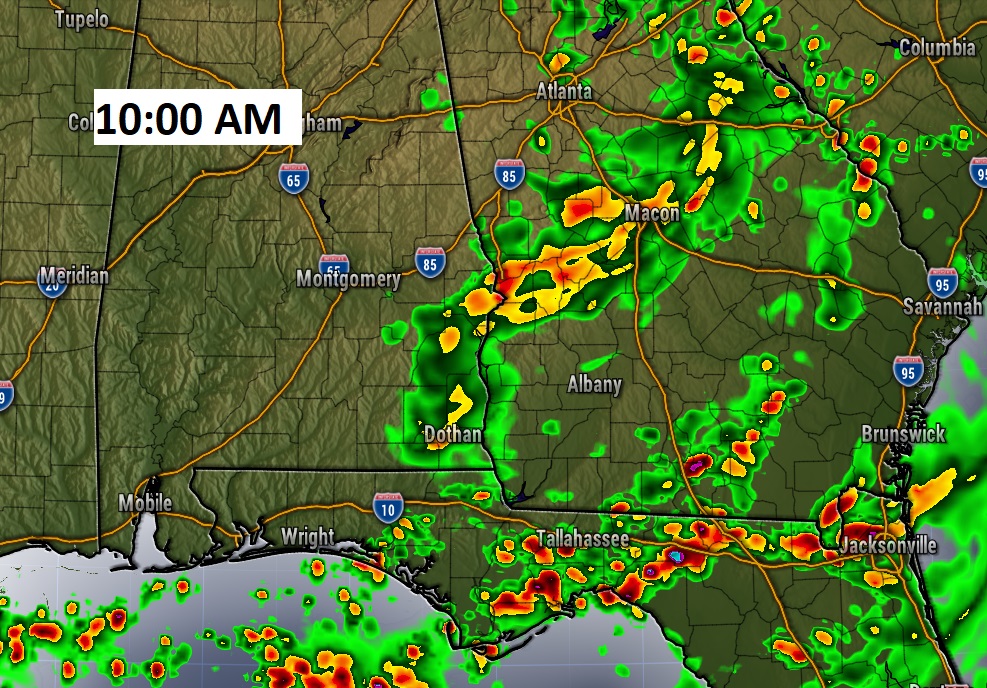
TODAY: Risk of rain and a few storms from Claudette will continue through mid-morning. The afternoon looks dry for most of us. It will be cloudy at first, but we should break into sunshine eventually. That will allow us to warm to the upper 80’s this afternoon. Low tonight 73. Here’s Future Radar at about 10AM.
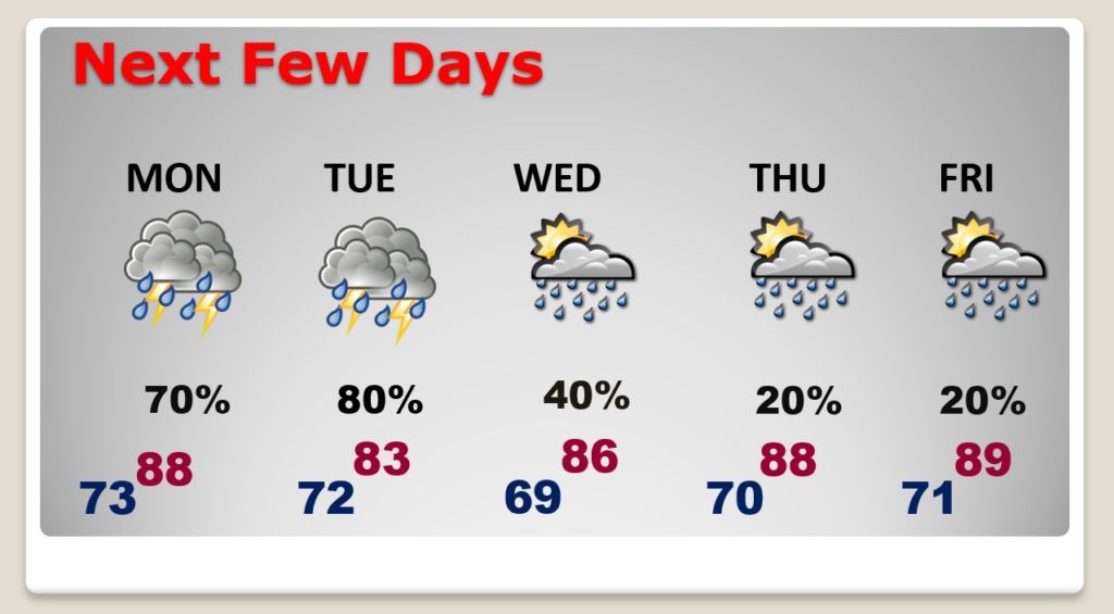
NEXT FEW DAYS: Rain chances will be very high on Monday and Tuesday especially as a frontal system approaches.
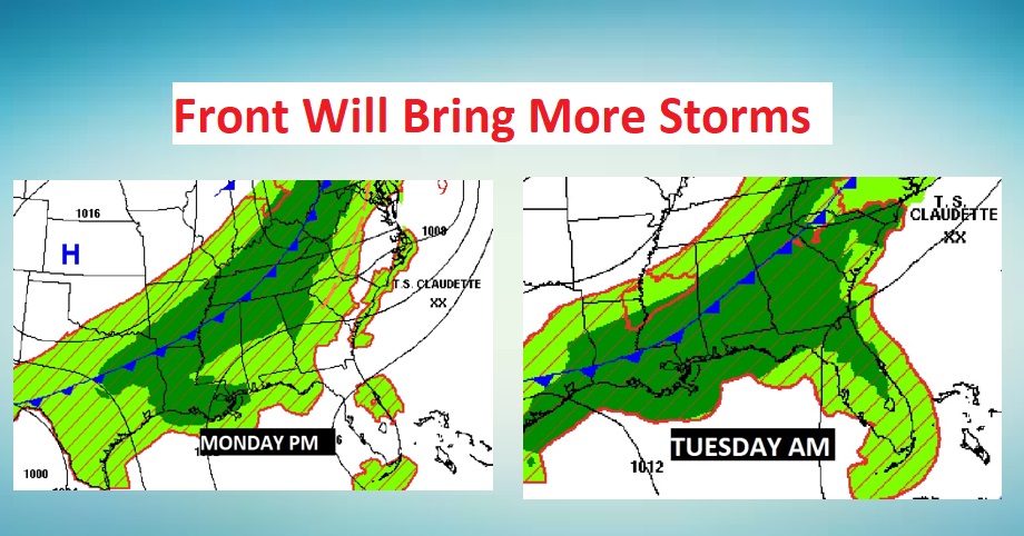
Showers and storms are likely Monday and Tuesday. Some storms could be strong. Rain chances will decrease by Wednesday and Thursday as the front migrates to the coast. We’ll hang on to a small chance of spotty storms late week.
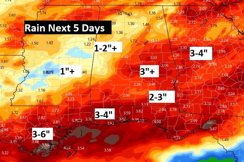
Once again, we’re facing the potential for significant rainfall amounts with the frontal system approaching. Take a look at the rainfall potential map for the next 5 days.
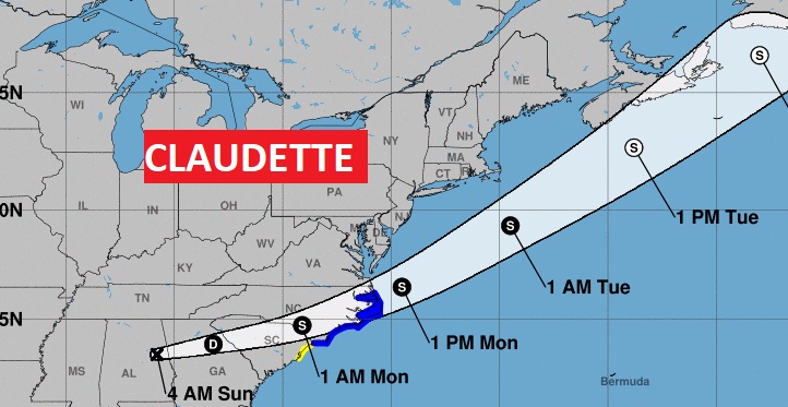
CLAUDETTE’S FUTURE: Claudette is still in east central Alabama this morning. Claudette will depart into Georgia today, heading for the Carolinas. It’ll be around Athens, GA at 1PM.
Claudette may actually regain Tropical Storm strength over the Carolinas late tonight before reaching the Atlantic coast. This will be the second time Claudette would reach Storm strength over land. It happened over southern Louisiana yesterday.
SUMMER SOLSTICE: Today is also the first day of summer, even though we’ve been in a summer pattern for several weeks. Summer officially begins at 10:32 PM tonight. Starting tomorrow, the days will gradually begin to get shorter. Official sunrise Sunday is 5:37 am. Sunset Sunday night is 7:56PM. It’s officially the longest day of the year. (a few seconds longer than yesterday)
I’ll have a complete video update tomorrow morning. Enjoy your Sunday!
–Rich