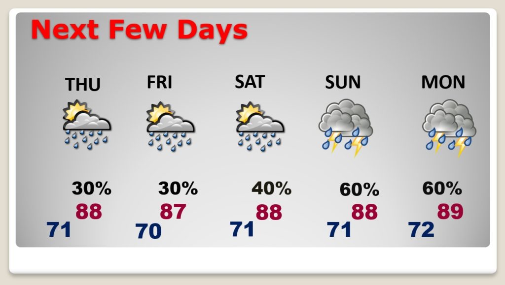
Good Morning! I guess the BEST news is, we will not be in the 90’s over the next several days. And, the dewpoint is now in the 60’s instead of the 70’s. In this part of the world, during this time of the year, this is GREAT news. Meanwhile, that old front still “haunts” the coast. We’ll keep a small mention of “pop-up” Hit or miss” storms in the forecast each day. But, the rain chances make spike higher again starting Sunday and beyond. We’ll check the tropics. Could we see something else in the Gulf next week?
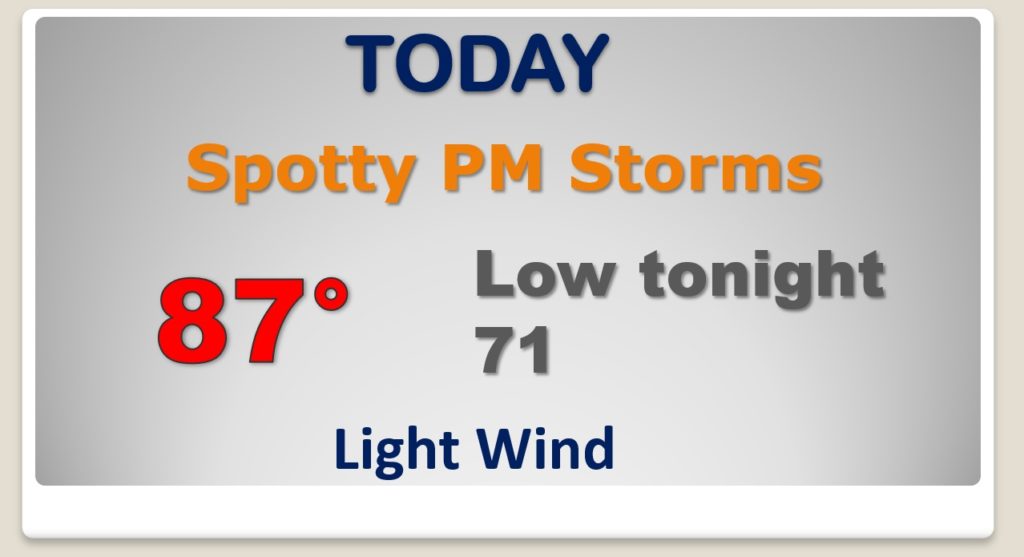
Pretty standard summertime forecast, except not too hot, compared to normal. Spotty, random storms, in the afternoon & evening.
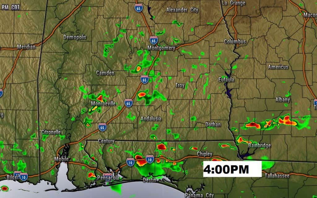
The risk of “hit or miss” storms will remain in the forecast for each of the next several days. Rain chances will spike higher Sunday through Tuesday. Temperatures should generally stay below 90 for s few days. That’s good news.
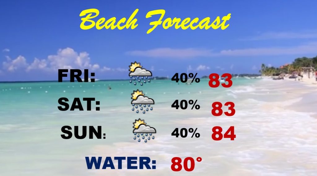
Pretty standard summertime forecast for the Beach this weekend. MUCH better than last week…by a mile!
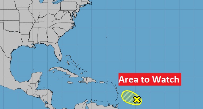
National Hurricane Center is still monitoring that Area to Watch in the tropical Atlantic headed toward the Islands.
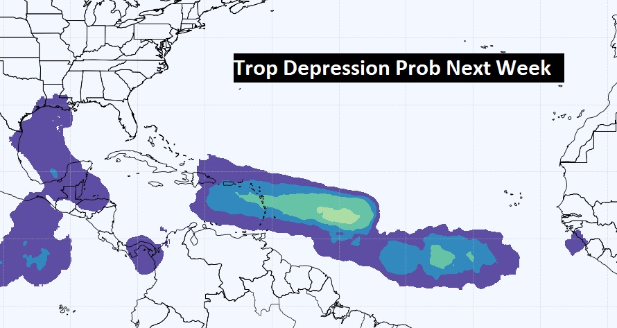
The EURO model’s Tropical Depression Probability map suggests we need to watch the Gulf next week.
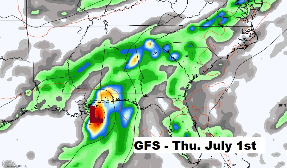
The American GFS model….. well I will just add this graphic without comment. Day 8. Next week…