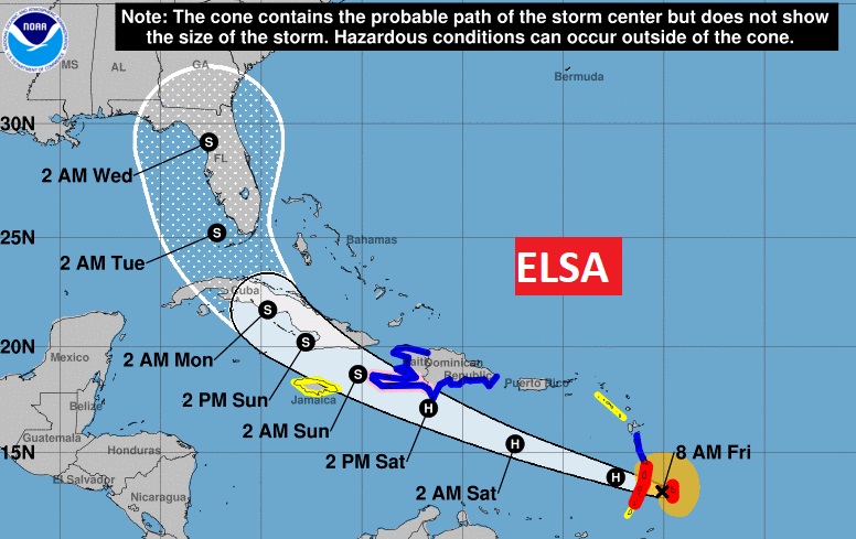
10AM NHC UPDATE: Air Force Recon reports #Elsa is still a 75 mph Hurricane, 5 miles north of St. Vincent, moving west at 29 mph. Future forecast cone has not changed much. It still covers all of the Florida Penn. and eastern Gulf through Tuesday into Wednesday.
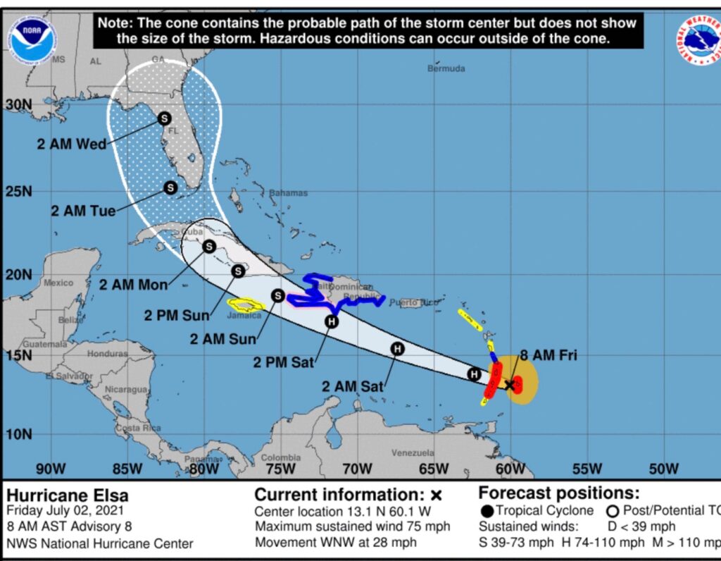
BREAKING NEWS 7:30AM: Elsa just became the first hurricane of the season. Top winds 75 mph, located 40 miles east of Barbados moving WNW at 28. Hurricane warning issued for Barbados
EARLY MORNING UPDATE:
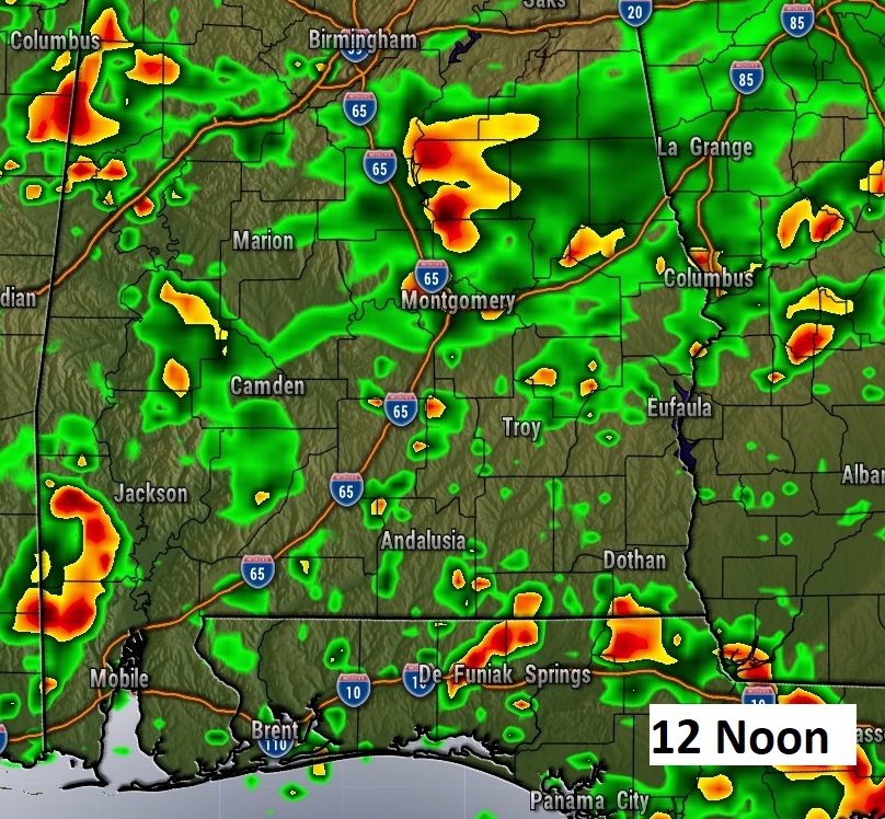
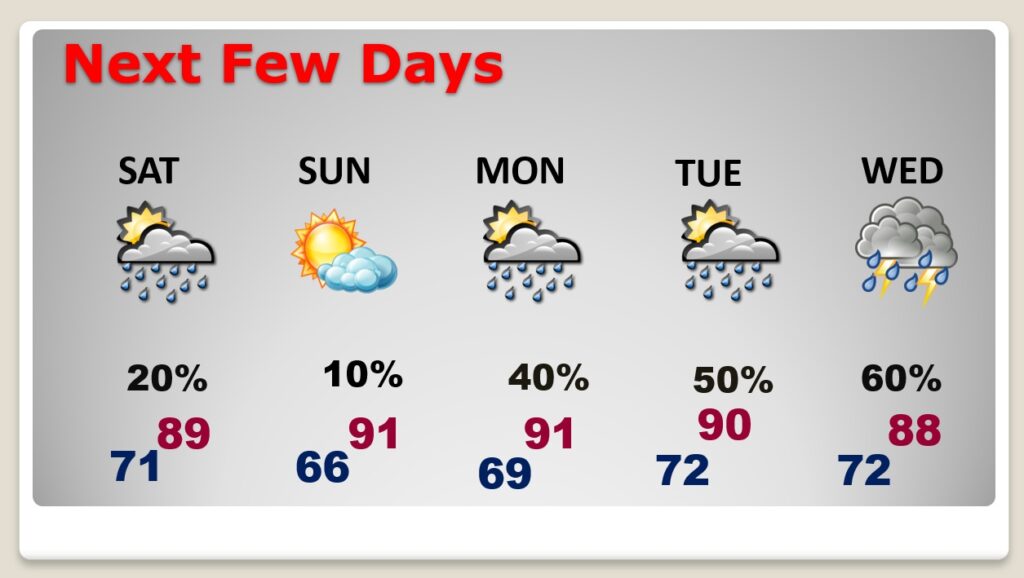
Good Morning! Radar will be very active today. Showers and storms will be widespread, as a frontal system moves southward through the state. Expect locally heavy downpours in spots. Watch out for dangerous lightning. The Holiday Weekend forecast is now better for most of us. The front makes it down to the coast. That’s where the best rain chance will be all weekend. But, for most of us, Saturday, and 4th of July Sunday should be primarily dry. Meanwhile, All eyes on ELSA. Will Elsa be a Gulf of Mexico problem? Florida? Or, into the Atlantic ocean? And, what about the timeline? I have the latest from the National Hurricane Center. And, we’ll compare potential model tracks.
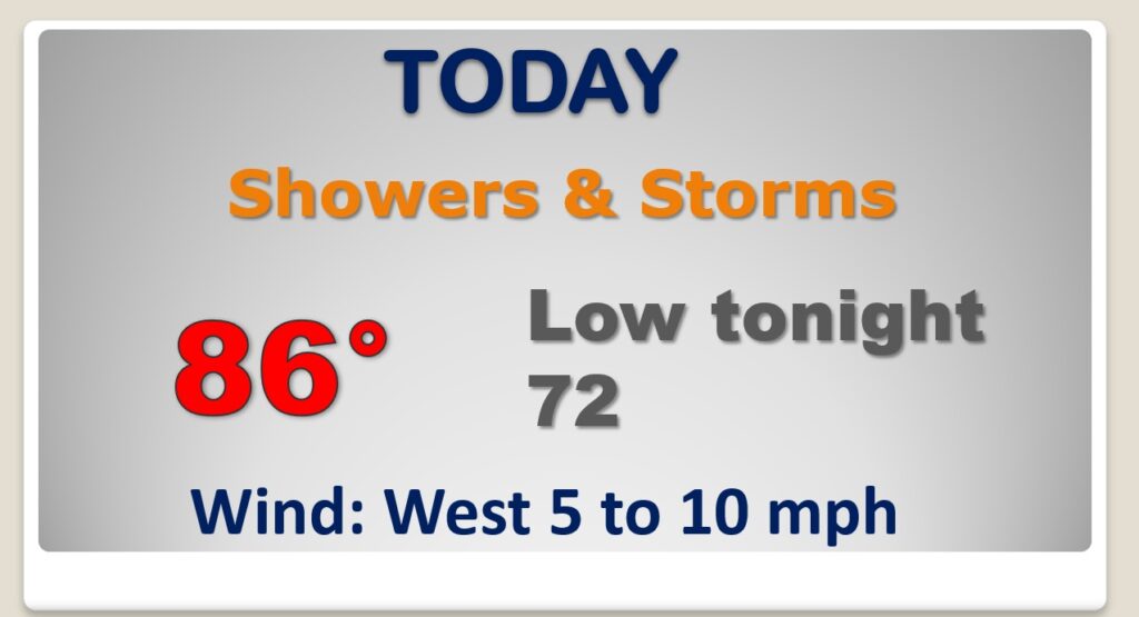
Showers and storms will be widespread today, as the front moves southward. It’s going to rain. Count on it.
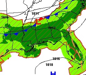
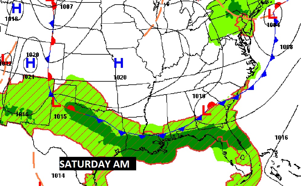
The front parks near the coast for the weekend. The forecast is good in central Alabama and awful on the coast.
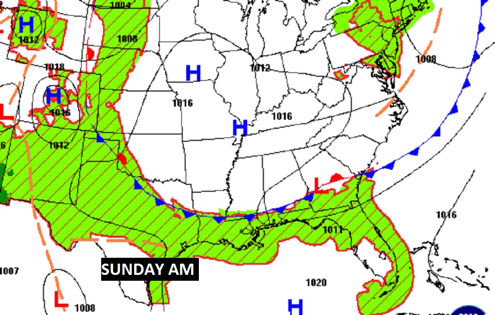
So the weekend forecast is a lot better. Showers and storms return early next week as the front retreats northward.
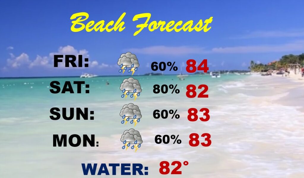
Unfortunately…the forecast down at the coast for the holiday weekend is not good.
...HIGH RIP CURRENT RISK IN EFFECT THROUGH LATE SUNDAY NIGHT...
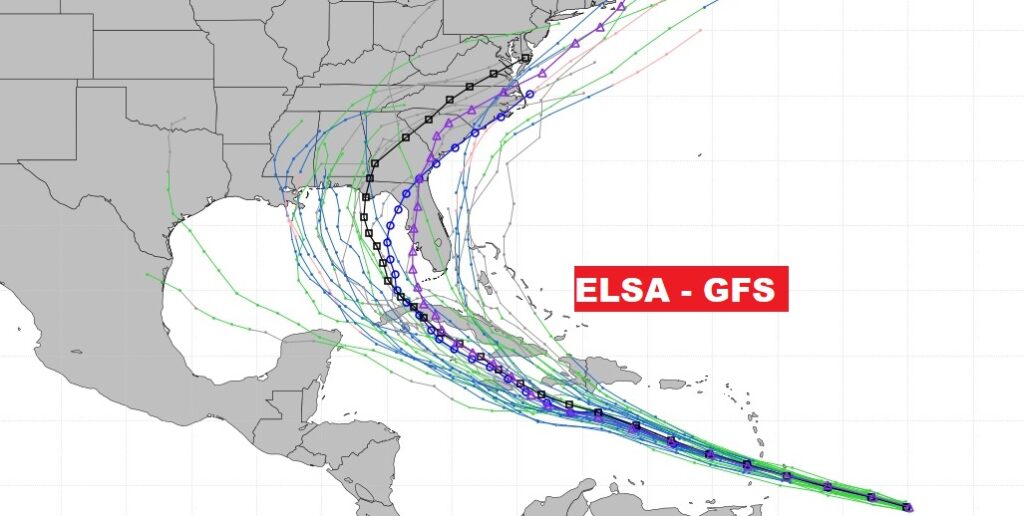
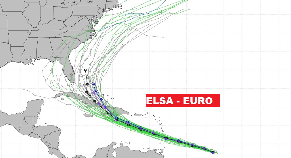
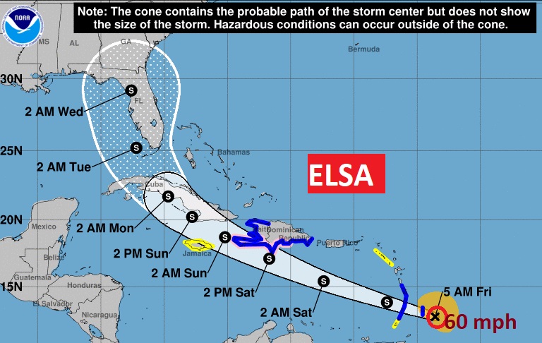
As of 4AM, Elsa is a 60 mph tropical storm about 70 miles from Barbados, moving WNW at a very fast 28 mph. Tropical Storm conditions will effect the islands shortly. The forecast cone now covers all of Florida and the eastern Gulf of Mexico. Possible Elsa landfall early next week. Models still vary a lot from the Gulf to the Atlantic.